Download
Preview
Add to list
More
11.2 km
~2 hrs 44 min
298 m
Point-to-Point
“"Explore Germany's scenic Ahrtalweg, blending natural beauty, historical sites, and wildlife on a medium-difficulty hike."”
Starting near Kreis Euskirchen in Germany, this 11 km (approximately 6.8 miles) point-to-point trail takes you from Blankenheim to Freilinger See via the scenic Ahrtalweg. With an elevation gain of around 200 meters (656 feet), this medium-difficulty hike offers a blend of natural beauty, historical landmarks, and opportunities for wildlife spotting.
Getting There
To reach the trailhead, you can either drive or use public transport. If driving, head towards Blankenheim, which is well-signposted from major roads in the region. For those using public transport, take a train to Blankenheim (Wald) station. From there, local buses or a short taxi ride will get you to the starting point near Kreis Euskirchen.
Trail Highlights
Blankenheim
The trail begins in the charming town of Blankenheim, known for its medieval architecture and the historic Blankenheim Castle. As you start your hike, take a moment to explore the town's cobblestone streets and half-timbered houses. The Ahr spring, the source of the Ahr River, is also located here and is a must-see before you set off.
Ahrtalweg
As you leave Blankenheim, you'll follow the Ahrtalweg, a well-marked trail that meanders through lush forests and open meadows. The path is relatively even, making it accessible for most hikers. Keep an eye out for local wildlife such as deer, foxes, and a variety of bird species. The trail is particularly beautiful in the spring and autumn when the foliage is vibrant.
Elevation and Terrain
The trail features a gradual elevation gain of around 200 meters (656 feet), with the most significant climbs occurring in the first half of the hike. The terrain is a mix of dirt paths and gravel roads, so sturdy hiking boots are recommended. There are a few steep sections, but they are short and manageable for hikers with a moderate level of fitness.
Points of Interest
Historical Significance
The region is steeped in history, with several points of interest along the way. About halfway through the hike, you'll come across remnants of Roman settlements and ancient fortifications. These sites offer a glimpse into the area's rich past and are perfect spots for a brief rest and some exploration.
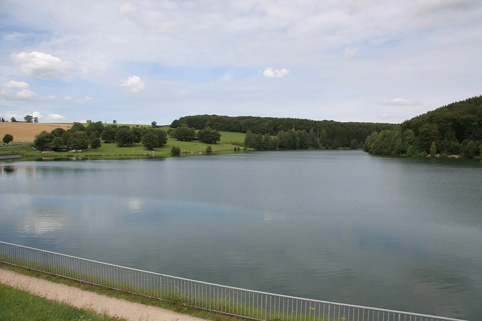
Freilinger See
As you approach the end of the trail, you'll arrive at Freilinger See, a picturesque lake surrounded by forest. This is an ideal spot for a picnic or a refreshing swim in the warmer months. The lake area also has facilities such as restrooms and a small café, making it a convenient place to relax after your hike.
Navigation
For navigation, it's advisable to use HiiKER, which provides detailed maps and real-time updates on the trail conditions. The trail is well-marked, but having a reliable navigation tool can enhance your hiking experience and ensure you stay on the right path.
Wildlife and Flora
The trail offers ample opportunities to observe local wildlife. Deer and foxes are commonly seen, and birdwatchers will appreciate the variety of species that inhabit the area. The flora is equally diverse, with wildflowers blooming in the spring and a canopy of colorful leaves in the autumn.
Practical Information
- Distance: 11 km (6.8 miles)
- Elevation Gain: 200 meters (656 feet)
- Difficulty: Medium
- Trail Type: Point-to-point
Ensure you carry enough water, snacks, and a first-aid kit. Weather can be unpredictable, so pack a rain jacket and check the forecast before you set out. The trail is accessible year-round, but the best times to hike are spring and autumn when the weather is mild and the scenery is at its most vibrant.

What to expect?
Activity types
Comments and Reviews
User comments, reviews and discussions about the Blankenheim to Freilinger See via Ahrtalweg, Germany.
4.0
average rating out of 5
1 rating(s)