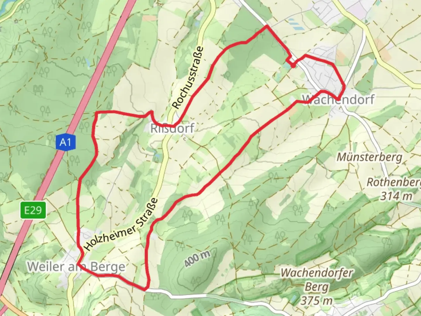
Download
3D Flyover
Add to list
More
10.7 km
~2 hrs 21 min
138 m
Loop
“The Wachendorf Rundweg is a scenic 11-kilometer loop featuring lush forests, meadows, and the historic Wachendorf Castle.”
Starting near Kreis Euskirchen, Germany, the Wachendorf Rundweg is a picturesque loop trail that spans approximately 11 kilometers (around 6.8 miles) with an elevation gain of about 100 meters (328 feet). This medium-difficulty trail offers a delightful mix of natural beauty, historical landmarks, and serene landscapes, making it a rewarding experience for hikers of various skill levels.
Getting There
To reach the trailhead, you can either drive or use public transportation. If you're driving, set your GPS to Kreis Euskirchen, Germany, and look for parking options near the trailhead. For those using public transport, take a train or bus to Euskirchen station. From there, local buses or taxis can take you closer to the starting point.
Trail Navigation
For navigation, it's highly recommended to use the HiiKER app, which provides detailed maps and real-time updates to ensure you stay on track throughout your hike.
Trail Highlights
Nature and Wildlife
The Wachendorf Rundweg is a haven for nature enthusiasts. As you traverse the trail, you'll encounter lush forests, open meadows, and gently rolling hills. The diverse flora includes oak, beech, and pine trees, while the fauna ranges from deer and foxes to a variety of bird species. Keep your eyes peeled for the occasional sighting of rare birds, especially during the early morning hours.
Historical Significance
One of the most notable landmarks along the trail is the Wachendorf Castle, a medieval structure that dates back to the 12th century. Located approximately 4 kilometers (2.5 miles) into the hike, the castle offers a glimpse into the region's rich history. The castle grounds are open to the public, and it's worth taking a short detour to explore its ancient walls and towers.
Trail Sections
Initial Ascent
The trail begins with a gentle ascent through a dense forest. This section is about 2 kilometers (1.2 miles) long and gains around 50 meters (164 feet) in elevation. The well-marked path is relatively easy to follow, but be mindful of tree roots and uneven terrain.
Midway Meadows
Around the 5-kilometer (3.1-mile) mark, the trail opens up into expansive meadows. This is a great spot to take a break, enjoy a picnic, and soak in the panoramic views of the surrounding countryside. The elevation gain here is minimal, making it a relaxing segment of the hike.
Final Descent
The last 4 kilometers (2.5 miles) of the trail involve a gradual descent back into the forest. This section can be a bit slippery after rain, so sturdy hiking boots are recommended. The path winds through a series of small streams and wooden bridges, adding a touch of adventure to the final leg of your journey.
Practical Tips
- Footwear: Sturdy hiking boots are essential, especially for the forested and potentially slippery sections.
- Weather: Check the weather forecast before you go. The trail can be muddy after rain, and certain sections may become more challenging.
- Supplies: Bring enough water and snacks, as there are no facilities along the trail.
- Wildlife: While the wildlife is generally harmless, it's always a good idea to keep a safe distance and avoid feeding any animals.
The Wachendorf Rundweg offers a perfect blend of natural beauty and historical intrigue, making it a must-visit for any hiking enthusiast exploring the Kreis Euskirchen region.
Comments and Reviews
User comments, reviews and discussions about the Wachendorf Rundweg, Germany.
5.0
average rating out of 5
3 rating(s)
