Download
3D Flyover
Add to list
More
5.2 km
~1 hrs 27 min
253 m
Loop
“The Keuperberg via Burgensteig trail offers a 5 km loop of historical landmarks, lush forests, and wildlife.”
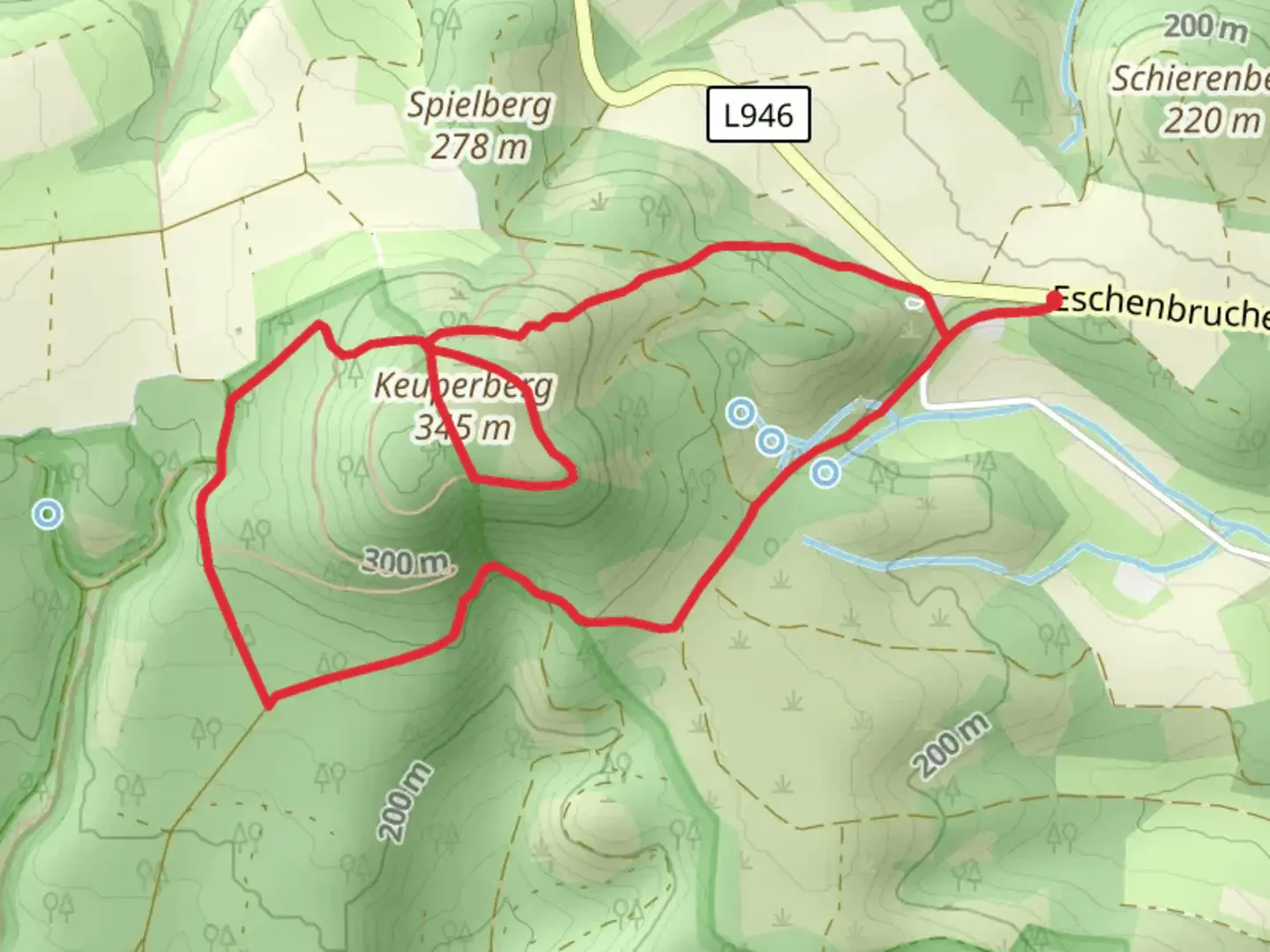
Starting near Kreis Lippe, Germany, the Keuperberg via Burgensteig trail is a captivating 5 km (3.1 miles) loop with an elevation gain of approximately 200 meters (656 feet). This medium-difficulty trail offers a blend of natural beauty, historical landmarks, and diverse wildlife, making it an enriching experience for hikers.
Getting There
To reach the trailhead, you can either drive or use public transport. If driving, set your GPS to Kreis Lippe, Germany, and look for parking near the starting point. For those using public transport, take a train or bus to the nearest station in Detmold, and from there, a local bus or taxi can take you to the trailhead.
Trail Navigation
For navigation, it's highly recommended to use the HiiKER app, which provides detailed maps and real-time updates to ensure you stay on track.
Trail Highlights
Historical Significance
The region around Kreis Lippe is steeped in history. As you hike, you'll come across remnants of ancient fortifications and castles, particularly notable along the Burgensteig section of the trail. These structures date back to the medieval period and offer a glimpse into the area's rich past. Keep an eye out for informational plaques that provide context and historical details.
Natural Beauty
The trail meanders through lush forests and open meadows, offering a variety of landscapes. In spring and summer, the meadows are dotted with wildflowers, while the forests provide a cool, shaded respite. The elevation gain is gradual, making it accessible for most hikers, but be prepared for some steeper sections as you approach the Keuperberg summit.
Wildlife
The area is home to a variety of wildlife, including deer, foxes, and numerous bird species. Early morning or late afternoon hikes increase your chances of spotting these animals. Remember to respect their habitat and observe from a distance.
Key Landmarks
Keuperberg Summit
At approximately 2.5 km (1.55 miles) into the hike, you'll reach the Keuperberg summit. Here, you'll be rewarded with panoramic views of the surrounding countryside. It's an excellent spot for a rest and some photography.
Burgensteig Section
Around the 3.5 km (2.17 miles) mark, you'll enter the Burgensteig section, where the trail winds past ancient ruins and fortifications. This part of the trail is particularly scenic and offers a tangible connection to the region's history.
Trail Conditions and Safety
The trail is well-marked but can be muddy after rain, so waterproof hiking boots are advisable. Carry enough water and snacks, as there are no facilities along the trail. Mobile reception can be spotty in some areas, making the HiiKER app even more essential for navigation.
Final Stretch
The last 1.5 km (0.93 miles) of the trail descends gradually back to the starting point, passing through serene woodlands and offering a peaceful end to your hike.
Comments and Reviews
User comments, reviews and discussions about the Keuperberg via Burgensteig, Germany.
5.0
average rating out of 5
3 rating(s)
