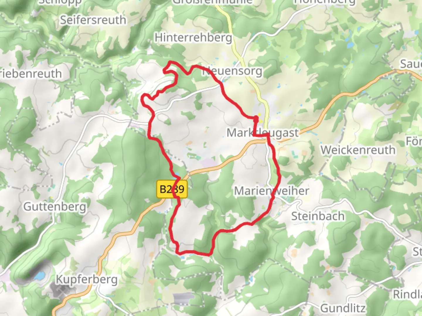
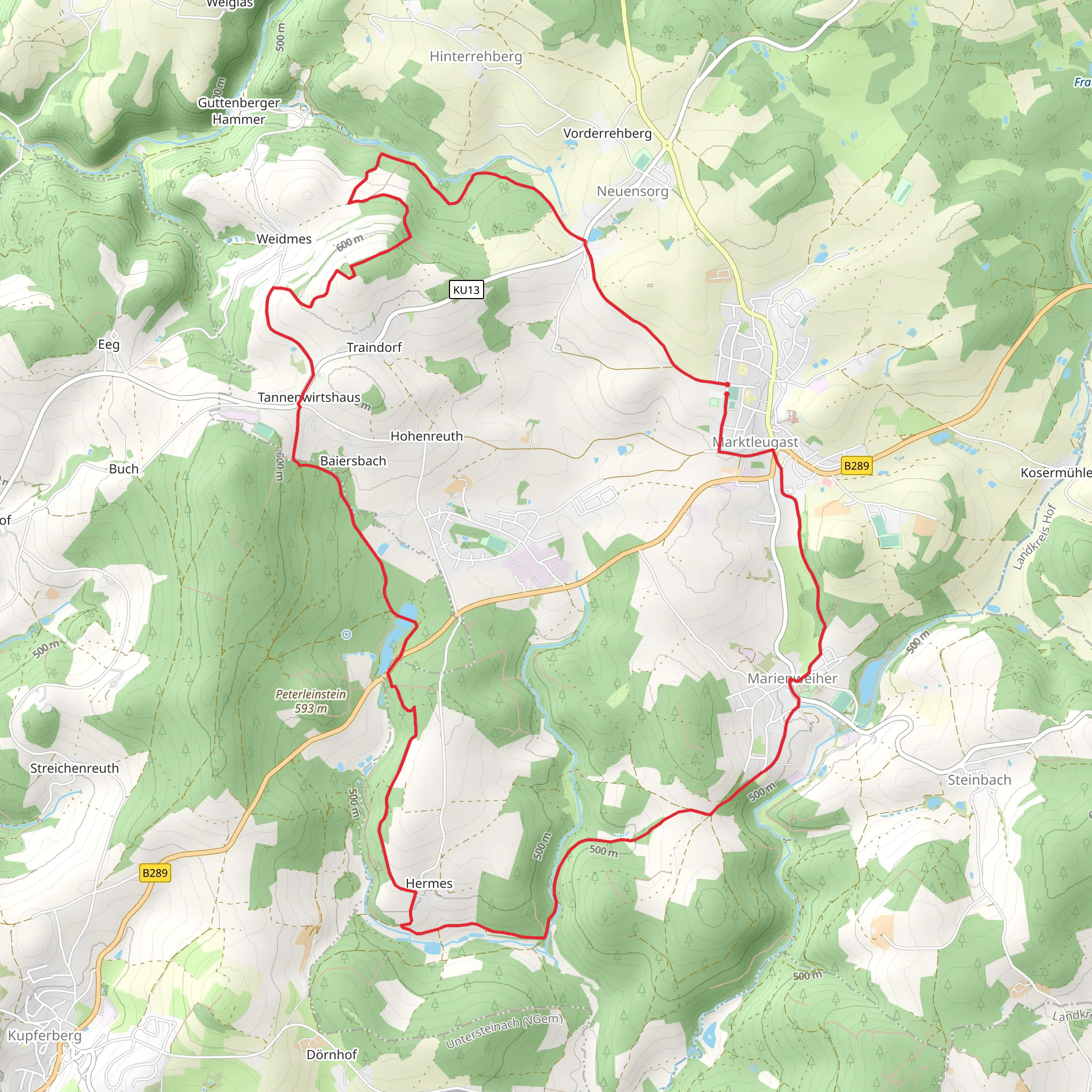
Spiegelteich via Buergermeisterweg Marktleugast and Zur Weidmeser Hoehe
Download
3D Flyover
Add to list
More
14.9 km
~3 hrs 28 min
290 m
Loop
“Discover the 15 km Kulmbach loop: a medium-difficulty trail blending natural beauty with historical intrigue.”
Starting near Kulmbach, Germany, this 15 km (approximately 9.3 miles) loop trail offers a delightful mix of natural beauty and historical intrigue. With an elevation gain of around 200 meters (656 feet), it is rated as medium difficulty, making it accessible for most hikers with a moderate level of fitness.
Getting There
To reach the trailhead, you can either drive or use public transport. If driving, head towards Kulmbach and follow signs to Marktleugast. There is ample parking available near the starting point. For those using public transport, take a train to Kulmbach and then a local bus to Marktleugast. The nearest significant landmark to the trailhead is the Marktleugast Town Hall.
Trail Overview
The trail begins near the Marktleugast Town Hall and quickly immerses you in the serene beauty of the Franconian Forest. The first section of the trail, known as the Buergermeisterweg, is relatively flat and takes you through lush meadows and dense woodlands. Keep an eye out for local wildlife such as deer and various bird species.
Significant Landmarks
Around the 5 km (3.1 miles) mark, you will come across the Spiegelteich, a picturesque pond that offers a perfect spot for a short break. The reflection of the surrounding trees on the water's surface is a sight to behold, especially in the early morning light.
Continuing on, the trail ascends gradually towards Zur Weidmeser Hoehe. This section involves a steady climb, gaining approximately 100 meters (328 feet) in elevation over 3 km (1.9 miles). The effort is well worth it, as the summit provides panoramic views of the surrounding countryside. On a clear day, you can see as far as the Fichtel Mountains.
Historical Significance
The region around Marktleugast is steeped in history. The trail itself passes by several old farmhouses and traditional Bavarian structures, offering a glimpse into the area's past. Marktleugast has a rich history dating back to the Middle Ages, and you may encounter informational plaques along the trail that provide insights into the local heritage.
Navigation and Safety
For navigation, it is highly recommended to use the HiiKER app, which provides detailed maps and real-time updates. The trail is well-marked, but having a reliable navigation tool will ensure you stay on track.
Flora and Fauna
The trail is a haven for nature enthusiasts. In spring and summer, the meadows are adorned with wildflowers, while the forested sections are home to a variety of flora, including oak, beech, and pine trees. Wildlife sightings are common, so keep your camera ready.
Final Stretch
The final part of the loop descends gently back towards Marktleugast, passing through more open fields and small streams. This section is relatively easy and allows you to cool down after the more strenuous climb to Zur Weidmeser Hoehe.
Practical Tips
- Wear sturdy hiking boots, as some sections can be muddy, especially after rain.
- Carry enough water and snacks, as there are limited facilities along the trail.
- Check the weather forecast before heading out, as conditions can change rapidly.
This trail offers a perfect blend of natural beauty, moderate physical challenge, and historical interest, making it a rewarding experience for any hiker.
Comments and Reviews
User comments, reviews and discussions about the Spiegelteich via Buergermeisterweg Marktleugast and Zur Weidmeser Hoehe, Germany.
4.0
average rating out of 5
1 rating(s)
