Download
Preview
Add to list
More
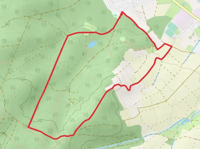
89.3 km
~5 days
2093 m
Multi-Day
The Spessartbogen is a 89.3 km trail that starts in , Main-Kinzig-Kreis, Germany. Based on our data, the hike is graded as Medium. For information on how we grade trails, please read measuring the difficulty of a hiking trail on hiiker. Also, check our latest community posts for trail updates. This hike can be completed in approx 4 days. Caution is advised on trail times as this depends on multiple variables. For more info read about how we calculate hike time.

Frequently asked questions
How long does it take to hike the Spessartbogen and how is it usually split into stages?
The Spessartbogen is an 89.29 km multi-day hike with about 2,093 m of climbing, so it is usually walked over 4 days. A common stage breakdown is Langenselbold to Freigericht-Horbach at about 18.8 km, Freigericht-Horbach to Bad Orb at 27.4 km, Bad Orb to Mernes at 11.5 km, and Mernes to Schlüchtern at 32.1 km.
Where does the Spessartbogen start and finish?
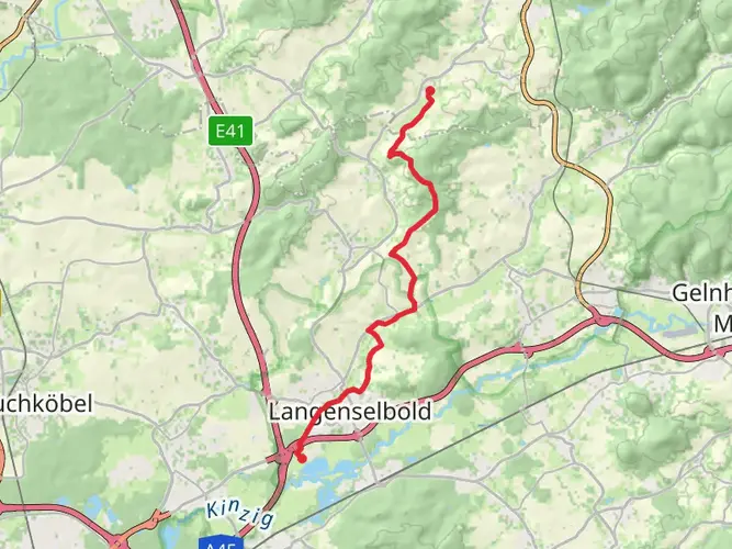
The Spessartbogen begins near Parkplatz Buchberg close to the station in Langenselbold and finishes in Schlüchtern. The route is marked in both directions, so it can also be hiked westbound from Schlüchtern toward Langenselbold.
What is the first stage of the Spessartbogen from Langenselbold like?
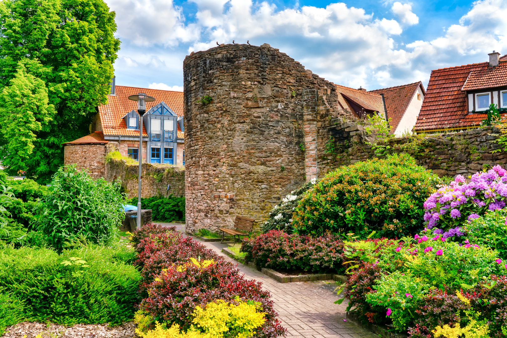
Stage 1 of the Spessartbogen runs from Langenselbold to Freigericht-Horbach and is about 18.8 km long with roughly 460 m of ascent. This section follows a wooded ridge in the sandstone Spessart and passes landmarks including the Buchbergturm, the Dicke Tanne forest playground, the Fernblick observation tower, and the Gondelteich.
What is the second stage of the Spessartbogen from Freigericht-Horbach to Bad Orb like?
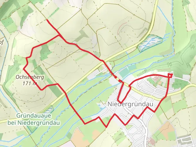
Stage 2 of the Spessartbogen is the longest of the standard middle sections at about 27.4 km, with around 678 m of ascent and 697 m of descent. Highlights on this stretch include the Mariengrotte near Horbach, the Breitenborner Höhe, the Forsthaus Niederhof area, the Altenburg Celtic site, the Molkenberg tower, and the spa town of Bad Orb.
What is the third stage of the Spessartbogen from Bad Orb to Mernes like?
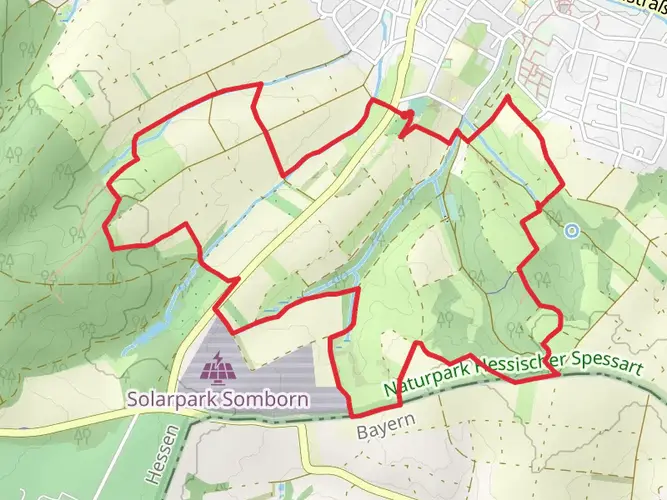
Stage 3 of the Spessartbogen from Bad Orb to Mernes is the shortest standard section at about 11.5 km with around 381 m of climbing. The route passes sandstone quarries, a Kneipp water-treading area, the Sölchesweiher, and reaches Mernes through the Jossa valley; there is also a longer variant continuing toward Marjoß or Jossa.
What is the fourth stage of the Spessartbogen from Mernes to Schlüchtern like?
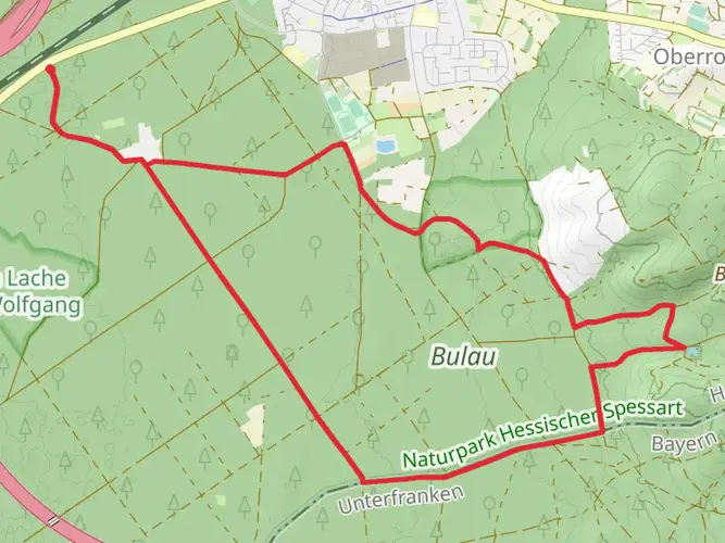
Stage 4 of the Spessartbogen runs from Mernes to Schlüchtern and covers about 32.1 km with roughly 792 m of ascent and 856 m of descent. It is the biggest final day on the route, and the official trail page notes a signed detour in the Bernhardswald area, so this section can feel more committing than the earlier stages.
Can the Spessartbogen be reached by train or public transportation?
Yes. The Spessartbogen has signed access from stations at Langenselbold, Wächtersbach, Bad Soden-Salmünster, and Schlüchtern. Additional signed feeder routes also connect places such as Rodenbach-Niederrodenbach, Biebergemünd-Roßbach, Wiesbüttsee or Jossgrund-Lettgenbrunn-Wegscheide, and Sinntal-Jossa.
Where can you park for the Spessartbogen and is the trail well marked?
Parking is available at official portals and trail access points along the Spessartbogen. Named parking areas used for the route include Parkplatz Buchberg in Langenselbold, Fernblick in Freigericht-Neuses, Gondelteich in Freigericht-Horbach, Krötenteich Waldrode, Breitenborner Höhe, Molkenberg in Bad Orb, Haselruhe near Bad Orb, and Ortsmitte Mernes. The trail is waymarked throughout with the Spessartbogen logo on a white background.
Comments and Reviews
User comments, reviews and discussions about the Spessartbogen, Germany.
4.25
average rating out of 5
8 rating(s)