Download
3D Flyover
Add to list
More
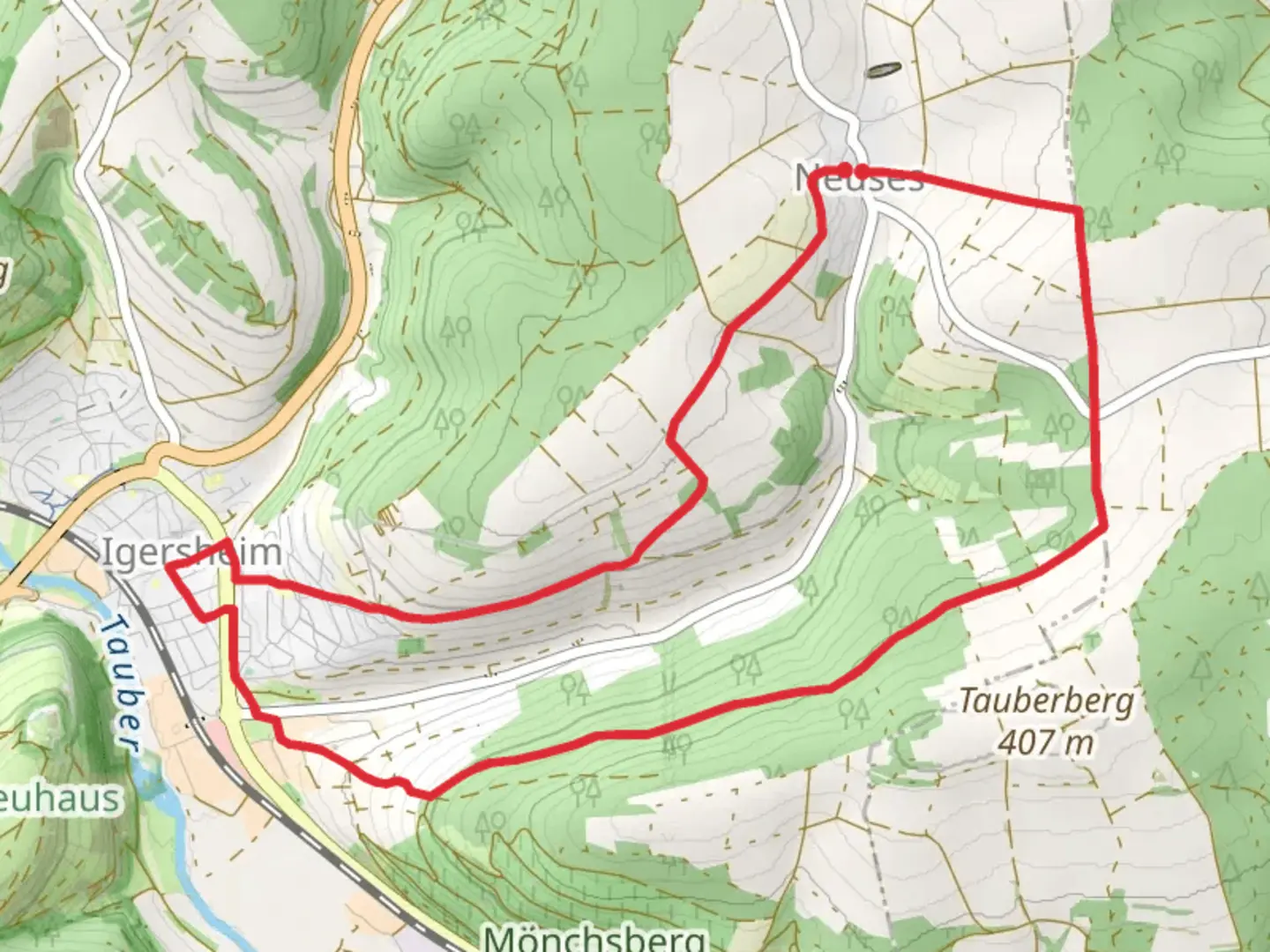
10.9 km
~2 hrs 33 min
228 m
Loop
“Explore the scenic and historical richness of Main-Tauber-Kreis on the moderately challenging Rundweg Igersheim loop trail.”
Starting near Main-Tauber-Kreis, Germany, the Rundweg Igersheim is a delightful loop trail that spans approximately 11 kilometers (around 6.8 miles) with an elevation gain of about 200 meters (656 feet). This trail is rated as medium difficulty, making it suitable for moderately experienced hikers.
Getting There
To reach the trailhead, you can either drive or use public transport. If you're driving, you can park near the town of Igersheim, which is well-signposted and has ample parking facilities. For those using public transport, the nearest significant landmark is the Igersheim train station. From there, it's a short walk to the trailhead.
Trail Navigation
For navigation, it's highly recommended to use HiiKER, which provides detailed maps and real-time updates. This will help you stay on track and enjoy the hike without any worries.
Trail Highlights
The Rundweg Igersheim offers a mix of natural beauty and historical significance. As you start the hike, you'll be greeted by lush forests and rolling hills. The first section of the trail is relatively flat, making it a good warm-up for the more challenging parts ahead.
Nature and Wildlife
Around the 3-kilometer (1.86-mile) mark, you'll enter a dense forest area. This section is particularly rich in flora and fauna. Keep an eye out for deer and various bird species that inhabit this region. The forest canopy provides ample shade, making it a pleasant walk even during warmer months.
Historical Significance
At approximately 5 kilometers (3.1 miles) into the hike, you'll come across the ruins of an old castle. This castle dates back to the medieval period and offers a glimpse into the region's historical past. It's a great spot to take a break and soak in the historical ambiance.
Mid-Trail Elevation Gain
The trail starts to ascend more steeply around the 7-kilometer (4.35-mile) mark. This section will take you up to the highest point of the trail, offering panoramic views of the Main-Tauber-Kreis region. The elevation gain here is about 100 meters (328 feet) over a distance of 2 kilometers (1.24 miles), so pace yourself and enjoy the scenery.
Final Stretch
As you descend back towards Igersheim, the trail becomes easier, winding through open fields and small patches of woodland. This final section is a great opportunity to cool down and reflect on the hike.
Practical Tips
- Footwear: Given the mixed terrain, sturdy hiking boots are recommended.
- Water: Carry enough water, especially during the summer months.
- Weather: Check the weather forecast before you go, as the trail can become slippery in wet conditions.
- Wildlife: Be respectful of the wildlife and maintain a safe distance.
The Rundweg Igersheim offers a well-rounded hiking experience with its blend of natural beauty, wildlife, and historical landmarks. Whether you're a local or a visitor, this trail provides a wonderful opportunity to explore the scenic and historical richness of the Main-Tauber-Kreis region.

Comments and Reviews
User comments, reviews and discussions about the Rundweg Igersheim, Germany.
average rating out of 5
0 rating(s)