Download
Preview
Add to list
More
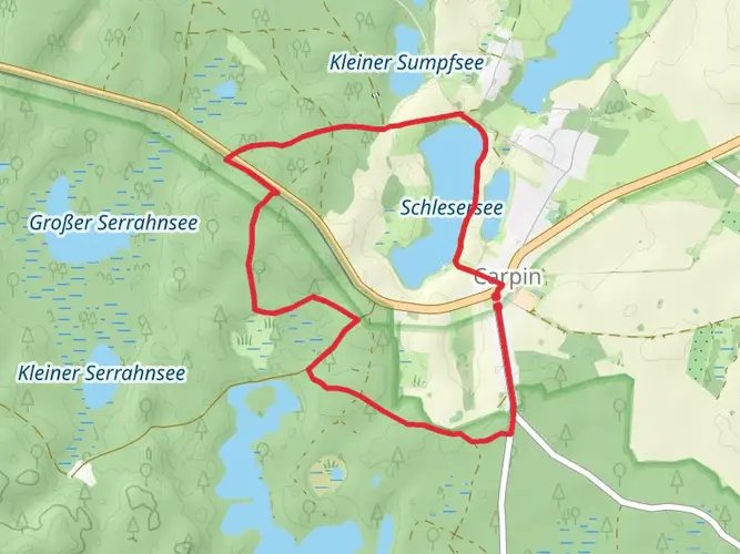
186.6 km
~9 days
1053 m
Multi-Day
“Embark on the Märkischer Landweg for a historic and scenic hike across Germany's serene lakes and rolling hills.”
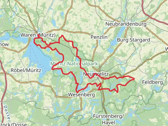
Embarking on the Märkischer Landweg, hikers will traverse approximately 187 kilometers (about 116 miles) of varied landscapes, from the tranquil waters of the Mecklenburgische Seenplatte to the rolling hills of Brandenburg. With an elevation gain of around 1000 meters (3280 feet), the trail offers a medium difficulty level, suitable for hikers with some experience.
Getting to the Trailhead
The trailhead is conveniently located near the Mecklenburgische Seenplatte, a region known for its abundance of lakes. To reach the starting point, travelers can use public transportation by taking a train to the nearest station and then a bus to the trailhead. For those driving, parking is available near the starting area. It's advisable to use a navigation tool like HiiKER to pinpoint the exact location and plan the journey.
Navigating the Märkischer Landweg
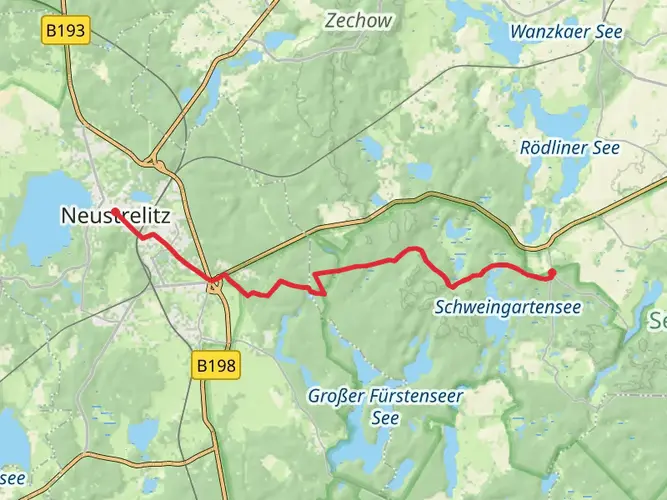
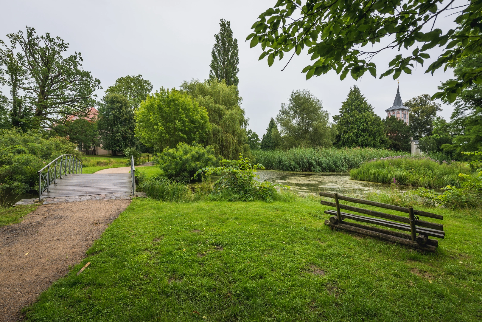
The trail is well-marked, guiding hikers through a tapestry of forests, pastures, and charming villages. Along the way, the path meanders beside serene lakes and crosses gentle streams, offering picturesque views and opportunities for wildlife spotting. Birds, deer, and a variety of flora can be observed, especially in the quieter sections of the trail.
Historical Significance and Landmarks
The region is steeped in history, with the trail passing through areas that have been significant since medieval times. Hikers will encounter historic landmarks such as ancient churches, castles, and remnants of old villages. These sites provide a glimpse into the past and are a testament to the area's rich cultural heritage.
Natural Beauty and Challenges
The trail's elevation gain is spread out across its length, with some sections more challenging than others. The highest points offer expansive views of the surrounding countryside, making the climbs worthwhile. The diverse terrain includes forested paths, open fields, and occasionally rocky sections, requiring sturdy footwear and careful footing.
Preparation and Planning
Hikers should prepare for variable weather conditions and carry appropriate gear, including rain protection and layers for cooler temperatures. It's essential to have a reliable source of water and to plan for resupply points along the trail. Hikers can use HiiKER to locate water sources, accommodation, and other essential services.
Conclusion
The Märkischer Landweg is a journey through natural beauty, history, and the peaceful countryside of Germany. With proper preparation and an adventurous spirit, hikers will find this trail to be a rewarding experience that offers a unique blend of scenic landscapes and historical intrigue.

Frequently asked questions
How long does the Märkischer Landweg take to hike from start to finish?
The Märkischer Landweg is 186.63 km long, so most hikers treat it as a multi-day route rather than a weekend walk. A common pace on this trail is around 10 stages, which matches published stage planning in the Uckermark, with daily distances often falling in roughly the 10 to 27 km range.
Can the Märkischer Landweg be hiked without carrying luggage?
Yes. A luggage-transfer version of the Märkischer Landweg is offered in the Uckermark, with 9 overnight stays including breakfast and baggage transport between accommodations. That setup is designed for walkers covering the route over multiple days without carrying a full pack the whole way.
Where can you stay overnight on the Märkischer Landweg?
Overnight options on the Märkischer Landweg include towns and trail stops such as Lychen, Templin, Angermünde, Schwedt/Oder, and Mescherin. Official camping and simple overnight spots are listed along several stages, including Wurlsee Camping Lychen, Camping am Fährsee in Templin, Campingplatz am Wolletzsee near Angermünde, StroamCamp in Schwedt/Oder, and Campingplatz am Oderstrom in Mescherin.
Is camping allowed on the Märkischer Landweg?
Camping on the Märkischer Landweg is possible, but it is best planned around official campgrounds and designated simple sites rather than informal wild camping. Published stage information lists places such as Biwakplatz Küstrinchen, Biwakplatz Fegefeuer, Campingpark Himmelpfort, Wurlsee Camping Lychen, Camping am Fährsee in Templin, Campingplatz am Wolletzsee, StroamCamp in Schwedt/Oder, and Campingplatz am Oderstrom in Mescherin.
What is the best stage of the Märkischer Landweg for scenery?
One of the standout scenic sections of the Märkischer Landweg is the Angermünde to Stolpe stage. This section leads to the Stolper Turm earthworks, where there is a broad panorama over the southern Oder Valley, and it sets up the following Stolpe to Schwedt/Oder stretch along the western edge of the Lower Oder Valley National Park with oxbow waters, reedbeds, and floodplain woodland.
Can you cycle the Märkischer Landweg instead of hiking it?
The Märkischer Landweg is a long-distance hiking trail, not a dedicated bike route. Cyclists looking to cover the same broader landscapes of the Uckermark usually use regional cycling routes instead, such as the 260 km Uckermärkischer Radrundweg, which also passes through the Uckermärkische Seen Nature Park, the Schorfheide-Chorin Biosphere Reserve, and the Lower Oder Valley National Park.
What kind of landscape does the Märkischer Landweg cross?
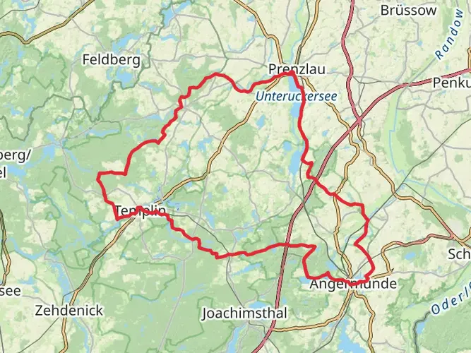
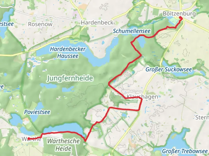
The Märkischer Landweg crosses a broad sweep of the Uckermark through three protected landscapes: the Uckermärkische Seen Nature Park, the Schorfheide-Chorin Biosphere Reserve, and the Lower Oder Valley National Park region. The route is known for glacially formed hills, forests, lakes, streams, fields, and quieter villages, with especially wetland-rich scenery near the Oder Valley.
Comments and Reviews
User comments, reviews and discussions about the Märkischer Landweg, Germany.
4.2
average rating out of 5
5 rating(s)