Download
3D Flyover
Add to list
More
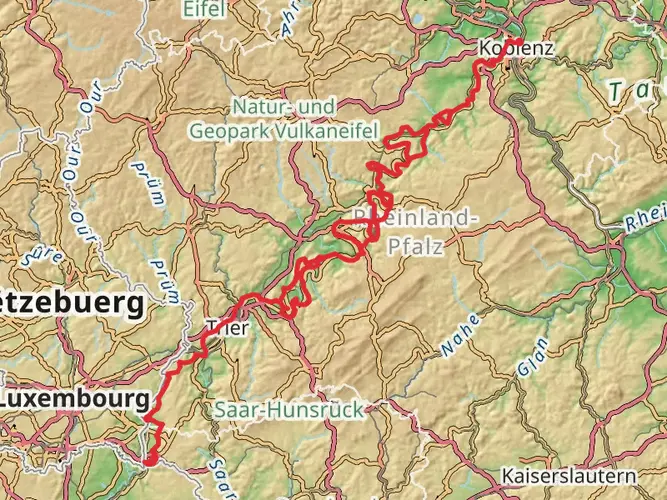
377.2 km
~15 days
7230 m
Multi-Day
“Embark on the Saar-Hunsrück-Steig: a scenic, historic trek through Germany's Hunsrück heartland.”
Spanning approximately 377 kilometers (234 miles) and with an elevation gain of around 7200 meters (23622 feet), the Saar-Hunsrück-Steig is a captivating long-distance hiking trail that weaves through the scenic landscapes of the Hunsrück region in Germany. This point-to-point trail begins near the town of Merzig-Wadern, offering hikers a medium difficulty trek through diverse terrains, including lush forests, rolling hills, and picturesque river valleys.
Getting to the Trailhead To start your journey on the Saar-Hunsrück-Steig, you can reach the trailhead near Merzig-Wadern by public transport or car. The nearest significant landmark is the town of Perl, located close to the German-Luxembourg border. From Perl, you can take a regional bus to Merzig, and then a taxi or another local bus to the trailhead. If driving, you can navigate to Merzig and follow local signage to the starting point of the trail.
Navigating the Trail As you embark on the Saar-Hunsrück-Steig, you'll find that the trail is well-marked with distinctive signage, making it easy to follow. For additional navigation support, the HiiKER app provides detailed maps and GPS coordinates to ensure you stay on the right path.
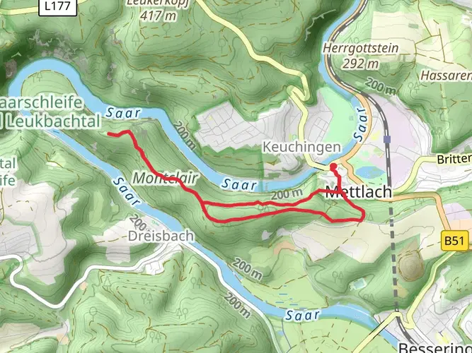
Landmarks and Natural Beauty The trail offers a rich tapestry of natural and cultural landmarks. One of the early highlights is the Cloef viewpoint, overlooking the dramatic Saar River bend near Mettlach, roughly 15 kilometers (9.3 miles) from the start. Further along, the trail passes through the mystical Dollberge, a range of forested hills with intriguing rock formations.
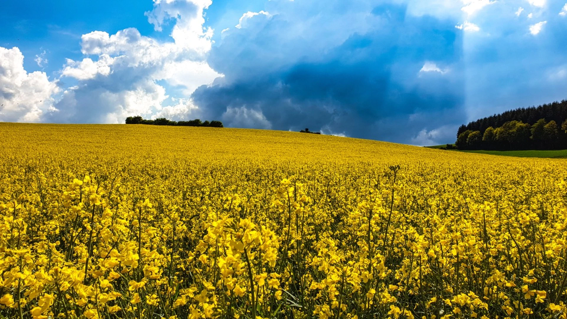
Wildlife and Flora The Saar-Hunsrück-Steig is a haven for nature enthusiasts. The dense forests are home to a variety of wildlife, including deer, foxes, and numerous bird species. The trail also traverses several nature reserves, where you can observe the diverse flora, including rare orchids and other wildflowers, especially in the spring and summer months.
Cultural and Historical Significance The region is steeped in history, with the trail occasionally crossing paths with ancient Roman roads. Hikers will encounter historical sites such as the Celtic ring wall at Otzenhausen and the ruins of the medieval Grimburg Castle. These sites provide a glimpse into the area's past and are perfect spots for a rest while taking in the historical ambiance.
Terrain and Elevation The trail's terrain is varied, with some sections requiring a bit more stamina due to steep inclines. The elevation gain is spread out across the entire route, with some of the more challenging ascents found in the Hunsrück hills. However, the trail is generally accessible to hikers with a moderate level of fitness.
Preparation and Planning Before setting out, ensure you have appropriate gear for the trail's varying conditions. Waterproof hiking boots, layered clothing, and a reliable rain jacket are essential. It's also advisable to carry a first-aid kit, sufficient water, and snacks. Given the trail's length, planning overnight stays in the towns and villages along the route is necessary. These locations offer a range of accommodations, from campgrounds to guesthouses.
Seasonal Considerations The Saar-Hunsrück-Steig can be hiked year-round, but the best conditions are typically from late spring to early autumn. During these months, the weather is more favorable, and the full beauty of the region's flora is on display. Winter hiking is possible but requires preparation for colder temperatures and shorter daylight hours.
By taking into account these details and preparing accordingly, hikers can fully immerse themselves in the natural beauty and historical richness of the Saar-Hunsrück-Steig.

Frequently asked questions
Where does the Saar-Hunsrück-Steig begin and end?
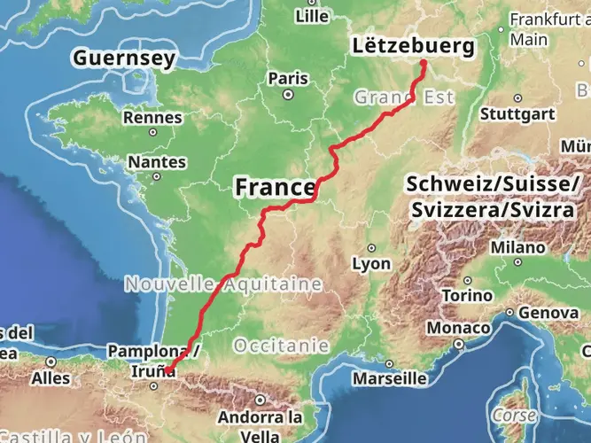
The Saar-Hunsrück-Steig starts in Perl on the Moselle and runs east to Boppard on the Rhine, with a branch to Trier. The full long-distance route is commonly described as about 415 km overall, while this route listing covers 377.16 km with 7,230 m of climbing in the Merzig-Wadern section.
How many stages does the Saar-Hunsrück-Steig have?
The main route from Perl to Boppard is divided into 24 stages on the official trail overview, and there is also a branch toward Trier. Stage 1 runs from Perl to Hellendorf, and Stage 2 continues via Tünsdorf and Orscholz to Mettlach, where the Saarschleife and Cloef viewpoint are among the best-known early highlights.
Is the Saar-Hunsrück-Steig suitable for beginners?
The Saar-Hunsrück-Steig is generally rated medium rather than easy, so it is better suited to hikers with some fitness and experience over multiple days. This route covers 377.16 km with 7,230 m of ascent, and even the official full route is broken into many stages rather than treated as a beginner walk.
Can the Saar-Hunsrück-Steig be hiked without carrying full luggage?
Yes. The trail region supports hut, guesthouse, hotel, vacation rental, and trekking-camp stays along the route, which makes it practical to plan a lighter multi-day walk with overnight stops instead of carrying full camping gear. Accommodation listings are organized specifically for the Saar-Hunsrück-Steig and its stages.
What are the best-known highlights on the Saar-Hunsrück-Steig near the start?
One of the signature early landmarks on the Saar-Hunsrück-Steig is the Cloef viewpoint above the Saarschleife in Mettlach-Orscholz. The Cloef sits about 180 m above the Saar, and the nearby Cloef-Atrium and treetop walk make this one of the most recognizable sections in the western part of the trail.
Are there Traumschleifen connected to the Saar-Hunsrück-Steig?
Yes. The Saar-Hunsrück-Steig is linked with a dense network of more than 100 Traumschleifen premium loop hikes across the region between the Saar, Moselle, Nahe, and Rhine. These side trips are generally 6 to 20 km long, waymarked as loop walks, and several can be reached directly from the long-distance trail.
Comments and Reviews
User comments, reviews and discussions about the Saar-Hunsrück-Steig, Germany.
5.0
average rating out of 5
4 rating(s)