Download
3D Flyover
Add to list
More
160.3 km
~7 days
3986 m
Multi-Day
“Embark on a breathtaking 100-mile journey through the Bavarian Alps, steeped in history and natural splendor.”
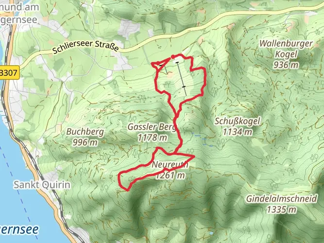
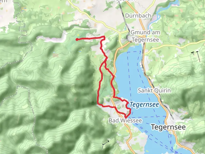
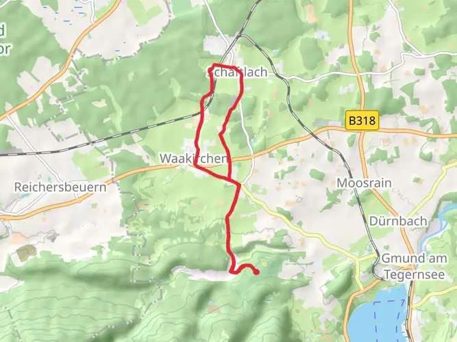
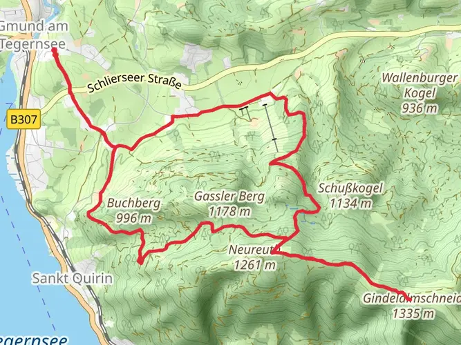
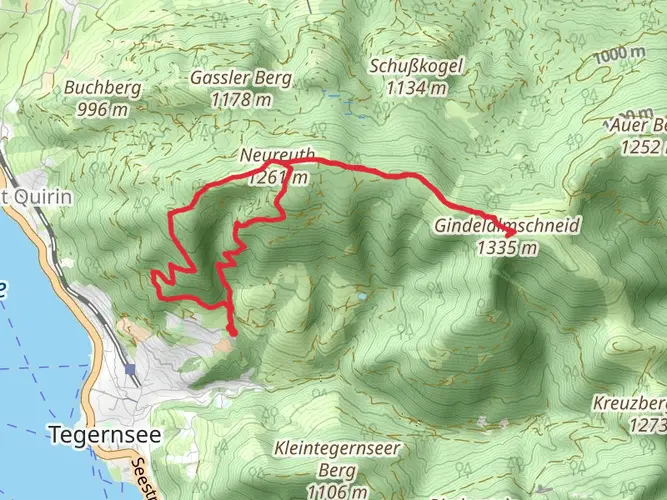
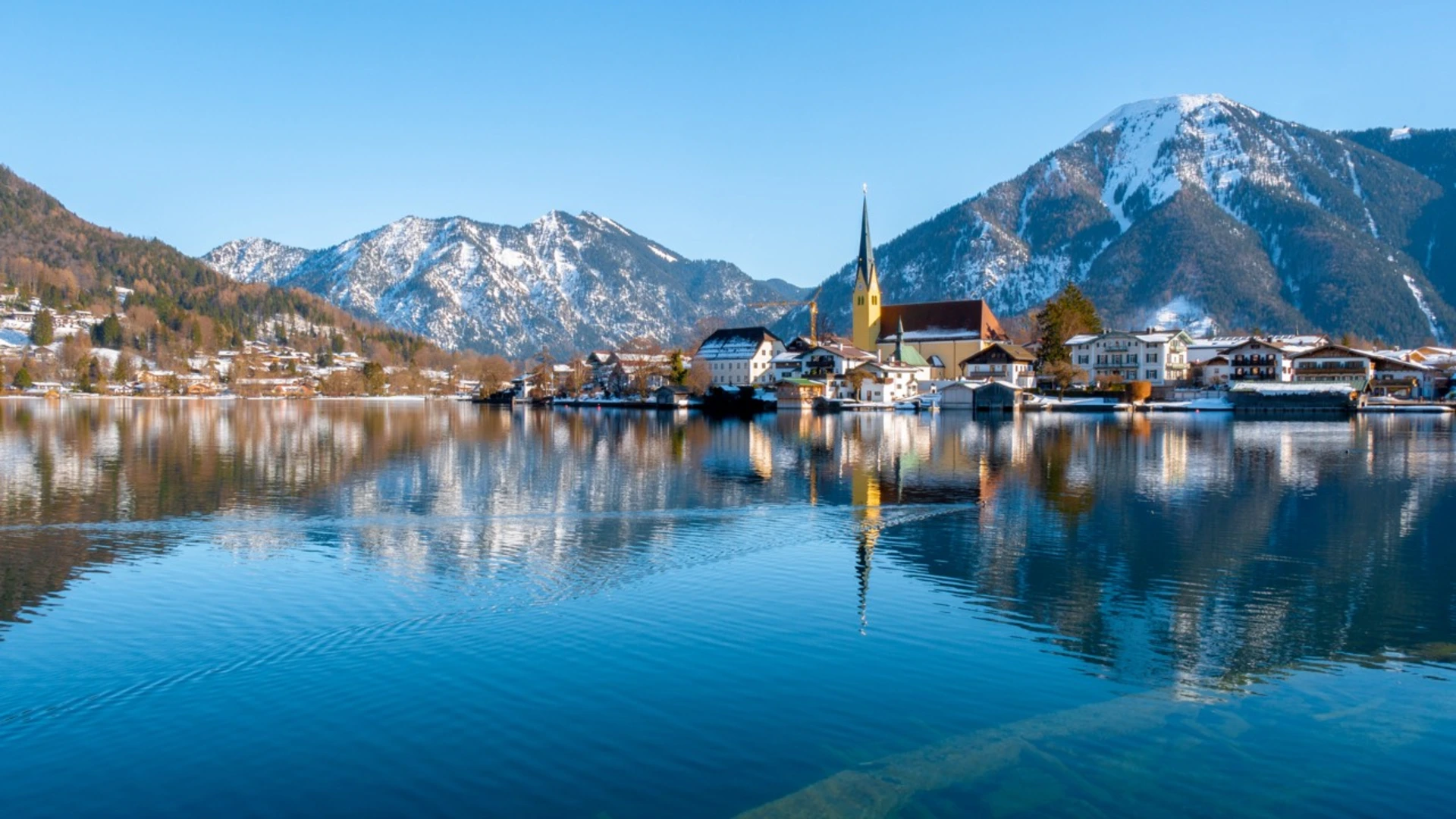
Embarking on Die Alpenüberquerung, hikers will traverse approximately 160 kilometers (about 100 miles) of varied terrain, ascending a total of around 3900 meters (nearly 12,800 feet) in elevation. This point-to-point trail begins near the quaint town of Miesbach, Germany, nestled in the foothills of the Bavarian Alps.
Getting to the Trailhead To reach the starting point, adventurers can drive to Miesbach, which is easily accessible from Munich via the A8 autobahn. For those preferring public transport, regular trains connect Munich to Miesbach, followed by a short bus or taxi ride to the trailhead.
The Journey Through the Alps The trail meanders through lush valleys, alpine forests, and over craggy mountain passes, offering a tapestry of natural beauty. In the early stages, hikers will pass through picturesque Bavarian countryside, with the trail gradually ascending into the more rugged terrain of the Alps.
Wildlife and Flora As you ascend, keep an eye out for the diverse wildlife that inhabits these mountains, including chamois, marmots, and golden eagles. The flora is equally impressive, with alpine meadows bursting with edelweiss, gentians, and alpenrose during the warmer months.
Cultural and Historical Landmarks The trail is not only a journey through nature but also through time. Hikers will encounter historical landmarks such as ancient monasteries, castles, and remnants of old Roman roads. The region is steeped in history, with many sites dating back to the Middle Ages and earlier.
Navigation and Planning To navigate the trail, hikers can utilize the HiiKER app, which provides detailed maps and waypoints. It's advisable to plan for multiple days of hiking, with overnight stays in mountain huts or small inns along the route. Ensure to book accommodations in advance, especially during the peak summer months.
Preparation and Safety Given the trail's medium difficulty rating, it's suitable for hikers with a reasonable level of fitness and experience. The weather in the Alps can change rapidly, so be prepared with appropriate gear for cold, rain, and possibly snow, even in summer. Always inform someone of your itinerary and check in regularly.
Conclusion Die Alpenüberquerung is a trail that offers a rich blend of natural beauty, wildlife, and historical intrigue. With careful planning and respect for the mountain environment, hikers can look forward to an unforgettable alpine adventure.

Frequently asked questions
Where does Die Alpenüberquerung start and finish?
Die Alpenüberquerung is a point-to-point crossing that begins in the Tegernsee area in Upper Bavaria and ends in Sterzing, also called Vipiteno, in South Tyrol, Italy. The full route is about 160.27 km long, and the commonly described crossing runs from Gmund am Tegernsee through the Achensee and Zillertal regions before crossing the main Alpine ridge toward Sterzing.
How difficult is Die Alpenüberquerung and what fitness level does it require?
Die Alpenüberquerung is rated Extra Difficult and covers 160.27 km with 3,986 m of ascent, so it is not a beginner-level walk. It suits hikers who can handle repeated long days, sustained climbing, and a full week of mountain travel, especially because the route includes major alpine transitions such as the crossing toward the Pfitscher Joch.
How many days does Die Alpenüberquerung usually take?
Die Alpenüberquerung is typically completed in 7 stages, which makes it about a week-long trek from the Tegernsee area to Sterzing. Based on the total distance of 160.27 km, that works out to roughly 23 km per day on average, although some stages are clearly harder than others, especially the more mountainous crossings.
Can Die Alpenüberquerung be hiked self-guided?
Die Alpenüberquerung is commonly done as a self-guided hut-to-town or inn-to-inn crossing rather than only as a guided trip. The route is described as a unified, signposted Alps crossing from the Tegernsee area to Sterzing, and the standard itinerary is broken into 7 established stages through Bavaria, Tyrol, and South Tyrol.
How do you get to the start of Die Alpenüberquerung from Munich?
Die Alpenüberquerung is straightforward to reach from Munich by rail. The Tegernsee region is served by regular train connections, and the crossing itself is promoted with a recommended rail arrival to Gmund am Tegernsee, where the route begins; drivers can also reach the area from Munich via the A8 corridor toward the Bavarian Alps.
Is there parking at the start of Die Alpenüberquerung near Tegernsee?
Long-stay parking in Gmund am Tegernsee is limited, and the local tourism guidance specifically notes that there are currently no long-duration parking options in Gmund itself. For a week-long crossing, the usual alternatives are parking in Munich or Holzkirchen and arriving by train, or using 7-day parking options in nearby Rottach-Egern or Kreuth and returning by bus to the start.
What are the main places and landmarks on Die Alpenüberquerung?
Die Alpenüberquerung links several well-known Alpine regions on one continuous crossing. The route runs from the Tegernsee area to Achensee, continues through the Zillertal, crosses the main Alpine ridge at the Pfitscher Joch, then descends through the Pfitschtal to finish in the medieval town of Sterzing, the northernmost town in Italy.
Comments and Reviews
User comments, reviews and discussions about the Die Alpenüberquerung, Germany.
4.67
average rating out of 5
9 rating(s)