Download
3D Flyover
Add to list
More
6.4 km
~1 hrs 43 min
270 m
Loop
“Experience a 6 km loop trail near Miltenberg, blending lush nature, historical landmarks, and moderate hiking.”
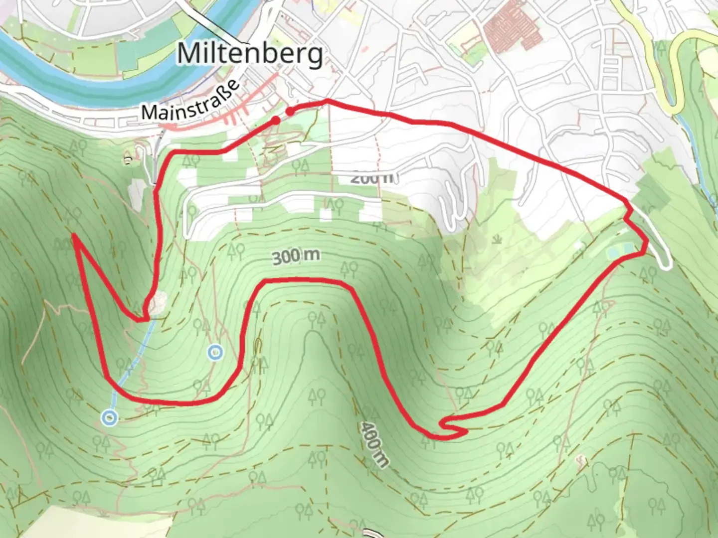
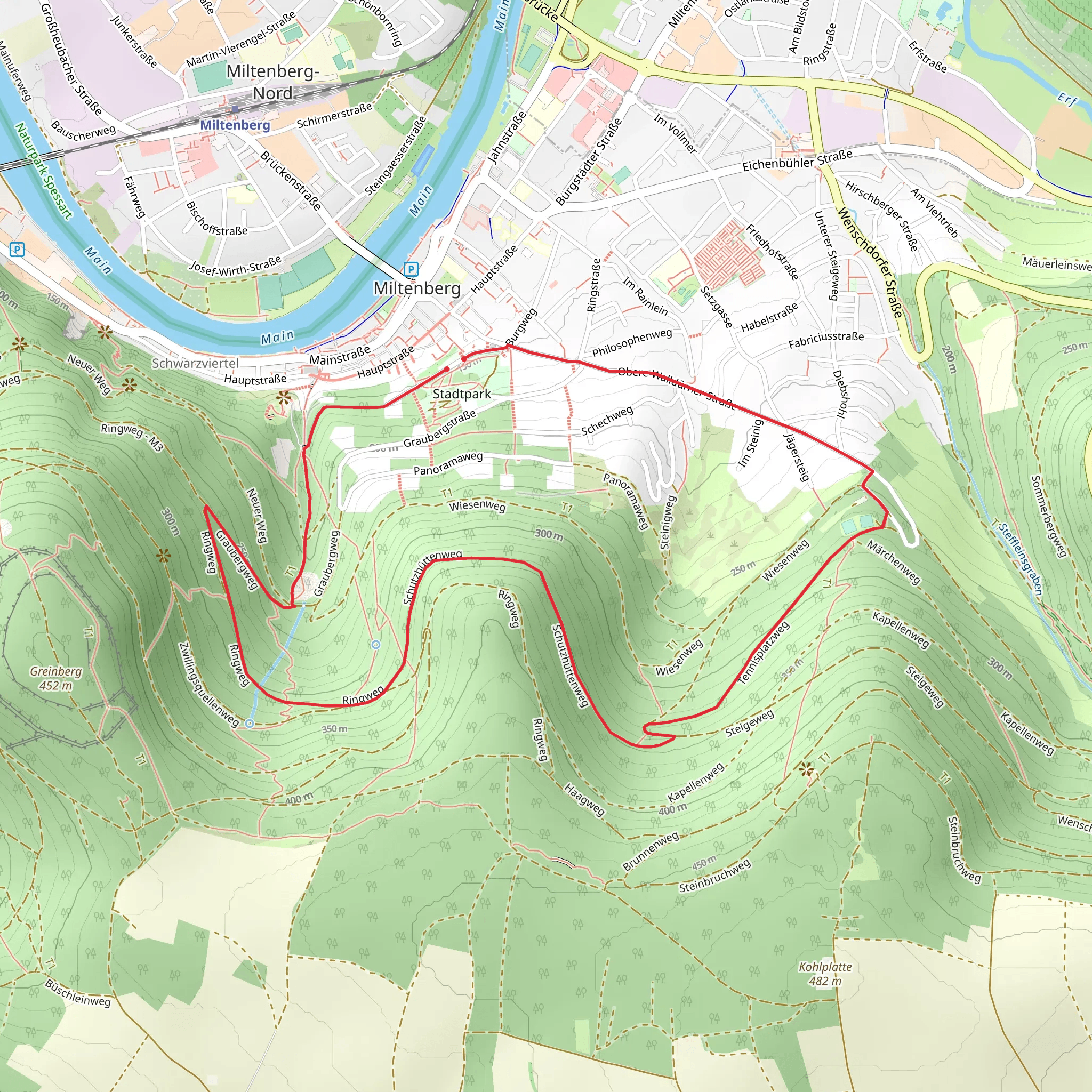
Starting near the picturesque town of Miltenberg, Germany, this 6 km (approximately 3.7 miles) loop trail offers a delightful mix of natural beauty and historical intrigue. With an elevation gain of around 200 meters (656 feet), the trail is rated as medium difficulty, making it suitable for moderately experienced hikers.
Getting There
To reach the trailhead, you can either drive or use public transport. If you're driving, head towards Miltenberg and look for parking near the town center. For those using public transport, Miltenberg is well-connected by train. The nearest train station is Miltenberg Bahnhof, from where you can walk to the trailhead in about 15 minutes.
Trail Overview
The trail begins near the historic town center of Miltenberg, known for its well-preserved medieval architecture. As you start your hike, you'll quickly find yourself immersed in the lush greenery of the Odenwald forest. The initial part of the trail is relatively flat, allowing you to ease into the hike while enjoying the serene surroundings.
Historical Significance
One of the highlights of this trail is its proximity to the Ostlicher Limesweg, part of the Upper Germanic-Rhaetian Limes, a UNESCO World Heritage site. This ancient Roman frontier wall once marked the boundary of the Roman Empire. As you hike, you'll come across remnants of this historical structure, offering a fascinating glimpse into the past. Keep an eye out for informational plaques that provide context and historical details about the Limes.
Nature and Wildlife
The trail meanders through dense forests and open meadows, offering a diverse range of flora and fauna. In the spring and summer months, the meadows are often dotted with wildflowers, attracting various species of butterflies and bees. Birdwatchers will also find plenty to enjoy, with common sightings including woodpeckers, owls, and various songbirds.
Key Landmarks
- Miltenberg Castle: Approximately 1 km (0.6 miles) into the hike, you'll pass by the Miltenberg Castle. Though not directly on the trail, a short detour will reward you with stunning views of the Main River and the surrounding countryside.
- Roman Watchtower: Around the 3 km (1.8 miles) mark, you'll encounter a reconstructed Roman watchtower. This is a great spot to take a break and soak in the historical atmosphere.
- Panoramic Viewpoints: As you gain elevation, several viewpoints offer panoramic vistas of the Odenwald forest and the Main River valley. These spots are perfect for photography or simply taking a moment to appreciate the natural beauty.
Navigation and Safety
For navigation, it's highly recommended to use the HiiKER app, which provides detailed maps and real-time GPS tracking. The trail is well-marked, but having a reliable navigation tool will ensure you stay on course.
Final Stretch
The last part of the trail descends gradually back towards Miltenberg. As you approach the town, you'll pass through vineyards and orchards, offering a different but equally charming landscape. The loop concludes back at the starting point, where you can explore more of Miltenberg's historic sites or enjoy a meal at one of the local restaurants.
This trail offers a perfect blend of natural beauty, historical significance, and moderate physical challenge, making it a rewarding experience for any hiker.
Comments and Reviews
User comments, reviews and discussions about the Miltenberg and Ostlicher Limesweg, Germany.
4.29
average rating out of 5
7 rating(s)
