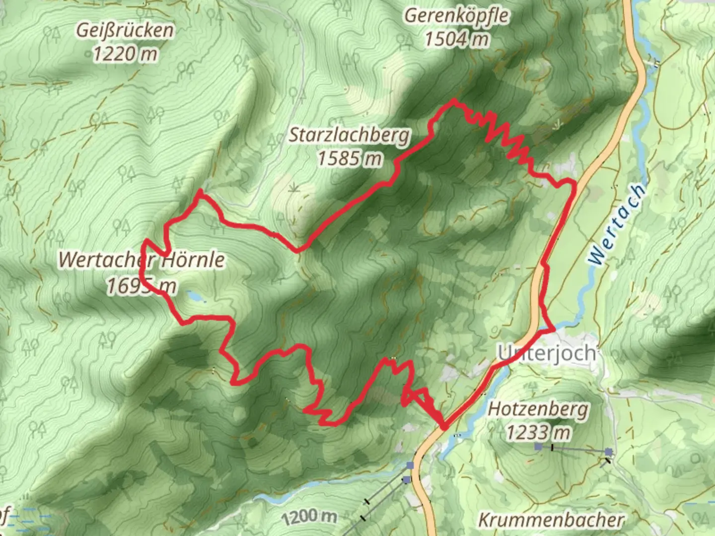
Wertacher Hörnle via Wertach - Lokale Beschilderte Wanderwege
Download
3D Flyover
Add to list
More
14.3 km
~4 hrs 23 min
922 m
Point-to-Point
“Experience breathtaking views and historical intrigue on the challenging Wertacher Hörnle trail in Bavaria.”
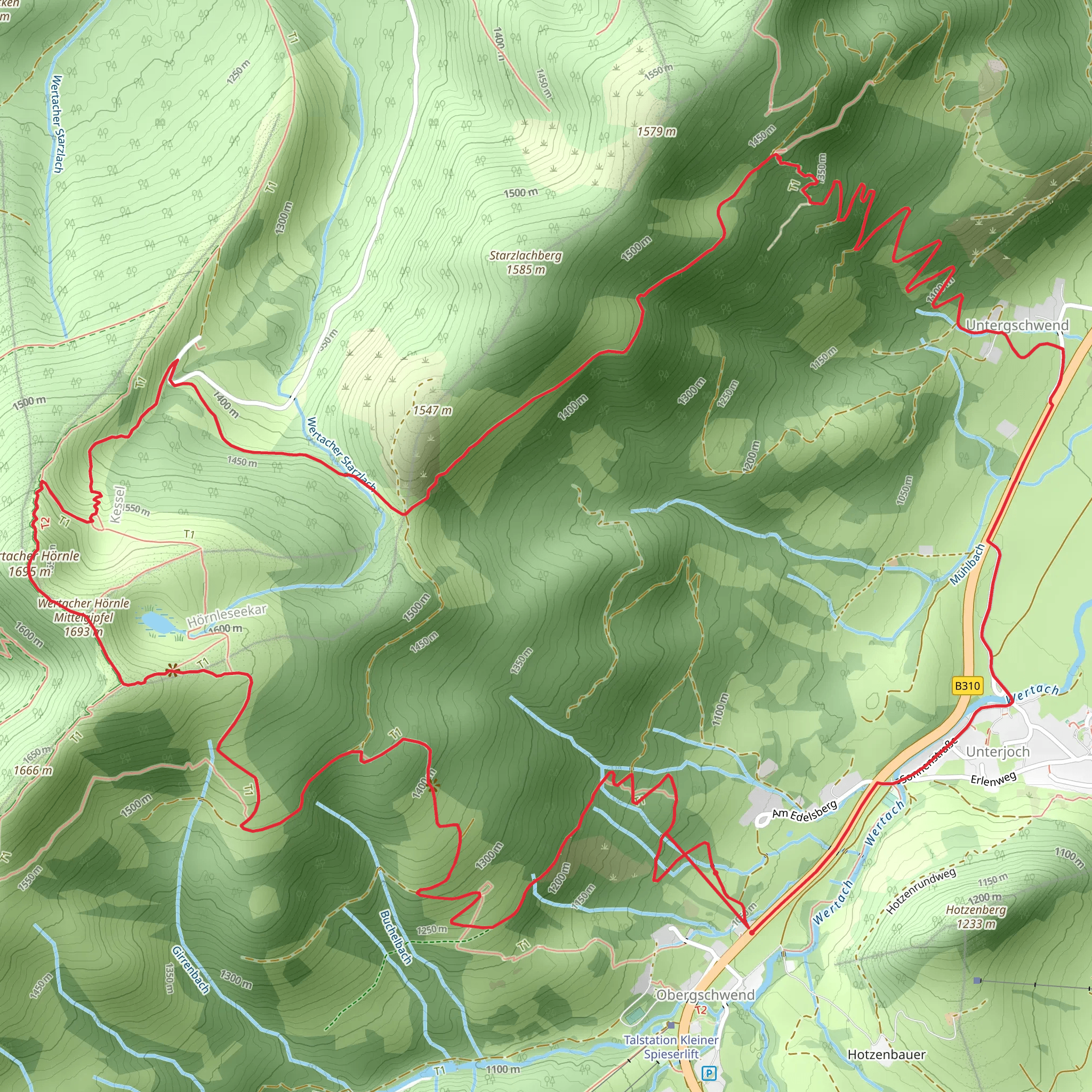
Nestled in the picturesque region of Oberallgäu, Germany, the Wertacher Hörnle via Wertach trail offers a challenging yet rewarding hiking experience. This point-to-point trail stretches approximately 14 kilometers (about 8.7 miles) and features an elevation gain of around 900 meters (approximately 2,950 feet), making it a demanding trek suitable for experienced hikers.
Getting There
To reach the trailhead, travelers can opt for public transport or drive. If you choose public transport, the nearest major town is Wertach, which is accessible by regional trains and buses from larger cities like Munich or Kempten. From Wertach, local buses or a short taxi ride can take you to the trailhead. For those driving, the trailhead is conveniently located near Wertach, with parking available nearby.
Trail Overview
The journey begins near the charming village of Wertach, a region known for its lush landscapes and traditional Bavarian architecture. As you set off, the trail quickly ascends through dense forests, offering a serene start to your adventure. The initial section is steep, with an elevation gain that will test your endurance, but the tranquility of the forest provides a peaceful backdrop.
Significant Landmarks and Nature
As you emerge from the forest, the landscape opens up to reveal expansive alpine meadows. These meadows are particularly stunning in spring and summer, when wildflowers blanket the ground in vibrant colors. Keep an eye out for local wildlife, including deer and various bird species that inhabit the area.
Approximately halfway through the hike, you'll encounter the first significant landmark: the summit of Wertacher Hörnle. At an elevation of 1,695 meters (5,561 feet), this peak offers breathtaking panoramic views of the Allgäu Alps and the surrounding valleys. It's an ideal spot to take a break and soak in the natural beauty.
Historical Significance
The region around Wertach has a rich history, with evidence of human settlement dating back to the Roman era. The trail itself follows paths that have been used for centuries by shepherds and traders. As you hike, consider the generations of people who have traversed these same routes, contributing to the cultural tapestry of the area.
Navigation and Safety
Given the trail's difficulty, it's crucial to be well-prepared. Ensure you have a reliable navigation tool like HiiKER to guide you through the more challenging sections. Weather conditions in the Alps can change rapidly, so pack appropriate gear, including layers, rain protection, and sturdy hiking boots.
Final Stretch
The descent from Wertacher Hörnle takes you through more open landscapes, with sweeping views that accompany you back towards civilization. The trail concludes near the village of Oberjoch, where you can find local amenities and transportation options to return to your starting point or continue exploring the region.
This hike offers a blend of natural beauty, challenging terrain, and historical intrigue, making it a must-do for avid hikers seeking an unforgettable adventure in the heart of the Bavarian Alps.
Comments and Reviews
User comments, reviews and discussions about the Wertacher Hörnle via Wertach - Lokale Beschilderte Wanderwege, Germany.
4.0
average rating out of 5
2 rating(s)
