Download
Preview
Add to list
More
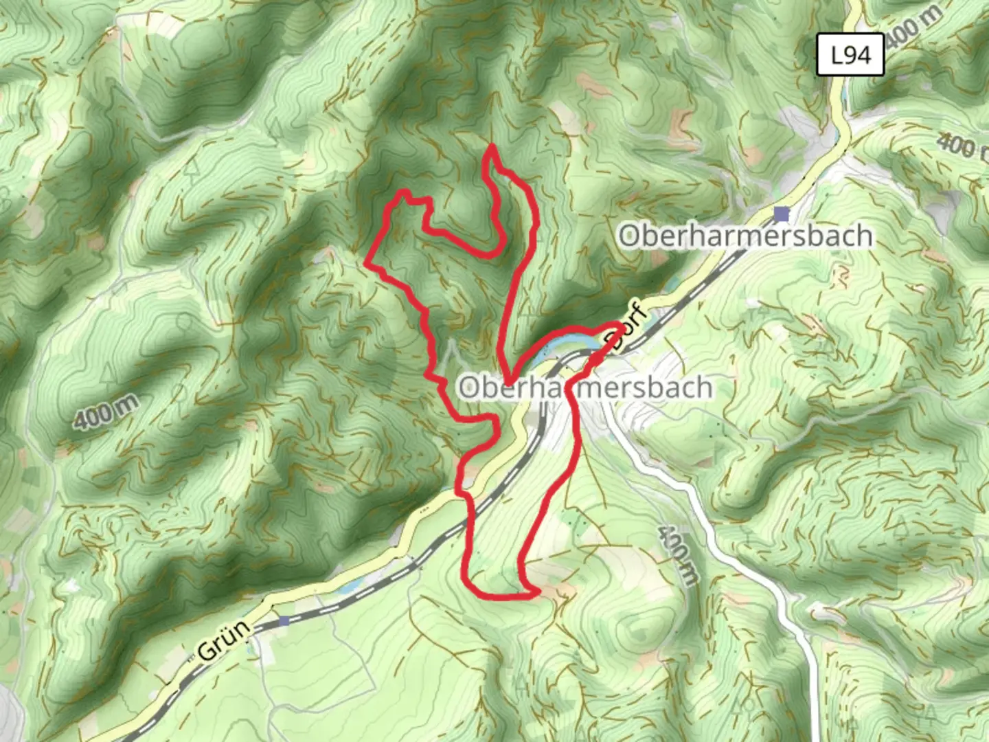
8.2 km
~2 hrs 17 min
381 m
Loop
“The Katzenstein, Bernhardsberg, and Jedensbach Loop offers stunning views and moderate challenges for experienced hikers.”
Starting near Ortenaukreis, Germany, the Katzenstein, Bernhardsberg, and Jedensbach Loop is an 8 km (approximately 5 miles) trail with an elevation gain of around 300 meters (984 feet). This loop trail is rated as medium difficulty, making it suitable for moderately experienced hikers.
Getting There
To reach the trailhead, you can drive or use public transport. If driving, set your GPS to Ortenaukreis, Germany, and look for parking near the trailhead. For public transport, take a train or bus to the nearest station in Ortenaukreis and then a local bus or taxi to the trailhead.
Trail Overview
The trail begins with a gentle ascent through a dense forest, providing ample shade and a cool environment, especially during the summer months. As you progress, the path becomes steeper, leading you to the first significant landmark, Katzenstein. This rocky outcrop offers panoramic views of the surrounding valleys and is an excellent spot for a short break and some photography.
Bernhardsberg
Continuing from Katzenstein, the trail takes you to Bernhardsberg. This section involves a moderate climb, but the effort is well worth it. At the summit of Bernhardsberg, you will find a small clearing with a bench, perfect for a rest while taking in the scenic views. The area is rich in flora, with various wildflowers blooming in the spring and summer.
Jedensbach
The descent from Bernhardsberg leads you towards Jedensbach. This part of the trail is relatively easier, with a gentle downhill slope. Jedensbach is a picturesque stream that meanders through the forest, providing a serene backdrop for the latter part of your hike. Keep an eye out for local wildlife, including deer and various bird species that frequent the area.
Historical Significance
The region around Ortenaukreis has a rich history dating back to medieval times. Along the trail, you may come across remnants of old stone structures and markers that hint at the area's historical significance. These landmarks offer a glimpse into the past and add an element of intrigue to your hike.
Navigation
For navigation, it is highly recommended to use the HiiKER app, which provides detailed maps and real-time updates to ensure you stay on the right path. The trail is well-marked, but having a reliable navigation tool can enhance your hiking experience and provide peace of mind.
Final Stretch
The final stretch of the loop brings you back to the starting point near Ortenaukreis. This section is relatively flat, allowing you to cool down and reflect on the diverse landscapes and experiences the trail has offered.

What to expect?
Activity types
Comments and Reviews
User comments, reviews and discussions about the Katzenstein, Bernhardsberg and Jedensbach Loop, Germany.
4.4
average rating out of 5
5 rating(s)