Download
3D Flyover
Add to list
More
238.6 km
~10 days
4992 m
Multi-Day
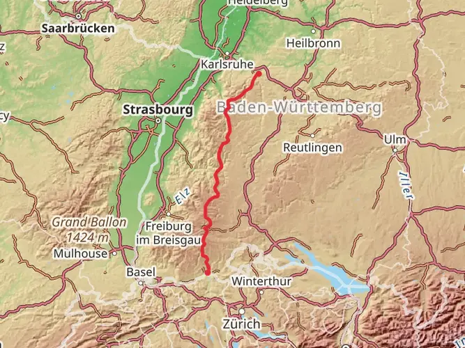
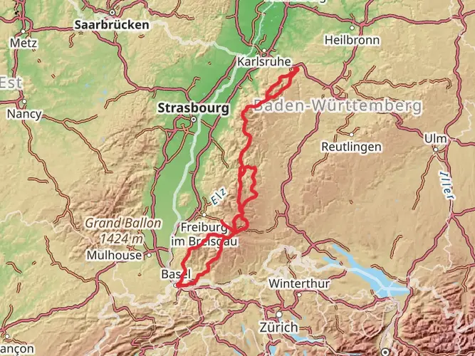
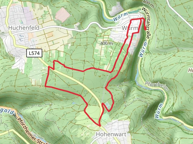
The Ostweg is a 238.6 km trail that starts in Pforzheim, Pforzheim, Germany. Based on our data, the hike is graded as Medium. For information on how we grade trails, please read measuring the difficulty of a hiking trail on hiiker. Also, check our latest community posts for trail updates. This hike can be completed in approx 10 days. Caution is advised on trail times as this depends on multiple variables. For more info read about how we calculate hike time.

Frequently asked questions
Where does the Ostweg start and finish in the Black Forest?
The Ostweg starts in Pforzheim on the northern edge of the Black Forest and runs south to Schaffhausen in Switzerland. The full route is about 238.56 km in this itinerary, and official Schwarzwaldverein materials describe the long-distance trail as roughly 245 km from Pforzheim to Schaffhausen.
How many stages does the Ostweg have in the Black Forest?
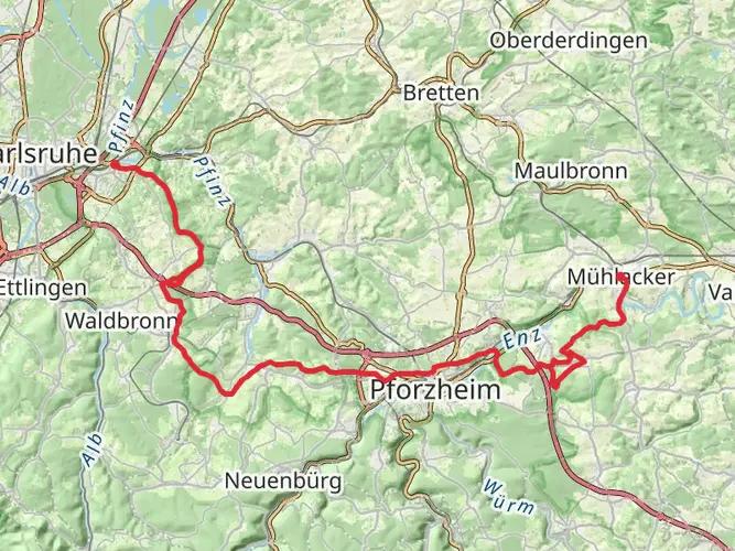
The Ostweg is commonly divided into 10 to 12 daily stages, depending on pace and overnight stops. A widely used 12-stage breakdown runs from Pforzheim to Bad Liebenzell, then through Oberhaugstett, Pfalzgrafenweiler, Freudenstadt, Alpirsbach, Schramberg, Villingen, Sunthausen, Geisingen, Achdorf, Stuhlingen, and finishes in Schaffhausen.
How long does it take to hike the Ostweg from Pforzheim to Schaffhausen?
Most hikers complete the Ostweg in about 10 to 12 days. At 238.56 km with 4,992 m of climbing, it fits a classic medium-difficulty multi-day schedule, and the official stage suggestions also support a roughly 12-day crossing.
What is the route of the Ostweg through the Black Forest?
The Ostweg runs north to south through the eastern side of the Black Forest, beginning in Pforzheim and heading toward Schaffhausen. Along the way it passes places including Bad Liebenzell, Pfalzgrafenweiler, Freudenstadt, Alpirsbach, Schramberg, Villingen, Geisingen, and Stuhlingen, with highlights such as the Monbachtal, the Baar plateau, the Wutachfluhen, and the Rhine near the finish.
Is the Ostweg a good choice for beginner long-distance hikers?
The Ostweg is often more approachable than the higher, more alpine-feeling Black Forest ridge routes because it links many towns and villages along the way. Even so, it is still a 238.56 km multi-day hike with 4,992 m of ascent, so it suits fit beginners with solid day-hiking experience better than complete first-timers.
What is stage 1 of the Ostweg and how far is it?
A standard first stage of the Ostweg runs from Pforzheim to Bad Liebenzell. That opening day is usually listed at about 25 km and introduces the route’s pattern of valleys, forest paths, and town-to-town progress on the eastern side of the Black Forest.
What is stage 8 of the Ostweg and how far is it?
In the common 12-stage division, stage 8 of the Ostweg runs from Villingen to Sunthausen. That section is usually given as about 16.5 km, making it one of the shorter days on the route before the trail continues toward Geisingen, Achdorf, and Stuhlingen.
Comments and Reviews
User comments, reviews and discussions about the Ostweg, Germany.
4.4
average rating out of 5
5 rating(s)