Download
3D Flyover
Add to list
More
10.7 km
~2 hrs 45 min
362 m
Loop
“Embark on a challenging yet rewarding hike through lush forests, historical landmarks, and stunning valley views.”
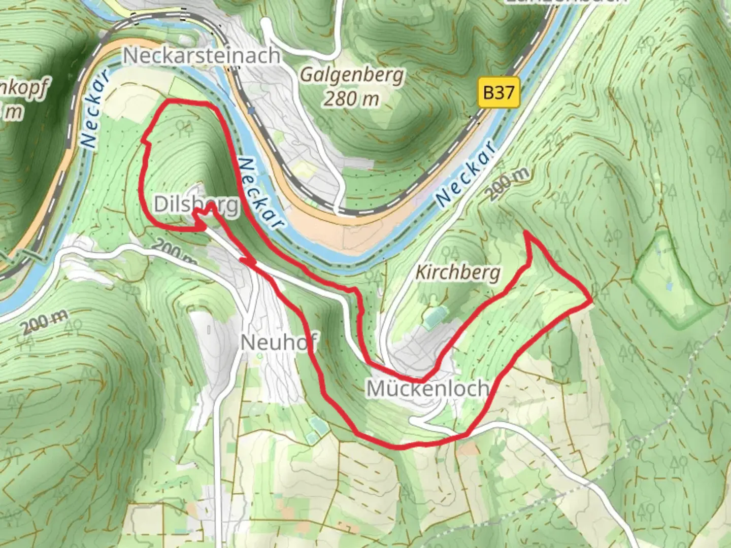
Nestled in the picturesque region of Rhein-Neckar-Kreis, Germany, this challenging loop trail spans approximately 11 kilometers (about 6.8 miles) with an elevation gain of around 300 meters (approximately 984 feet). The trailhead is conveniently located near the town of Neckargemünd, which is easily accessible by both car and public transport. If you're driving, you can park in Neckargemünd and begin your adventure from there. For those using public transport, the Neckargemünd train station is well-connected, with regular services from Heidelberg and other nearby cities.
Trail Overview
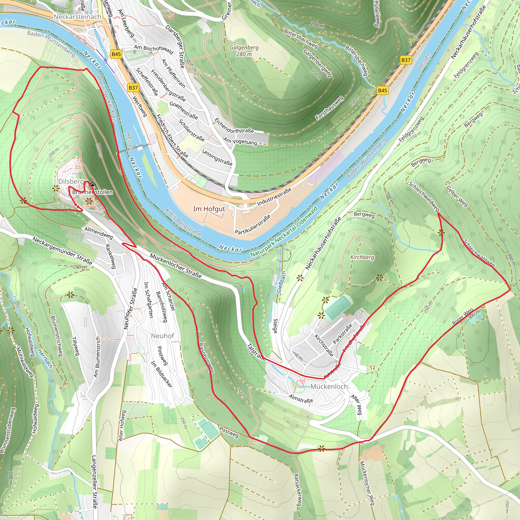
The Neckar via Main Stromberg Weg and Schleichwald Weg offers a demanding yet rewarding hiking experience. As you embark on this loop, you'll traverse through dense forests, open meadows, and along the serene Neckar River. The trail is known for its varied terrain, which includes steep ascents and descents, making it suitable for experienced hikers looking for a challenge.
Natural Beauty and Wildlife
As you hike, you'll be enveloped by the lush greenery of the Schleichwald forest, home to a diverse array of flora and fauna. Keep an eye out for native wildlife such as deer, foxes, and a variety of bird species. The forest canopy provides ample shade, making it a pleasant hike even on warmer days. In spring and summer, the trail is adorned with wildflowers, adding vibrant splashes of color to your journey.
Historical Significance
The region surrounding the trail is steeped in history. The Neckar River has been a vital waterway since Roman times, and the area is dotted with remnants of its storied past. As you hike, you'll pass by several historical landmarks, including ancient ruins and traditional German architecture. The nearby town of Neckargemünd itself boasts a charming old town with half-timbered houses and cobblestone streets, offering a glimpse into the region's rich cultural heritage.
Navigation and Safety
Given the trail's difficulty rating, it's crucial to be well-prepared. Ensure you have sturdy hiking boots, sufficient water, and snacks for the journey. The trail is well-marked, but it's advisable to use the HiiKER app for navigation to stay on track and explore any detours or points of interest along the way. Weather conditions can change rapidly, so check the forecast before setting out and dress in layers to accommodate temperature fluctuations.
Points of Interest
Approximately halfway through the trail, you'll reach a scenic viewpoint overlooking the Neckar Valley. This spot offers breathtaking panoramic views, making it an ideal place to rest and take in the natural beauty. As you continue, you'll encounter the Main Stromberg Weg, a section known for its dense woodland and tranquil atmosphere. The Schleichwald Weg, on the other hand, provides a more open landscape with sweeping views of the surrounding countryside.
This trail promises a fulfilling adventure for those ready to tackle its challenges, offering a blend of natural splendor, historical intrigue, and the serene beauty of the German countryside.
Comments and Reviews
User comments, reviews and discussions about the Neckar via Main Stromberg Weg and Schleichwald Weg, Germany.
4.0
average rating out of 5
1 rating(s)
