Download
3D Flyover
Add to list
More
61.8 km
~3 days
969 m
Multi-Day
“Embark on Germany's picturesque Aar-Höhenweg, a journey through history and nature's splendor, navigable with HiiKER's guidance.”
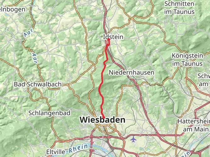
The Aar-Höhenweg is a scenic trail that stretches approximately 62 kilometers (about 38.5 miles) and features an elevation gain of around 900 meters (roughly 2950 feet). This point-to-point trail is nestled in the picturesque region near Rheingau-Taunus-Kreis, Germany, and offers a medium difficulty rating, making it accessible to hikers with a moderate level of experience.
Getting to the Trailhead
To reach the starting point of the Aar-Höhenweg, hikers can either drive or use public transportation. For those opting for public transport, the nearest significant landmark is the town of Taunusstein, which is well-connected by bus services. From there, hikers can navigate to the trailhead using the HiiKER app, which will provide precise directions and ensure a smooth start to the journey.
Navigating the Trail
As you embark on the Aar-Höhenweg, you'll traverse a variety of landscapes, including lush forests, open meadows, and rolling hills that offer panoramic views of the surrounding countryside. The trail is well-marked, and with the aid of HiiKER's digital maps, navigation should be straightforward.
Landmarks and Nature
One of the highlights of the Aar-Höhenweg is the rich natural beauty that accompanies hikers throughout their journey. Expect to encounter a diverse array of flora and fauna, including native birds and perhaps even glimpses of local wildlife such as deer.
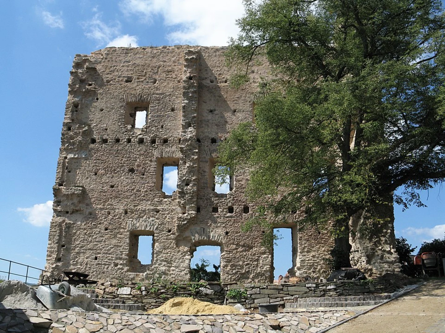
The trail also boasts several landmarks of historical significance. As you make your way along the path, you'll come across old mills, historic villages, and remnants of ancient settlements. These sites provide a glimpse into the region's past and its development over the centuries.
Preparation and Planning
Given the trail's length and elevation gain, it's important to prepare adequately. Ensure you have enough water, as well as snacks and meals for energy replenishment. Sturdy hiking boots are recommended due to the varied terrain, and always check the weather forecast before setting out to avoid any surprises.
Conclusion
The Aar-Höhenweg is a trail that promises a rewarding experience for those who undertake its journey. With its blend of natural beauty, historical intrigue, and a moderate challenge, it's a hike that offers something for everyone. Remember to plan ahead, use HiiKER for navigation, and most importantly, enjoy the adventure that awaits on this beautiful German trail.

Frequently asked questions
How long does it take to hike the Aar-Höhenweg from Taunusstein to Diez?
The Aar-Höhenweg is 61.79 km long with 969 m of climbing, so most hikers split it into 2 to 4 days. Strong hikers can cover it faster, but the route is generally better suited to a multi-day plan because it runs from the source area near Kastell Zugmantel above Taunusstein all the way down to Diez on the Lahn.
Where does the Aar-Höhenweg start and finish?
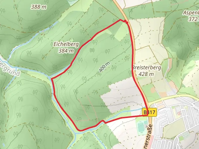
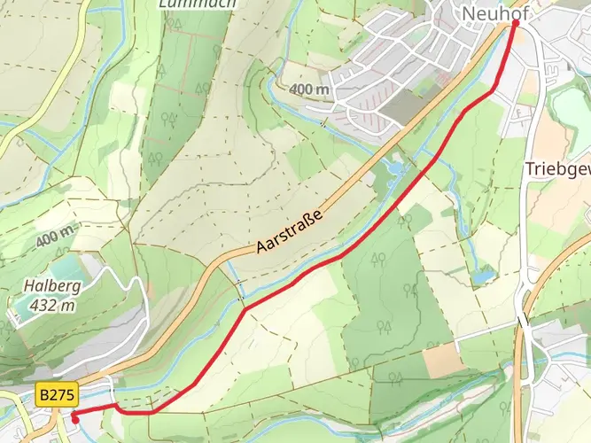
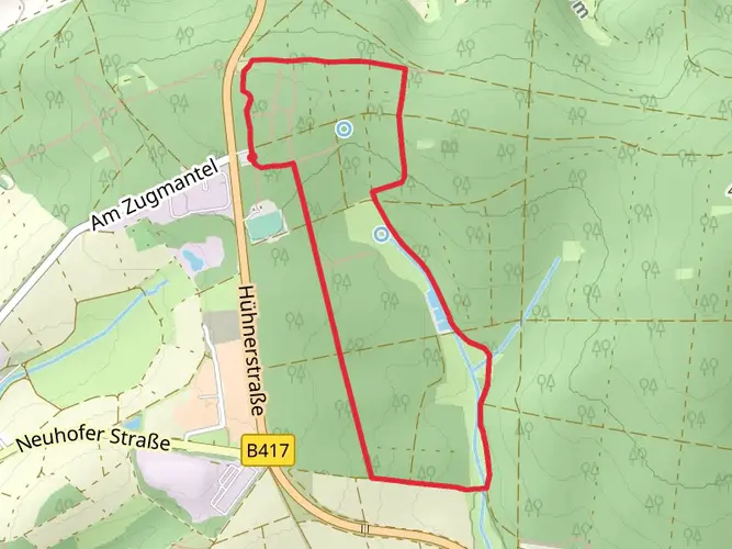
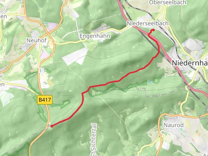
The Aar-Höhenweg begins near the source of the Aar by Kastell Zugmantel on the B417 near Taunusstein-Orlen and finishes in Diez, where the Aar meets the Lahn. Along the way it passes places including Wehen, Hahn, Bleidenstadt, Adolfseck, Oberneisen, and the final approach by Burg Ardeck before entering Diez.
Is the Aar-Höhenweg hard, and what kind of terrain does it have?
The Aar-Höhenweg is generally rated medium difficulty. The total ascent is 969 m over 61.79 km, and the route mixes forest tracks, meadow paths, valley-side trails, short steeper climbs, and some paved sections through towns such as Wehen, Bleidenstadt, Adolfseck, and Diez.
Can the Aar-Höhenweg be reached by public transportation?
Yes. A common public-transport approach is to travel to Wiesbaden, then take bus 225 to Orlen, Waffelfabrik Löser, and walk to the hiking parking area at Kastell Zugmantel near the start. At the Diez end, the route is also practical for a one-way hike because bus connections run through the Aar valley for the return.
Where can I park for the Aar-Höhenweg trailhead?
The usual trailhead parking for the Aar-Höhenweg is the hiking car park at Kastell Zugmantel on the B417, also called Hühnerstraße, near Taunusstein-Orlen. From that parking area, a short walk leads toward the reconstructed Roman tower, the Limes remains, and the source area of the Aar where the route begins.
What are the main sights on the Aar-Höhenweg?
Highlights on the Aar-Höhenweg include the Roman fort area at Kastell Zugmantel, reconstructed Limes features near the source of the Aar, views over Bad Schwalbach from the Four-Church View and Adolfseck pavilion, the Justinusfelsen inscription site, Burg Ardeck near Holzheim, and the historic center of Diez with its castle above the Lahn.
Is the Aar-Höhenweg a point-to-point trail or a loop?
The Aar-Höhenweg is a point-to-point trail, not a loop. It follows the Aar valley region from the uplands near Taunusstein down toward Diez, so transport planning matters more than on a circular walk and many hikers arrange a return by bus after finishing.
Comments and Reviews
User comments, reviews and discussions about the Aar-Höhenweg, Germany.
3.75
average rating out of 5
4 rating(s)