Download
3D Flyover
Add to list
More
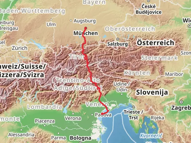
122.5 km
~5 days
1707 m
Multi-Day
“Embark on the König Ludwig Weg for a historic hike through Bavaria's enchanting landscapes and royal legacies.”
The König Ludwig Weg, or King Ludwig Way, is a scenic and historically rich trail that stretches approximately 122 kilometers (about 76 miles) through the picturesque region of Bavaria in Germany. With an elevation gain of around 1700 meters (approximately 5577 feet), hikers can expect a moderately challenging journey that traverses a variety of landscapes, from serene lakes to lush forests and pastoral countryside.
Starting near the town of Starnberg, which is easily accessible by public transport from Munich, the trailhead is a short walk from the Starnberg train station. For those arriving by car, parking is available in the area. The trail begins by skirting the shores of Lake Starnberg, where King Ludwig II of Bavaria was mysteriously found dead in 1886, adding a touch of intrigue right from the start.
Historical Significance and Cultural Highlights As you embark on the König Ludwig Weg, you'll be following in the footsteps of royalty. The trail is named after the beloved "Fairy Tale King," Ludwig II, known for his grand castles and contribution to the arts. Along the route, hikers will encounter various monuments and sites connected to the king's legacy, including the majestic Neuschwanstein Castle, which appears like a vision from a storybook against the Alpine backdrop.
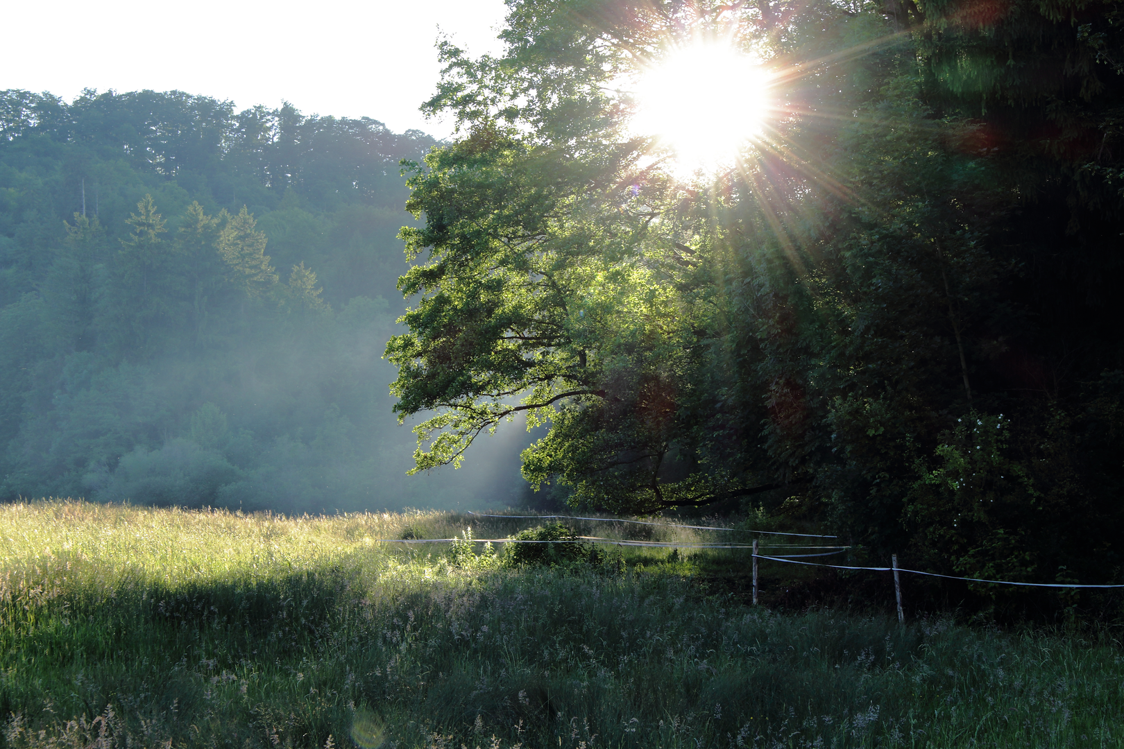
Landmarks and Natural Beauty The path leads adventurers through the Ammergau Alps, offering stunning views and the opportunity to witness the region's diverse flora and fauna. The trail meanders through the Murnauer Moos Nature Reserve, one of Central Europe's largest peat bogs, which is a haven for birdwatchers and nature enthusiasts.
As you progress, the trail takes you through charming Bavarian villages where traditional architecture and customs are still alive. The pilgrimage church of Wies, a UNESCO World Heritage Site, is a baroque masterpiece not to be missed, located roughly at the halfway point of the trail.
Navigation and Preparation Hikers can rely on HiiKER to navigate the trail, ensuring they stay on the correct path and can plan their stops accordingly. The app provides detailed maps and information on the trail, which is well-marked with signs featuring the image of King Ludwig in profile.
Accommodation and Supplies There are numerous guesthouses and inns along the route, allowing for comfortable overnight stays and the chance to sample local Bavarian cuisine. It's advisable to book accommodations in advance, especially during peak hiking season. Shops and restaurants in the villages provide opportunities to restock on supplies, but it's wise to carry essentials and snacks for the more remote sections of the trail.
Weather and Timing The best time to hike the König Ludwig Weg is from late spring to early autumn when the weather is mild, and the risk of snow is minimal. However, the Bavarian Alps can have unpredictable weather, so hikers should be prepared for sudden changes and pack appropriate clothing.
In conclusion, the König Ludwig Weg offers a unique blend of natural beauty, cultural immersion, and historical exploration. Whether you're a seasoned hiker or a history buff, this trail provides a memorable experience through the heart of Bavaria.

Frequently asked questions
What is the König Ludwig Weg and where does the König Ludwig Weg start and finish?
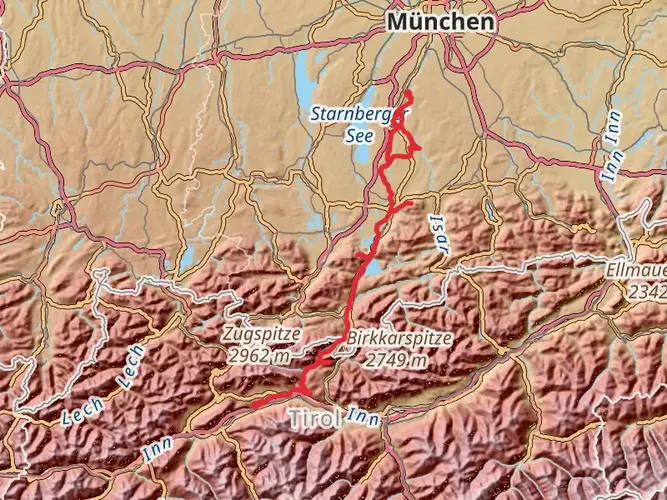
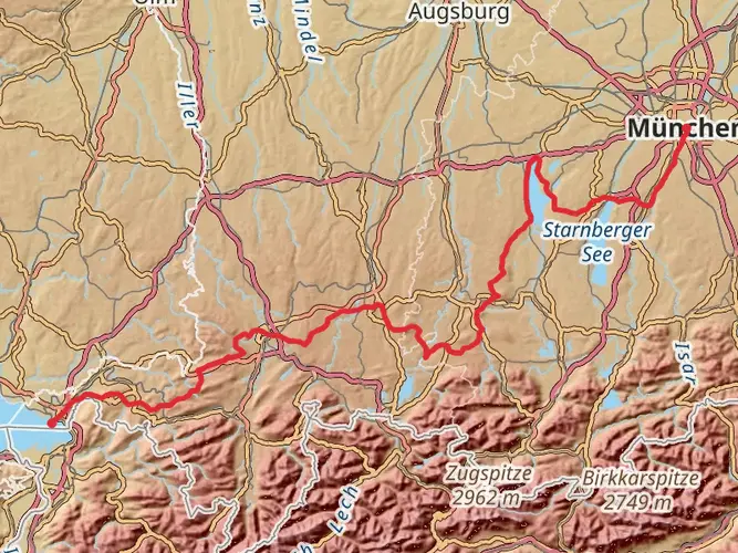
The König Ludwig Weg is a long-distance walking route in Bavaria that links places associated with King Ludwig II. The trail is about 122.49 km long with 1,707 m of elevation gain, starting at the Votivkapelle in Berg on Lake Starnberg and finishing in Füssen near Hohenschwangau and Neuschwanstein Castle.
How long does it take to hike the König Ludwig Weg?
Most hikers complete the König Ludwig Weg in about 6 to 8 days, depending on stage length and whether the Ammersee section is walked or crossed by boat. At 122.49 km in total, the route is commonly split into daily stages around 18 to 25 km, with the first stage from Lake Starnberg toward the Ammersee taking roughly 6 to 7 hours.
What is the first stage of the König Ludwig Weg like?
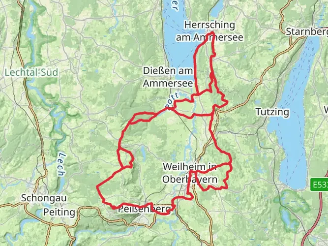
The first stage of the König Ludwig Weg runs from Berg am Starnberger See toward the Ammersee and is described as about 24 km with a walking time of roughly 6 to 7 hours. It passes the Votivkapelle, the Starnberg waterfront, the Maisinger Schlucht, Maisinger See, and climbs toward Kloster Andechs before continuing down toward Herrsching.
Is the König Ludwig Weg difficult?
The König Ludwig Weg is generally considered an easy multi-day trail overall, especially compared with alpine hut routes. The total elevation gain is 1,707 m over 122.49 km, so the challenge comes more from consecutive long walking days than from technical mountain terrain.
What are the main highlights on the König Ludwig Weg?
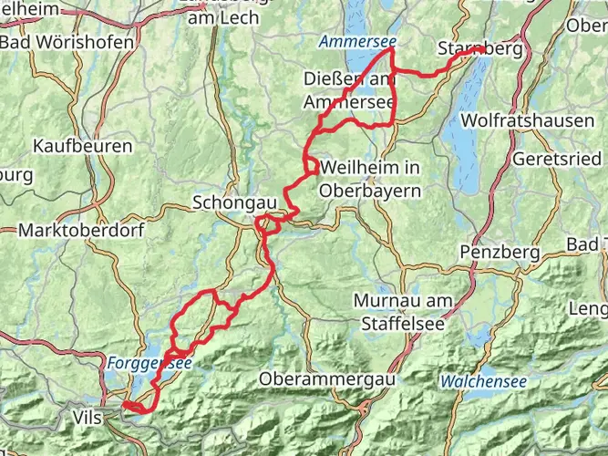
Major highlights on the König Ludwig Weg include Lake Starnberg, Kloster Andechs, the Ammersee area, Wessobrunn, the Wieskirche, the Hohen Peißenberg viewpoint, Bannwaldsee, Hohenschwangau, Marienbrücke, and Neuschwanstein Castle. The route ends in Füssen after passing the Schwanseepark and the Kalvarienberg above town.
Which lake is connected to King Ludwig II on the König Ludwig Weg?
The König Ludwig Weg begins at Lake Starnberg, the lake where King Ludwig II died on June 13, 1886. The trail’s start at the Votivkapelle in Berg marks the place above the lakeshore associated with his death, which is why the route is so closely tied to his story.
Can the König Ludwig Weg be reached by public transportation?
Yes. The northern end of the König Ludwig Weg is accessible from the Munich area by rail to Starnberg, and the route description notes strong public transportation links along the trail. Herrsching, Dießen, and Füssen are all well-known transport points on or near the route, which makes section hiking practical as well.
Comments and Reviews
User comments, reviews and discussions about the König Ludwig Weg, Germany.
4.86
average rating out of 5
7 rating(s)