Download
3D Flyover
Add to list
More
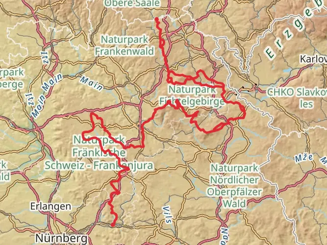
132.3 km
~6 days
2580 m
Multi-Day
“Embark on the historic Nurtschweg trail, a scenic Bavarian adventure rich in heritage and natural splendor.”
The Nurtschweg is a captivating trail that spans approximately 132 kilometers (about 82 miles) and ascends roughly 2500 meters (approximately 8200 feet) in elevation. This point-to-point journey begins near the quaint town of Tirschenreuth, located in the Upper Palatinate region of Bavaria, Germany. Hikers can expect a medium difficulty rating, making it accessible to those with a moderate level of fitness and hiking experience.
Getting to the Trailhead
To reach the starting point of the Nurtschweg, hikers can drive to the vicinity of Tirschenreuth, where parking is available. For those relying on public transportation, there are bus and train services that connect to Tirschenreuth from larger cities. Once in Tirschenreuth, local bus lines or taxis can take you closer to the trailhead.
Navigating the Trail
Hikers can utilize the HiiKER app for detailed maps and navigation assistance throughout the Nurtschweg. The trail is well-marked with signage, guiding adventurers through the scenic Upper Palatinate Forest, which is part of the larger Bohemian Forest, a significant natural border between Germany, Austria, and the Czech Republic.
Landmarks and Scenery
The Nurtschweg offers a diverse array of landscapes, including dense forests, serene meadows, and rolling hills. As you embark on the trail, you'll pass through charming villages and historical sites, such as the ruins of the medieval castle of Weißenstein. The trail also features the Waldnaabtal, a picturesque river valley with unique rock formations and tranquil ponds.
Wildlife and Nature
The region is rich in biodiversity, with the possibility of encountering a variety of wildlife, including deer, foxes, and numerous bird species. The trail traverses several nature reserves, where the preservation of flora and fauna is a priority. Hikers should be mindful of the environment and adhere to the principles of Leave No Trace to protect these natural habitats.
Historical Significance
The Nurtschweg trail is steeped in history, with the area having been settled since the Bronze Age. Throughout the hike, you'll come across remnants of the past, including ancient trade routes, historical border stones, and even sections of the "Golden Path," an important medieval trade route that linked Bavaria and Bohemia.
Preparation and Planning
Before setting out on the Nurtschweg, hikers should prepare for varying weather conditions and pack accordingly. The trail can be completed in several stages, with guesthouses and huts available for overnight stays. It's advisable to book accommodations in advance, especially during peak hiking seasons.
Water sources are available along the trail, but it's wise to carry enough water and a means of purification. For sustenance, pack high-energy snacks and plan for meals in the villages or at the inns along the route.
Safety and Etiquette
While the Nurtschweg is not considered a high-risk trail, it's important to stay on marked paths to ensure safety and protect the environment. Hikers should be equipped with a basic first aid kit, a reliable means of communication, and inform someone of their itinerary before departure.
Respect for local customs and regulations is paramount, as is courteous interaction with fellow hikers and residents. Dogs are often welcome on the trail but should be kept on a leash where required.
By following these guidelines and being well-prepared, hikers can fully enjoy the natural beauty and historical richness of the Nurtschweg trail.

Frequently asked questions
How many stages does the Nurtschweg have, and how long is each stage?
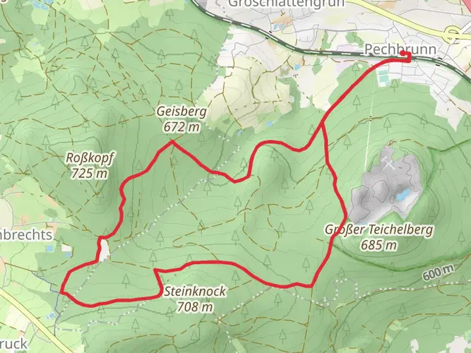
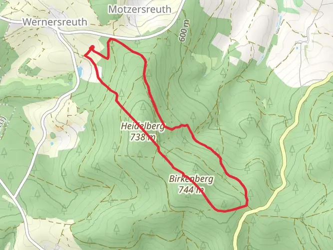
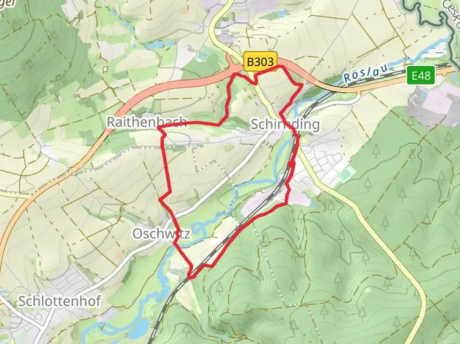
The Nurtschweg is a 132.28 km multi-day route that is commonly split into stages. On HiiKER, the main stage breakdown shown is 12.8 km, 27.6 km, 10.7 km, 19.5 km, 8.3 km, 38.8 km, 10.8 km, and 3.9 km, with several alternate segments also mapped. That makes it flexible for anything from a week-long hike to a shorter section walk.
Where does Nurtschweg stage 1 start and finish?
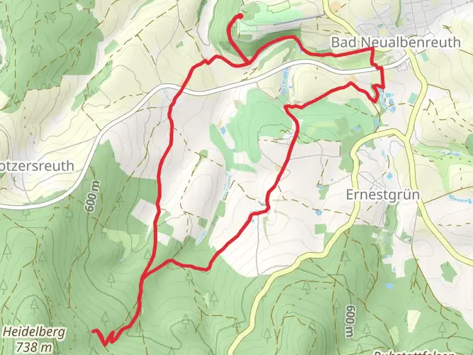
Nurtschweg stage 1 on HiiKER runs 12.8 km from Mitterhof near Waldsassen in Tirschenreuth to Schachten in Hardeck, with about 250 m of climbing. Another commonly cited opening section for the trail starts in Waldsassen and continues to Bad Neualbenreuth, so stage names can vary slightly depending on the stage plan being used.
What is Nurtschweg stage 3 like?
Nurtschweg stage 3 on HiiKER is a shorter day at 10.7 km, starting in Mähring and finishing at the Alte Stadtmauer in Bärnau. It has about 178 m of elevation gain, so it is one of the less demanding sections of the route and works well as a lighter day between longer stages.
How difficult is the Nurtschweg and how much climbing does it have?
The Nurtschweg is rated medium difficulty. Across the full route it covers 132.28 km with about 2,580 m of ascent, so the challenge comes more from sustained multi-day distance than from alpine terrain. Some sections are much bigger days than others, especially the 38.8 km stage with roughly 1,138 m of climbing.
Where does the Nurtschweg start and end?
The Nurtschweg is a point-to-point long-distance trail in the Upper Palatinate Forest near the German-Czech border. It is widely described as running between Waldsassen and Waldmünchen, passing places such as Bad Neualbenreuth, Mähring, Bärnau, Georgenberg, Waidhaus, and Tiefenbach along the way.
Can the Nurtschweg be hiked in shorter sections instead of as one long trip?
Yes. The Nurtschweg is well suited to section hiking because the route is already divided into multiple stages and alternates. Shorter options include compact days such as the 8.3 km section from Georgenberg to Frankenreuth, the 10.8 km section from Tiefenbach to Waldmünchen, or the 10.7 km stretch from Mähring to Bärnau.
Is the Nurtschweg suitable for mountain biking?
The Nurtschweg is primarily known as a long-distance hiking trail, not a dedicated MTB route. There is published MTB content using parts of the corridor, but that does not make the full hiking trail a signed or universally bike-approved mountain bike route. For riding, access and legality need to be checked section by section rather than assumed for the entire Nurtschweg.
Comments and Reviews
User comments, reviews and discussions about the Nurtschweg, Germany.
4.0
average rating out of 5
1 rating(s)