Download
Preview
Add to list
More
11.8 km
~3 hrs 16 min
546 m
Loop
“Experience natural beauty, historical landmarks, and diverse wildlife on the captivating 12 km Frillensee and Steiner Alm Loop.”
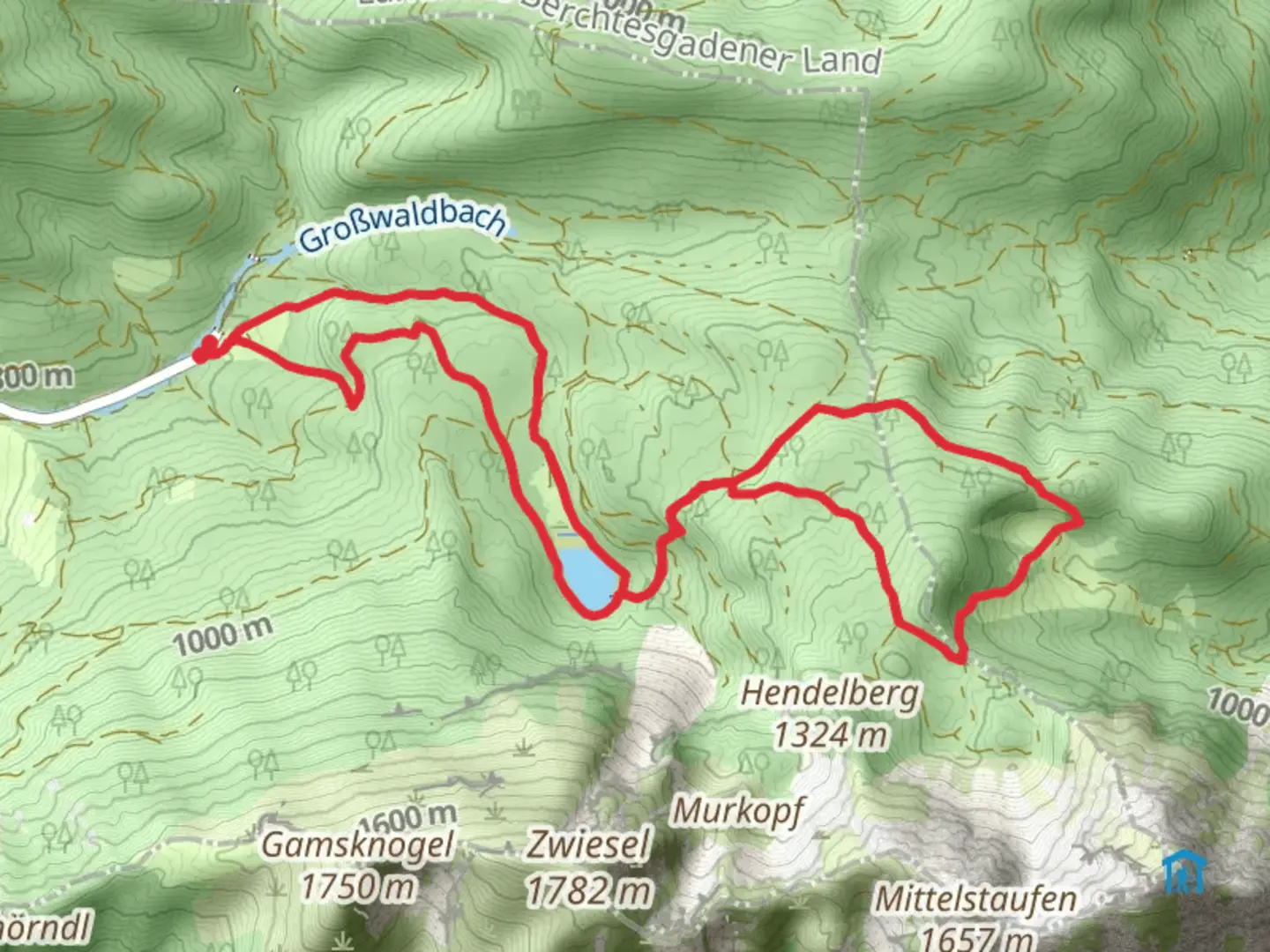
Starting near Traunstein, Germany, the Frillensee and Steiner Alm Loop via Frillensee Runde is a captivating 12 km (7.5 miles) loop trail with an elevation gain of approximately 500 meters (1,640 feet). This medium-difficulty trail offers a blend of natural beauty, historical landmarks, and diverse wildlife, making it a rewarding experience for hikers.
Getting There
To reach the trailhead, you can either drive or use public transport. If driving, head towards Traunstein and follow signs to the trailhead, which is conveniently located near the town. For those using public transport, take a train to Traunstein station. From there, local buses or taxis can take you to the starting point of the hike.
Trail Overview
The trail begins with a gentle ascent through lush forests, providing a serene atmosphere as you make your way towards Frillensee. This initial section is relatively easy, allowing you to warm up before the more challenging parts of the hike.
Frillensee
Approximately 3 km (1.9 miles) into the hike, you'll reach Frillensee, a picturesque alpine lake surrounded by dense woodland. The lake is a perfect spot for a short break, offering stunning reflections of the surrounding trees and mountains. Keep an eye out for local wildlife, including deer and various bird species that frequent the area.
Ascent to Steiner Alm
Continuing from Frillensee, the trail begins to climb more steeply as you head towards Steiner Alm. This section covers about 4 km (2.5 miles) and involves an elevation gain of around 300 meters (984 feet). The path can be rocky and uneven, so sturdy hiking boots are recommended. Along the way, you'll pass through alpine meadows, which are particularly beautiful in the spring and summer when wildflowers are in bloom.
Steiner Alm
At around the 7 km (4.3 miles) mark, you'll arrive at Steiner Alm, a traditional alpine hut that offers a glimpse into the region's pastoral history. The hut is often open to hikers, providing a cozy spot to rest and enjoy some local Bavarian snacks. The views from Steiner Alm are breathtaking, with panoramic vistas of the surrounding mountains and valleys.
Descent and Return
The descent from Steiner Alm is more gradual, winding through mixed forests and open meadows. This section is about 5 km (3.1 miles) long and brings you back to the trailhead near Traunstein. The path is well-marked, but it's always a good idea to have a reliable navigation tool like HiiKER to ensure you stay on track.
Historical Significance
The region around Traunstein has a rich history, with evidence of human settlement dating back to the Bronze Age. The alpine huts, like Steiner Alm, are part of a long tradition of mountain farming in Bavaria. These huts were historically used by shepherds and farmers during the summer months when livestock were grazed in the high pastures.
Wildlife and Flora
The trail offers ample opportunities to observe local wildlife. In addition to deer and birds, you might spot marmots and, if you're lucky, a chamois. The flora is equally diverse, with dense forests of spruce and fir giving way to alpine meadows filled with wildflowers such as gentians and edelweiss.
Practical Tips
- Wear sturdy hiking boots with good ankle support.
- Bring sufficient water and snacks, especially if you plan to stop at Steiner Alm.
- Check the weather forecast before you go, as conditions can change rapidly in the mountains.
- Use HiiKER for navigation to ensure you stay on the correct path.
This trail offers a perfect blend of natural beauty, historical interest, and physical challenge, making it a must-do for any hiking enthusiast visiting the Traunstein area.

What to expect?
Activity types
Comments and Reviews
User comments, reviews and discussions about the Frillensee and Steiner Alm Loop via Frillensee Runde, Germany.
4.5
average rating out of 5
4 rating(s)