Download
3D Flyover
Add to list
More
7.7 km
~2 hrs 30 min
578 m
Loop
“Embark on the Haberspitz Loop via Maximiliansweg for breathtaking views and a moderately challenging Bavarian Alps adventure.”
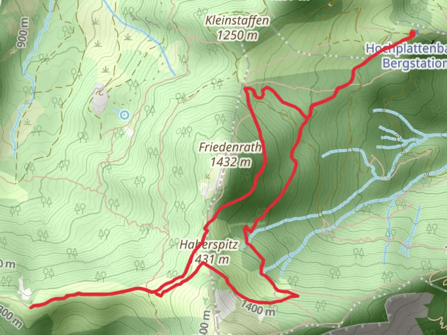
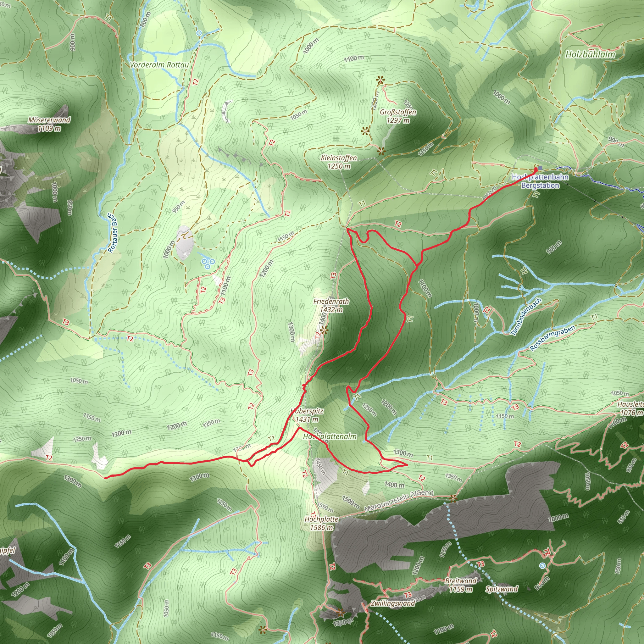
Starting near the charming town of Traunstein in Germany, the Haberspitz Loop via Maximiliansweg offers an invigorating hike through the Bavarian Alps. This 8 km (5 miles) loop trail features an elevation gain of approximately 500 meters (1,640 feet), making it a moderately challenging adventure suitable for hikers with a reasonable level of fitness.
Getting There
To reach the trailhead, you can either drive or use public transport. If driving, head towards Traunstein and look for parking options near the town center or closer to the trailhead. For those using public transport, Traunstein is well-connected by train. From Munich, you can take a direct train to Traunstein, which takes about 1.5 hours. Once in Traunstein, local buses or a short taxi ride can get you to the starting point of the trail.
Trail Overview
The trail begins near Traunstein and quickly immerses you in the natural beauty of the Bavarian Alps. The initial section of the hike is relatively gentle, allowing you to warm up as you traverse through lush forests and meadows. Keep an eye out for local wildlife such as deer and various bird species that inhabit the area.
Key Landmarks and Sections
Maximiliansweg
As you progress, you'll join the Maximiliansweg, a historic long-distance trail named after King Maximilian II of Bavaria. This section of the trail is particularly scenic, offering panoramic views of the surrounding mountains and valleys. The path here is well-marked, but it's always a good idea to have a reliable navigation tool like HiiKER to ensure you stay on track.
Haberspitz Summit
Approximately 4 km (2.5 miles) into the hike, you'll reach the summit of Haberspitz. At an elevation of around 1,200 meters (3,937 feet), this vantage point provides breathtaking views of the Chiemgau Alps and the distant Lake Chiemsee. It's a perfect spot to take a break, enjoy a snack, and soak in the stunning scenery.
Descent and Return
The descent from Haberspitz is a bit steeper, so take your time and watch your footing. The trail winds back through dense forests, eventually looping back towards Traunstein. Along the way, you'll pass by several small streams and possibly encounter more wildlife. The final stretch of the hike is relatively flat, allowing for a leisurely walk back to the trailhead.
Historical Significance
The region around Traunstein has a rich history, with evidence of human settlement dating back to the Bronze Age. The town itself is known for its well-preserved medieval architecture and historical landmarks. Hiking the Haberspitz Loop via Maximiliansweg not only offers natural beauty but also a glimpse into the cultural and historical tapestry of Bavaria.
Preparation and Tips
Given the moderate difficulty of the trail, it's essential to wear sturdy hiking boots and bring plenty of water and snacks. Weather in the Alps can be unpredictable, so pack a light rain jacket and dress in layers. A map or a navigation app like HiiKER is highly recommended to ensure you stay on the correct path.
This hike is best enjoyed from late spring to early autumn when the weather is most favorable, and the trails are clear of snow. Whether you're a seasoned hiker or someone looking to explore the Bavarian Alps for the first time, the Haberspitz Loop via Maximiliansweg offers a rewarding and memorable experience.
What to expect?
Activity types
Comments and Reviews
User comments, reviews and discussions about the Haberspitz Loop via Maximiliansweg, Germany.
5.0
average rating out of 5
2 rating(s)
