Download
3D Flyover
Add to list
More
164.7 km
~6 days
940 m
Multi-Day
“Embark on a scenic and historic 165 km trek through Uckermark's diverse terrain, replete with nature and culture.”
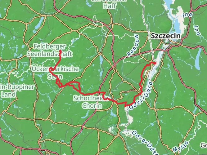
Embarking on the Uckermärker Landrunde, hikers will traverse approximately 165 kilometers (around 102 miles) of varied landscapes in the Uckermark region of Germany. With an elevation gain of roughly 900 meters (about 2950 feet), the trail loops through a serene tapestry of rolling hills, lakes, and historical villages, offering a medium difficulty level that suits both seasoned and intermediate hikers.
Getting to the Trailhead
The journey begins near the Uckermark area, which is accessible by car or public transport. For those opting for public transportation, the nearest significant city is Prenzlau, which can be reached by regional train services. From Prenzlau, local buses can take you closer to the trailhead. If driving, you can navigate to the starting point using HiiKER, which will guide you to the nearest parking area from where you can commence your hike.
Navigating the Trail
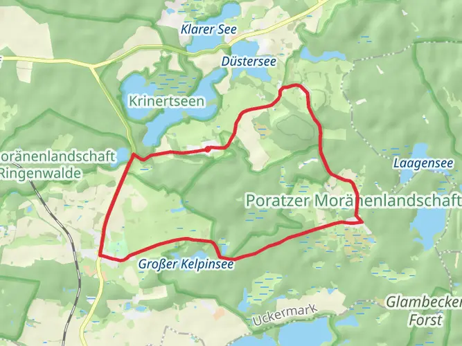
As you set out on the Uckermärker Landrunde, the path will lead you through a mosaic of dense forests, open meadows, and past numerous lakes, a testament to the glacial history that shaped this landscape. The trail is well-marked, and hikers can rely on HiiKER for up-to-date navigation and waypoints, ensuring you stay on the right path.
Natural Highlights and Wildlife
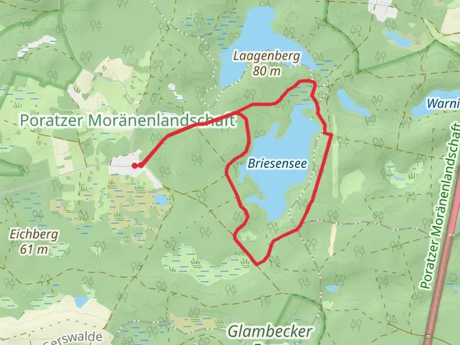
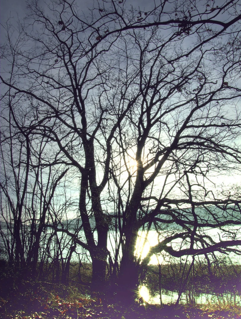
The Uckermark is known for its biodiversity. As you hike, keep an eye out for the variety of bird species that call this area home, including cranes and sea eagles. The trail also winds through several nature reserves, where the preservation of habitats allows for a thriving wildlife population. The serene Lake Oberuckersee and Unteruckersee are particularly noteworthy, offering picturesque spots for rest and reflection.
Cultural and Historical Significance
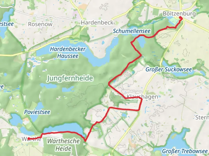
The region is steeped in history, with the trail passing through ancient beech forests that are part of a UNESCO World Heritage Site. The Uckermark has been inhabited since the Stone Age, and along the route, hikers will encounter remnants of its past, from medieval castles to historic villages with centuries-old architecture. The town of Boitzenburg, with its impressive castle, is a highlight and a perfect place to explore local history.
Preparation and Planning
Before setting out, hikers should prepare for a variety of weather conditions and pack accordingly. The trail can be completed in sections or as a multi-day trek, with guesthouses and campsites available for overnight stays. It's advisable to plan your accommodations in advance, especially during peak hiking seasons.
Water and food supplies can be replenished in the small towns dotted along the route, but carrying enough to last between these points is essential. As for gear, sturdy hiking boots, a reliable backpack, and layered clothing are must-haves for this adventure.
Conclusion
The Uckermärker Landrunde is a journey through time and nature, offering an immersive experience in one of Germany's most picturesque and historically rich regions. With careful planning and a spirit of adventure, hikers will find this trail to be a rewarding exploration of the natural and cultural heritage of the Uckermark.

Frequently asked questions
How long does the Uckermärker Landrunde take to hike as a multi-day route?
The Uckermärker Landrunde is a 164.7 km multi-day hike with 940 m of total ascent, so it is usually planned as a longer easy-going trek rather than a weekend walk. Official stage breakdowns commonly divide the route into about 8 walking days, which works out to roughly 20 km per day depending on overnight stops and detours.
Where does the Uckermärker Landrunde start, and how do hikers reach it by train?
The route is commonly approached from Prenzlau in the Uckermark. Rail access is straightforward, with ICE, RE, and RB services reaching Prenzlau, and one established access point is the parking area at Uckerpromenade. Some route descriptions also note a marked connection from Seehausen back toward Prenzlau along the Unteruckersee.
Is the Uckermärker Landrunde a loop trail or a point-to-point hike?
The Uckermärker Landrunde is best understood as a long-distance circuit through the Uckermark rather than a simple out-and-back trail. The full route covers 164.7 km through the region’s lake country, villages, and low rolling terrain, making it suitable for a staged multi-day itinerary with flexible start and finish logistics.
Is the Uckermärker Landrunde difficult, and is it suitable for less experienced long-distance hikers?
This route is rated easy, which fits its modest 940 m of elevation gain spread across 164.7 km. The challenge is more about distance and daily mileage than steep climbing, so it can suit less experienced long-distance hikers who are comfortable walking consecutive days and managing a multi-day schedule.
What kind of scenery does the Uckermärker Landrunde pass through in the Uckermark?
The Uckermärker Landrunde crosses classic Uckermark scenery shaped by the last Ice Age, including rolling moraine country, lakes, woods, meadows, and historic villages. Published route descriptions highlight places such as the Oberuckersee, Unteruckersee, the Biosphere Reserve Schorfheide-Chorin, and the Uckermärkische Seen Nature Park.
Can the Uckermärker Landrunde be split into a 2-day hike in the Uckermark?
Yes. While the full Uckermärker Landrunde is 164.7 km, it can be broken into shorter sections for a 2-day trip by choosing one or two consecutive stages. Typical official stages are often in the mid-teens to mid-20 km range, so a weekend section hike is realistic without committing to the entire route.
Is the Uckermärker Landrunde the same as the Märkischer Landweg?
No. The Uckermärker Landrunde and the Märkischer Landweg are different long-distance hikes in the same broader region. The Uckermärker Landrunde is a circular route in the Uckermark, while the Märkischer Landweg is a separate long-distance trail that runs across the region rather than forming the same loop.
Is there a map for the Uckermärker Landrunde, and what area does it cover?
Yes. The Uckermärker Landrunde is covered by dedicated hiking map sets, and the route is also associated with map areas around Prenzlau, the Uckerseen, Templin, Lychen, Fürstenberg, Angermünde, and the Unteres Odertal side of the region. For on-trail navigation, the full 164.7 km route can also be followed directly in HiiKER.
Comments and Reviews
User comments, reviews and discussions about the Uckermärker Landrunde, Germany.
4.83
average rating out of 5
6 rating(s)