Download
3D Flyover
Add to list
More
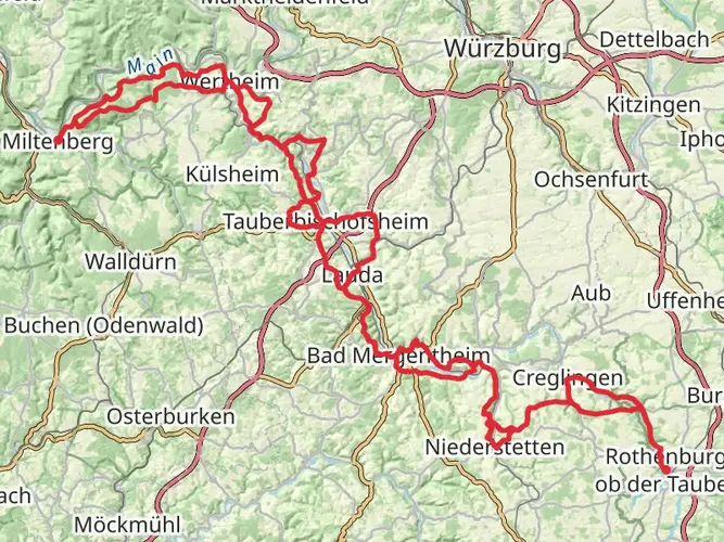
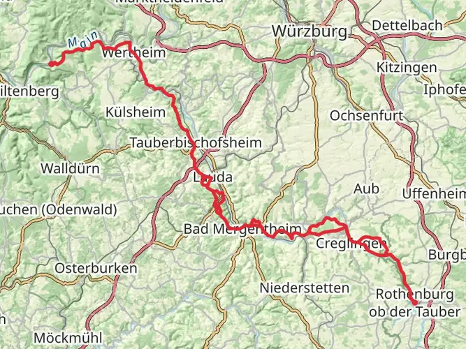
80.6 km
~3 days
1162 m
Multi-Day
“Embark on the Martinusweg Regionalweg Nord for a historic hike through Germany's scenic heartland and cultural treasures.”
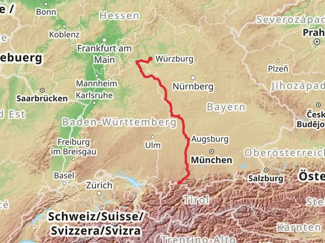
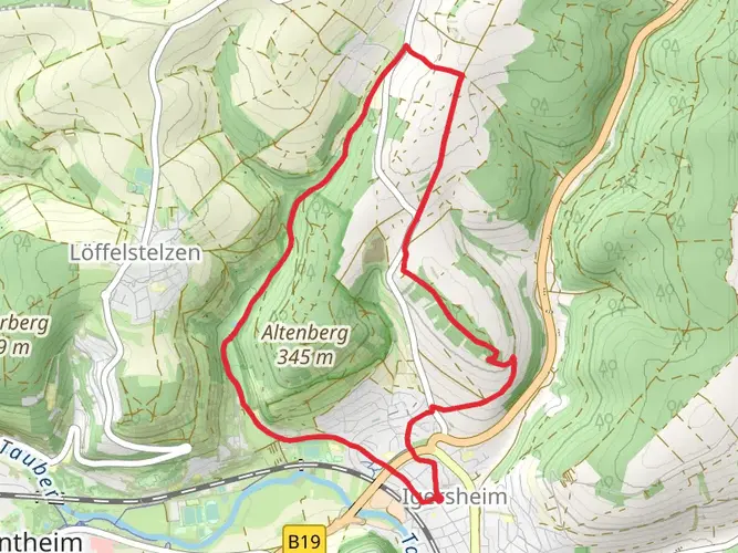
The Martinusweg Regionalweg Nord is a captivating journey through the picturesque landscapes of southern Germany, stretching approximately 81 kilometers (around 50 miles) with an elevation gain of roughly 1100 meters (approximately 3600 feet). This point-to-point trail begins near the administrative community of Bad Mergentheim, a region steeped in history and natural beauty.
Getting to the Trailhead
To reach the starting point of the Martinusweg Regionalweg Nord, hikers can utilize public transportation options such as regional trains and buses that service the Bad Mergentheim area. For those driving, parking is available in the vicinity of the trailhead. It's advisable to use the HiiKER app to navigate to the exact starting location and to plan your route accordingly.
Trail Experience
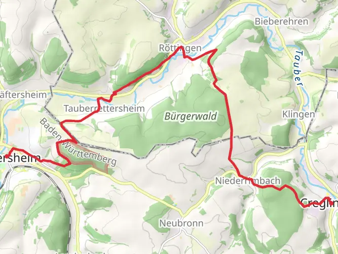
Embarking on the trail, hikers will traverse a variety of landscapes including lush forests, rolling hills, and serene river valleys. The path meanders through charming villages and past historical sites, offering a glimpse into the region's rich cultural heritage. Along the way, you'll encounter the Tauber River, a scenic highlight that adds to the trail's allure.
Historical Significance
The area is known for its historical significance, with the trail itself named after Saint Martin of Tours, a patron saint of the region. Hikers will find themselves walking paths that have been trodden for centuries, with opportunities to visit ancient churches, monasteries, and castles that dot the landscape.
Flora and Fauna
Nature enthusiasts will appreciate the diverse wildlife and plant species found along the Martinusweg Regionalweg Nord. The trail offers a habitat for a variety of birds, mammals, and insects. The changing seasons bring different flora to life, with wildflowers blooming in spring and a rich palette of autumn colors in the fall.
Landmarks and Points of Interest
Approximately halfway through the hike, near the 40-kilometer mark, adventurers will reach the town of Weikersheim, known for its impressive Renaissance castle and beautiful gardens. This is an ideal spot to rest and perhaps enjoy a meal or a guided tour of the castle.
As you continue, the trail will lead you through the wine-growing region of Tauberfranken, where you can indulge in local wine tasting and learn about the area's viticulture.
Navigation and Preparation
The trail is marked, but it's recommended to use the HiiKER app for navigation to ensure you stay on the correct path and to track your progress. The app can also provide detailed information about the trail's topography and points of interest.
Preparation is key for a successful hike on the Martinusweg Regionalweg Nord. Ensure you have adequate water, food, and clothing for the journey. The trail's medium difficulty rating means that while it's accessible to most hikers with a reasonable level of fitness, it's still important to prepare for varying terrain and potential weather changes.
Access and Amenities
Throughout the hike, you'll find accommodations ranging from hotels to guesthouses, allowing for a comfortable multi-day trek. It's advisable to book these in advance, especially during peak hiking seasons. Additionally, the trail passes through towns with shops and restaurants, providing opportunities to resupply and savor local cuisine.
Conclusion
The Martinusweg Regionalweg Nord offers a unique blend of natural beauty, historical exploration, and cultural immersion. With careful planning and a spirit of adventure, hikers will find this trail to be a rewarding experience that showcases the best of Germany's southern landscapes.

Frequently asked questions
How long is the Martinusweg Regionalweg Nord and how many days does it usually take?
The Martinusweg Regionalweg Nord is 80.62 km long with 1,162 meters of total ascent, so it fits best as a multi-day walk rather than a single-day hike. Most hikers break a route of this length into about 4 to 5 days, depending on daily mileage, lodging plans, and how much time is spent in towns and churches along the way.
Where does the Martinusweg Regionalweg Nord start near Bad Mergentheim?
The Martinusweg Regionalweg Nord starts in Bad Mergentheim, and the trail stages identify the starting point as Martinskapelle in the Altstadt. That places the beginning in the historic center of Bad Mergentheim, making it practical to reach on foot from the town center and transport connections.
Is the Martinusweg Regionalweg Nord a pilgrimage trail in southern Germany?
Yes. The Martinusweg Regionalweg Nord is one of the regional Martinusweg pilgrimage routes in southern Germany, and the wider Martinusweg network in Baden-Württemberg forms part of the Via Sancti Martini tradition linked to Saint Martin of Tours. This route connects into the Hohenlohe-Franken section that runs from Bad Mergentheim toward Heilbronn.
Is the Martinusweg Regionalweg Nord difficult?
The Martinusweg Regionalweg Nord is rated medium difficulty. Over 80.62 km, the route gains 1,162 meters in elevation, which points to a sustained but manageable challenge for hikers with decent fitness and some experience of back-to-back walking days.
Can the Martinusweg Regionalweg Nord be reached by public transportation from Bad Mergentheim?
Yes. Bad Mergentheim has a rail station and local bus connections, and the route begins in town rather than at a remote mountain trailhead. That makes public transport a realistic option for starting the Martinusweg Regionalweg Nord, especially for walkers arriving through Bad Mergentheim Bahnhof before heading into the Altstadt.
What kind of scenery does the Martinusweg Regionalweg Nord pass through?
The Martinusweg Regionalweg Nord passes through the landscapes around Bad Mergentheim in northern Baden-Württemberg, including the Tauber area, rolling countryside, villages, and wooded sections. The route is known as a pilgrimage walk, so the scenery is paired with cultural landmarks such as churches and historic settlements rather than high-alpine terrain.
Comments and Reviews
User comments, reviews and discussions about the Martinusweg Regionalweg Nord, Germany.
5.0
average rating out of 5
2 rating(s)