Download
3D Flyover
Add to list
More
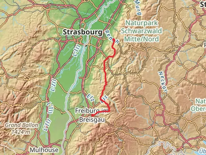
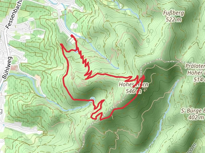
96.1 km
~5 days
3337 m
Multi-Day
“Embark on a captivating 96-km Renchtalsteig hike through the Black Forest, steeped in history and natural splendor.”
The Renchtalsteig is a captivating long-distance hiking trail that stretches approximately 96 kilometers (about 60 miles) through the heart of the Black Forest in Germany. With an elevation gain of around 3300 meters (approximately 10,827 feet), this trail offers a challenging yet rewarding experience for seasoned hikers. The trailhead is conveniently located near the administrative community of Oberkirch, which is easily accessible by public transport or car.
Getting to the Trailhead
To reach the starting point of the Renchtalsteig, hikers can take a train to the Oberkirch station and then a short bus or taxi ride to the trailhead. For those driving, parking is available in the vicinity of Oberkirch, from where you can begin your trek.
Navigating the Trail
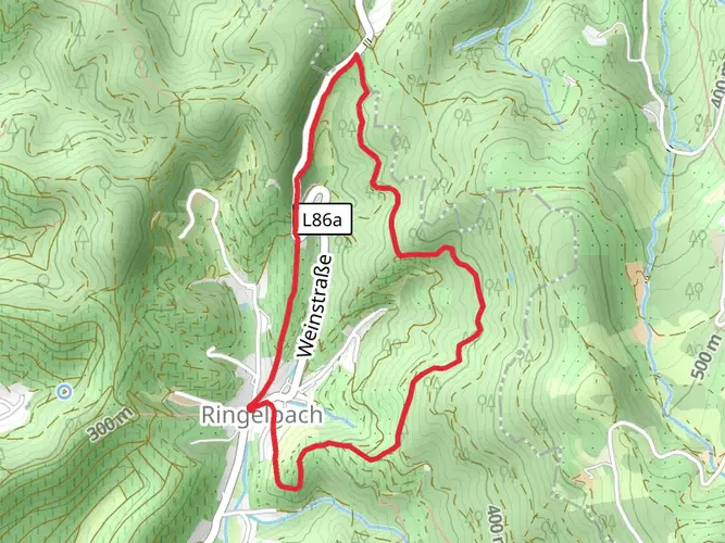
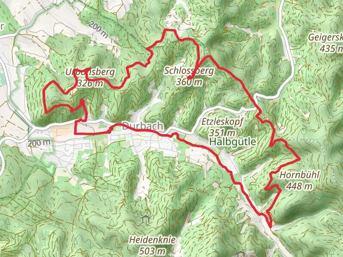
The Renchtalsteig is a point-to-point trail, meaning it starts and ends at different locations. Hikers can rely on the HiiKER app for detailed maps and navigation assistance throughout their journey. The trail is well-marked with signage, making it easy to follow even for those new to the area.
Trail Highlights and Landmarks
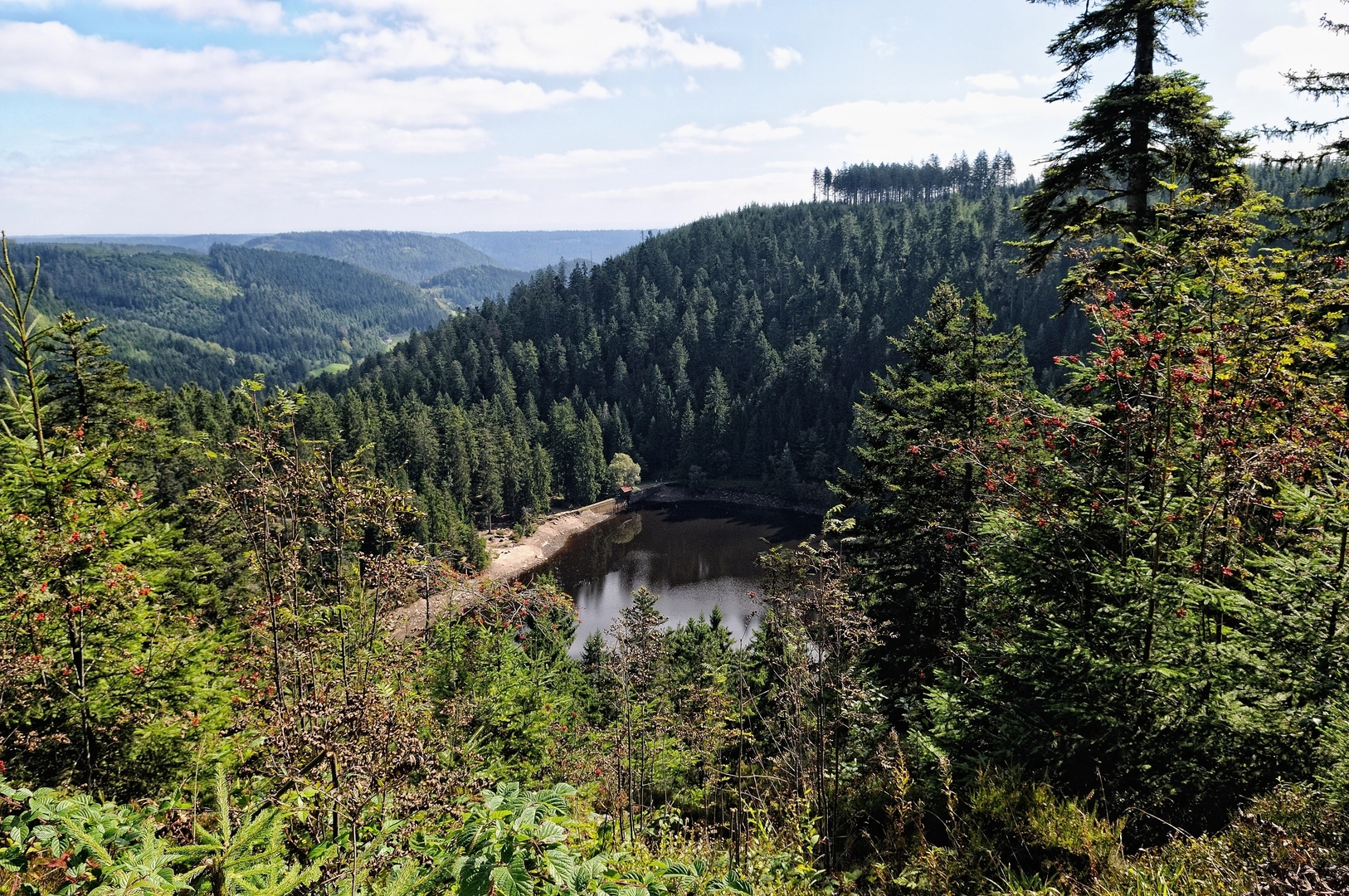
As you embark on the Renchtalsteig, you'll traverse lush forests, serene meadows, and picturesque vineyards. The trail offers stunning panoramic views of the Rhine Valley and, on clear days, the Vosges Mountains in France. Along the way, you'll encounter charming villages where you can experience the local culture and cuisine.
Historical Significance
The Black Forest region is steeped in history, and the Renchtalsteig is no exception. The trail passes through areas that have been significant since Roman times and later during the Middle Ages. Hikers will find remnants of this rich history in the form of old castles, monasteries, and ancient ruins.
Flora and Fauna
The diverse landscape of the Renchtalsteig is home to a variety of wildlife, including deer, foxes, and a wide range of bird species. The trail also winds through different altitudinal zones, allowing hikers to observe a variety of plant life, from deciduous and coniferous trees to alpine flowers.
Preparation and Planning
Given the trail's difficulty rating and length, it's essential to be well-prepared. Hikers should pack appropriate gear for varying weather conditions and have enough food and water for the duration of the hike. It's also advisable to plan for overnight stays in local guesthouses or shelters along the route.
Safety and Etiquette
Always remember to respect the natural environment by staying on the marked paths and disposing of waste properly. It's also important to be aware of the weather conditions and to have a plan in case of emergencies.
By preparing adequately and respecting the trail and its surroundings, hikers can look forward to an unforgettable adventure on the Renchtalsteig, full of natural beauty, historical intrigue, and the satisfaction of completing one of the Black Forest's most challenging hikes.

Frequently asked questions
How many stages does the Renchtalsteig have and how long is each one?
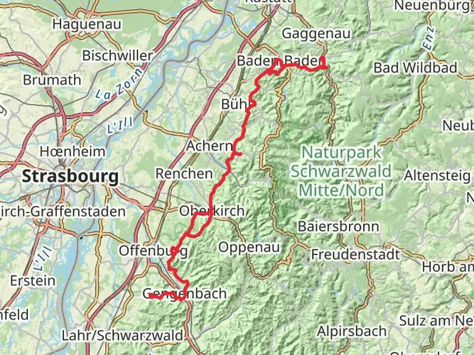
The Renchtalsteig is usually divided into 5 stages covering 96.13 km in total. The official stage breakdown is Bottenau to Oppenau at 22.8 km, Oppenau to Bad Peterstal at 16.5 km, Bad Peterstal to Alexanderschanze at 18.5 km, Alexanderschanze to Allerheiligen Waterfalls at 23.5 km, and Allerheiligen Waterfalls to Burgruine Schauenburg at 16.8 km.
How difficult is the Renchtalsteig and how much climbing does the full route involve?
The Renchtalsteig is a difficult multi-day hike with 3,337 meters of total elevation gain over 96.13 km. That combination of distance and climbing makes it better suited to experienced hikers who are comfortable with repeated long days in the Black Forest and sustained ascents between valley towns and higher ridges.
Where does Renchtalsteig Stage 1 start and what are the main highlights on Renchtalsteig Etappe 1?
Stage 1 of the Renchtalsteig starts at Rathaus Bottenau in Oberkirch and ends at Hugenhöfe in Oppenau, covering 22.8 km in about 7 to 8 hours. Highlights on this opening stage include Wallfahrtskapelle St. Wendel, Schloss Staufenberg, the Moosturm lookout tower on Mooskopf at 872 m, and wide views into the Rhine plain, the Vosges, and the Renchtal.
What is Renchtalsteig Stage 5 like and where does Renchtalsteig Etappe 5 finish?
Stage 5 runs 16.8 km from the Allerheiligen Waterfalls area to Schauenburg Parking, with an official hiking time of about 5 to 6 hours. It begins at the Wasserfall-Parkplatz, climbs past the cascades and Klosterruine Allerheiligen, then crosses spots such as Rappenschrofen and Schwalbenstein before finishing below Burgruine Schauenburg.
Are there places to stay overnight on the Renchtalsteig?
Yes. Overnight options listed along the Renchtalsteig include accommodations in Oberkirch, Lautenbach, Oppenau, and Bad Peterstal-Griesbach, plus a Trekking Camp am Renchtalsteig. Named options on or near the route include Waldhotel Grüner Baum, Hotel Renchtalblick, Gasthof Blume, Hotel Sonnenhof, Höhenhotel Kalikutt, and the Renchtalhütte area on Stage 4.
Can the Renchtalsteig be reached by public transportation from Oberkirch?
Yes. The trail is connected to public transportation, and access from Oberkirch station is signposted. Official route information for the stages references OSB train line 718 and Südwestbus line 7137, with some stages also linked by seasonal or weekday bus services such as lines 7123 and 7126.
Comments and Reviews
User comments, reviews and discussions about the Renchtalsteig, Germany.
4.67
average rating out of 5
9 rating(s)