Download
3D Flyover
Add to list
More
60.6 km
~3 days
1362 m
Multi-Day
“Embark on the Kochersteig for a scenic and historic trek through Germany's varied landscapes and time.”
The Kochersteig is a captivating journey that unfolds over approximately 61 kilometers (around 38 miles) of varied landscapes, with an elevation gain of roughly 1300 meters (about 4265 feet). This point-to-point trail is nestled in the picturesque region near Schwäbish Hall, Germany, and is rated as medium difficulty, offering a blend of natural beauty and historical intrigue.
Getting to the Trailhead
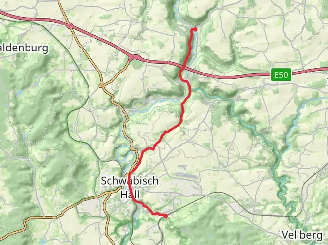
To embark on the Kochersteig adventure, hikers can arrive at the trailhead located near the administrative community of Schwäbisch Hall. For those opting for public transportation, the area is accessible via regional trains and buses that service Schwäbisch Hall. From the train station, local buses or a short taxi ride can bring you to the starting point. If driving, parking is available in the vicinity of the trailhead, ensuring a convenient start to the hike.
Navigating the Trail
As you set out on the Kochersteig, the use of a navigation tool like HiiKER can be invaluable for staying on track and aware of upcoming terrain changes. The trail meanders through a mix of dense forests, open meadows, and alongside the serene Kocher River, which adds a peaceful soundtrack to the hike.
Landmarks and Natural Beauty
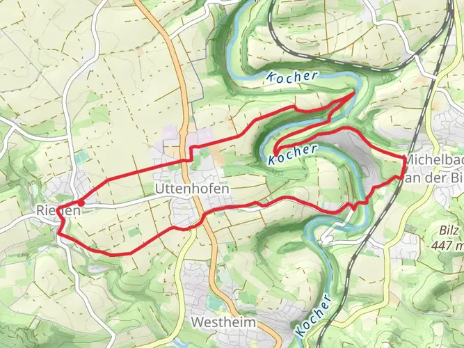
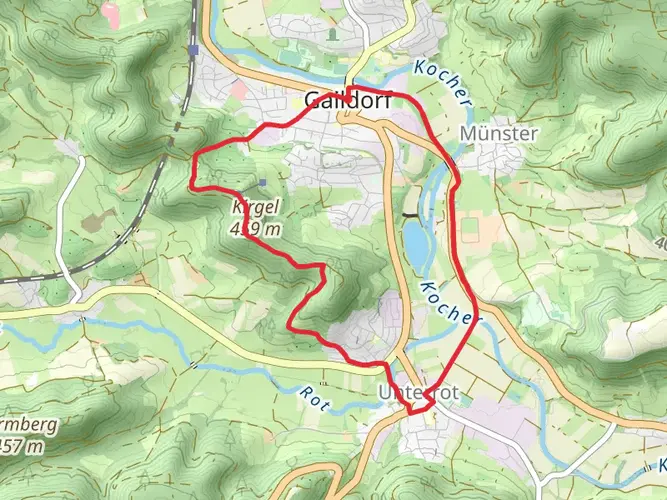
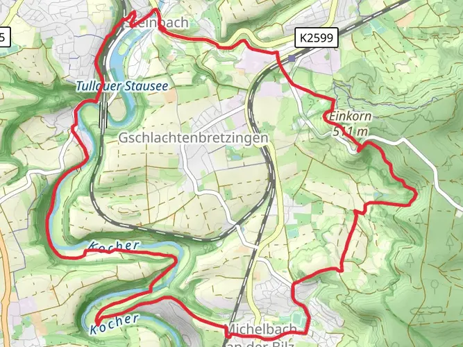
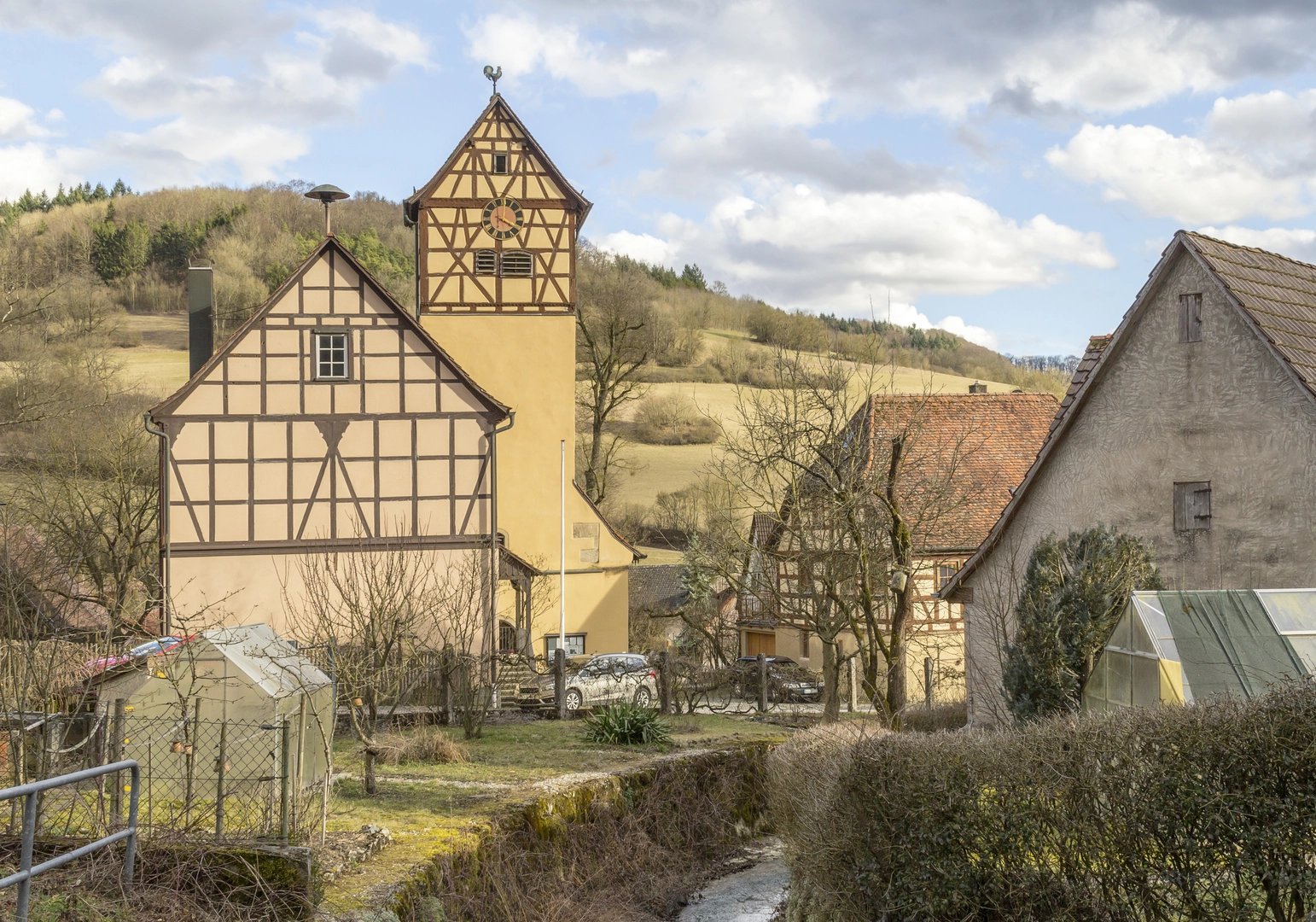
One of the early highlights is the ascent to Einkorn, a hill offering panoramic views of the Hohenlohe Plain. As you continue, the trail takes you through the historic town of Schwäbisch Hall, where timber-framed houses and the impressive St. Michael's Church stand as testaments to the region's rich past.
Further along, the Kochersteig leads hikers through the Bühlertal, a valley that showcases the diversity of the local flora and fauna. Birdwatchers may delight in spotting species such as the black woodpecker and the European kingfisher.
Historical Significance
The region is steeped in history, with numerous castles and ruins dotting the landscape. The trail passes close to the ruins of Henneburg and Comburg, offering a glimpse into medieval life. These historical sites provide an opportunity to reflect on the centuries of human activity that have shaped the land.
Wildlife and Flora
The Kochersteig is home to a rich tapestry of wildlife. Deer, foxes, and a variety of bird species inhabit the forests and fields. The changing seasons bring different wildflowers into bloom, adding splashes of color to the trail.
Preparation and Planning
Hikers should prepare for the Kochersteig by packing sufficient water and snacks, as well as a map and compass or a digital navigation tool. Weather can be variable, so layered clothing is recommended. Sturdy hiking boots are essential for navigating the varied terrain, which includes well-maintained paths, rocky sections, and occasional steep inclines.
Conclusion
The Kochersteig is a trail that offers more than just a physical challenge; it is a journey through time and nature. With careful preparation and an appreciation for the history and natural beauty of the region, hikers will find this trail to be a rewarding experience.

Frequently asked questions
How many stages does the Kochersteig have, and what are Kochersteig Etappe 1, 2, and 3?
The Kochersteig is the three-stage Kocher section of the larger Kocher-Jagst-Trail. The full route is 60.62 km with 1,362 m of elevation gain, and the official stage overview lists Kochersteig Etappe 1, Etappe 2, and Etappe 3 as the three parts of the trail. That makes it a practical short multi-day hike rather than a week-long thru-hike.
How long does it take to hike the Kochersteig?
Most hikers complete the Kochersteig in 3 days because the 60.62 km route is organized into three stages. Strong walkers can cover longer sections, but the trail’s multi-day format suits a steady pace with time for climbs, descents, and stops in the Kocher valley and around Schwäbisch Hall.
Where does the Kochersteig start and finish?
The Kochersteig runs as a point-to-point route in the Schwäbisch Hall area of Baden-Württemberg. The stage listing places one end near Schwäbisch Hall-Hessental and another near Braunsbach, so transport planning matters more than on a loop walk. It is best approached as a linear trail rather than an out-and-back.
Is the Kochersteig part of the Kocher-Jagst-Trail?
Yes. The Kochersteig is one of the three named sections that make up the Kocher-Jagst-Trail, alongside the Jagststeig and Bühlersteig. The wider Kocher-Jagst-Trail totals 10 stages, while the Kochersteig itself covers the three Kocher-focused stages in the Schwäbisch Hall region.
Where can you park for the Kochersteig in Schwäbisch Hall?
In Schwäbisch Hall, two straightforward public parking options are Auwiese on Spitalmühlenstraße and Kocherwiesen on Steinbacherstraße. The city lists both as free public parking areas, which makes them useful for Kochersteig access or for leaving a car before using local transport to the other end of the route.
Can the Kochersteig be reached by public transportation?
Yes. Schwäbisch Hall is served by rail and local transit, and the city states that the wider urban area is connected by linked city bus and district bus services. Schwäbisch Hall-Hessental station is specifically identified as a suitable start or finish point for hikes in the area, which fits the Kochersteig’s point-to-point layout.
Is the Kochersteig difficult?
The Kochersteig is rated Easy, but it is still a 60.62 km multi-day route with 1,362 m of climbing. That means the challenge comes more from the total distance and repeated elevation changes over several days than from technical terrain. It suits hikers looking for a manageable long-distance walk rather than an alpine route.
Comments and Reviews
User comments, reviews and discussions about the Kochersteig, Germany.
4.57
average rating out of 5
7 rating(s)