Download
3D Flyover
Add to list
More
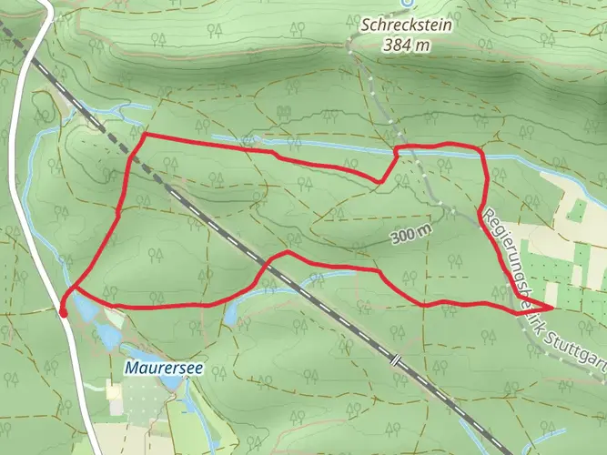
120.5 km
~5 days
2586 m
Multi-Day
“Embark on the Gäurandweg for a scenic hike through Germany's history and diverse countryside vistas.”
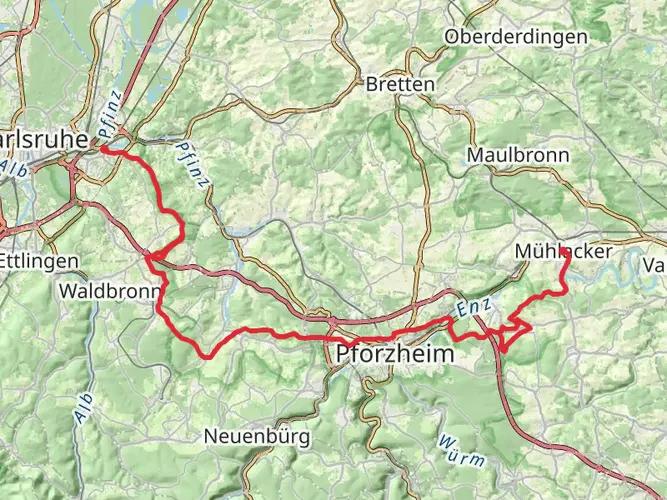
Embarking on the Gäurandweg, hikers will traverse approximately 120 kilometers (about 75 miles) of varied landscapes, with an elevation gain of around 2500 meters (approximately 8200 feet). This point-to-point trail begins near the VVG der Stadt Mühlacker in Germany, an area easily accessible by car or public transport. For those opting for public transport, Mühlacker train station is well-connected, and from there, local buses can drop you close to the trailhead.
Getting Started on the Gäurandweg
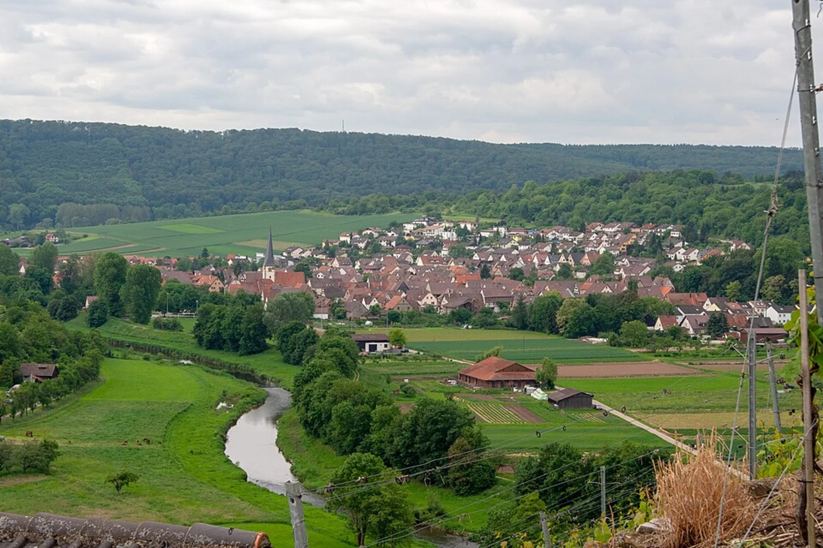
As you set out on the Gäurandweg, the trail will take you through the enchanting landscapes of the German countryside, characterized by rolling hills, dense forests, and picturesque villages. The trail is well-marked, but carrying a navigation tool like HiiKER is advisable to keep track of your progress and ensure you're on the right path.
Landmarks and Scenery
The Gäurandweg is rich in natural beauty and historical landmarks. In the initial segment of the hike, you'll pass through lush woodlands, with the trail gradually ascending to offer stunning views of the surrounding Gäu plateau. Approximately 30 kilometers (about 19 miles) in, you'll reach the town of Zavelstein, known for its well-preserved medieval castle ruins and the annual crocus bloom, which carpets the area in a vibrant purple during spring.
Continuing on, the trail meanders through the serene Monbach Valley, where the Monbach stream accompanies you, creating a peaceful ambiance with its gentle flow. This area is a haven for local wildlife, so keep an eye out for deer, foxes, and a variety of bird species.
Historical Significance
The Gäurandweg doesn't just offer natural wonders; it's also a journey through history. The region is dotted with remnants of the past, including ancient churches and castles. One of the historical highlights is the town of Weil der Stadt, the birthplace of the renowned astronomer Johannes Kepler. Here, you can explore the Kepler Museum, which is about halfway through the trail at around the 60-kilometer (37-mile) mark.
Terrain and Difficulty
The trail's terrain is diverse, with a mix of flat sections, gentle slopes, and a few challenging climbs. The elevation gain is spread out across the length of the trail, making it a medium-difficulty hike suitable for those with a moderate level of fitness. The path is well-maintained, but proper hiking boots are recommended as some sections can be rocky and uneven.
Preparation and Planning
Before setting out, ensure you have enough water and food for the journey, as there are stretches of the trail with limited access to amenities. It's also wise to check the weather forecast and dress in layers, as conditions can change rapidly in this region.
Conclusion
In conclusion, the Gäurandweg offers a rewarding experience for hikers looking to immerse themselves in the natural beauty and historical tapestry of Germany. With careful planning and preparation, this trail promises an unforgettable adventure through the heart of the German countryside.

Frequently asked questions
How long does it take to hike the Gäurandweg from Mühlacker to Freudenstadt?
The Gäurandweg is about 120.48 km long with 2,586 m of climbing, so it is usually treated as a 5-stage or roughly week-long hike. Official stage breakdowns put it at about 121 km from Mühlacker to Freudenstadt, while HiiKER’s route timing is about 7 days overall.
What are the stages of the Gäurandweg and where does each Etappe end?
The Gäurandweg is commonly divided into five stages between Mühlacker and Freudenstadt. The standard stage towns are Mühlacker to Tiefenbronn, Tiefenbronn to Stammheim, Stammheim to Nagold, Nagold to Waldachtal-Salzstetten, and Waldachtal-Salzstetten to Freudenstadt, covering about 121 km in total.
How long is Gäurandweg Etappe 1 from Mühlacker to Tiefenbronn?
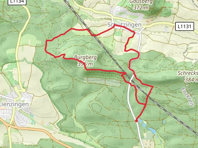
Gäurandweg Etappe 1 is about 19 to 20 km long from Mühlacker to Tiefenbronn. HiiKER lists the first stage at 19.6 km with 621 m of ascent, starting in Mühlacker, Enzkreis, and finishing in Tiefenbronn.
How difficult is the Gäurandweg and is it suitable for moderately experienced hikers?
The Gäurandweg is rated medium difficulty, with 120.48 km of total distance and 2,586 m of elevation gain. That makes it a solid multi-day route for hikers comfortable with back-to-back days, rolling climbs, and longer stage distances rather than technical mountain terrain.
Where does the Gäurandweg start and finish?
The Gäurandweg starts in Mühlacker in the Enz Valley and finishes in Freudenstadt. The route climbs out of the Enztal onto the Gäu landscapes, later crossing the Nagold Valley before continuing toward Waldachtal-Salzstetten and the higher ground near Freudenstadt.
Can the Gäurandweg be reached by public transportation from Mühlacker?
Yes. Mühlacker is the usual starting point for the Gäurandweg and has a rail station on the Karlsruhe–Stuttgart corridor, making it a practical access point for a point-to-point hike. Local transit connections from Mühlacker also help with getting close to the opening section of the trail.
What are the main highlights on the Gäurandweg route?
Notable highlights on the Gäurandweg include the historic town of Zavelstein with its castle ruins, the Monbach Valley, and the crossing of the Nagold Valley. The trail is also known for varied Gäu scenery including open heights, light forest, hedgerow landscapes, and stretches of dry grassland before reaching Freudenstadt.
Comments and Reviews
User comments, reviews and discussions about the Gäurandweg, Germany.
3.75
average rating out of 5
4 rating(s)