Download
3D Flyover
Add to list
More
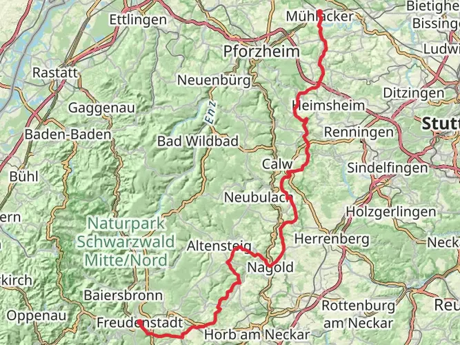
54.4 km
~3 days
990 m
Multi-Day
“Embark on the Nordrandweg for an enriching 54-kilometer hike through Germany's historical and natural splendors.”
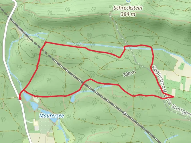
The Nordrandweg, a scenic trail spanning approximately 54 kilometers (about 33.5 miles) with an elevation gain of around 900 meters (roughly 2950 feet), offers hikers a medium-difficulty trek through the diverse landscapes of Germany. Starting near the VVG der Stadt Mühlacker, the trail is a point-to-point journey that can be accessed by public transport or car. For those opting for public transport, the Mühlacker train station is the nearest hub, with local buses providing access to the trailhead. By car, hikers can navigate to the starting point via the L1134, parking in the designated areas near the VVG der Stadt Mühlacker.
Navigating the Trail
As you embark on the Nordrandweg, HiiKER can be an invaluable tool for navigation, providing detailed maps and waypoints to ensure you stay on the right path. The trail is well-marked, guiding hikers through a variety of terrains including lush forests, rolling hills, and picturesque vineyards.
Landmarks and Scenery
One of the early highlights of the hike is the stunning view from the Löffelstelz Castle ruins, which you'll reach after a few kilometers. The castle, dating back to the 12th century, offers a glimpse into the region's rich history and provides panoramic views of the Enz valley.
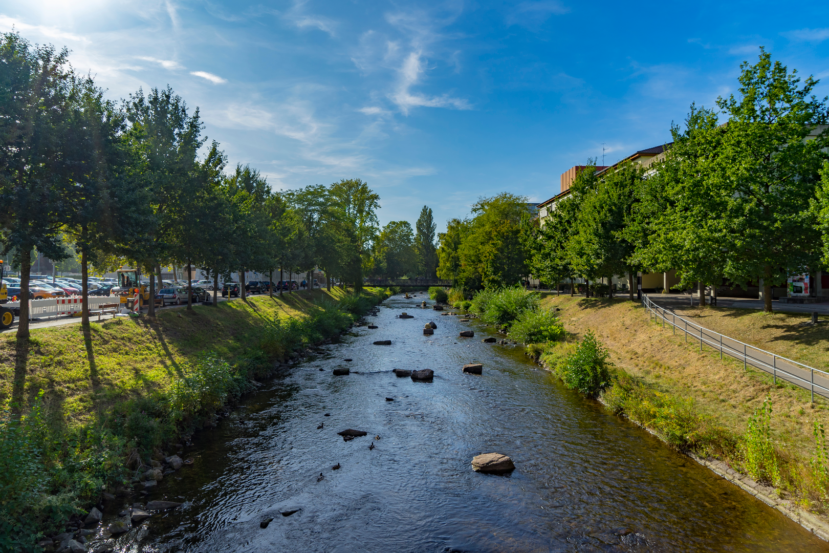
Continuing on, the trail meanders through the serene Monbach Valley, where the Monbach stream accompanies you, creating a peaceful soundtrack to your hike. This area is particularly beautiful in the spring when wildflowers bloom in abundance.
As you progress, the trail leads to the town of Neuenbürg, home to the impressive Neuenbürg Castle. This historical site, now a museum, is roughly halfway through the hike and is a perfect spot to rest and explore the local heritage.
Flora and Fauna
The Nordrandweg is a haven for nature enthusiasts. The diverse ecosystems along the trail support a wide range of wildlife, including deer, foxes, and a variety of bird species. The mixed forests you'll traverse are home to towering beech trees, spruces, and pines, with the changing seasons offering a kaleidoscope of colors.
Historical Significance
The region's history is deeply intertwined with the trail. The castles and ruins along the way are remnants of a bygone era when these fortifications played crucial roles in local and regional power dynamics. The vineyards you'll pass are part of a winemaking tradition that has shaped the cultural landscape for centuries.
Preparing for the Hike
Given the trail's length and varied terrain, it's advisable to tackle the Nordrandweg over two or three days, especially if you wish to fully enjoy the scenery and historical sites. There are several accommodations along the route, ranging from guesthouses to more rustic shelters, allowing for a comfortable multi-day hike.
Be sure to pack sufficient water and food, as there are stretches of the trail with limited access to amenities. Weather can be unpredictable, so layered clothing and waterproof gear are recommended. Lastly, ensure your mobile device is charged and equipped with the HiiKER app to aid in navigation and provide additional trail information.
With its combination of natural beauty, historical landmarks, and well-maintained paths, the Nordrandweg is a rewarding experience for hikers looking to immerse themselves in the heart of Germany's landscape and heritage.

Frequently asked questions
How long does the Nordrandweg near Mühlacker take to hike?
The Nordrandweg is 54.4 km long and is typically completed in about 3 days. With 990 m of total ascent and an easy rating, many hikers split it into shorter daily stages rather than treating it as a single long day hike.
Is the Nordrandweg an easy multi-day hike or a hard one?
The Nordrandweg is rated easy, but it is still a 54.4 km multi-day route with 990 m of climbing. That makes it manageable for many regular walkers over several days, especially compared with steeper long-distance trails, but the total distance still calls for solid day-by-day planning.
Where does the Nordrandweg start, and how do hikers reach it from Mühlacker?
The route starts near Mühlacker in Baden-Württemberg, within the VVG der Stadt Mühlacker area. Mühlacker station is the main rail hub for access, and local buses connect onward toward the trail area, while drivers commonly approach via the L1134 and use parking in or near Mühlacker.
Can the Nordrandweg be done using public transportation from Mühlacker station?
Yes. Mühlacker station is the main public transport gateway for the Nordrandweg, and the town is part of the Verkehrsverbund Pforzheim/Enzkreis network. Local buses serve Mühlacker and its surrounding districts, which makes rail-plus-bus access practical for reaching the route without a car.
What are the main sights on the Nordrandweg around Mühlacker?
Highlights on the Nordrandweg include views over the Enz valley, vineyard landscapes around Mühlacker, and the Löffelstelz Castle ruins above Dürrmenz. The route also passes through quieter wooded sections and stream valleys, including the Monbach Valley, which adds a very different feel from the open ridge and vineyard stretches.
How much elevation gain is on the Nordrandweg, and is it suitable for beginners?
The Nordrandweg has 990 m of total elevation gain over 54.4 km. Spread across a multi-day route, that amount of climbing is moderate rather than extreme, so the trail can suit beginners who are comfortable walking long distances on consecutive days and pacing the route sensibly.
Comments and Reviews
User comments, reviews and discussions about the Nordrandweg, Germany.
4.47
average rating out of 5
15 rating(s)