Download
Preview
Add to list
More
106.2 km
~6 days
3458 m
Multi-Day
“Embark on the Zweitälersteig for a captivating 106km journey through the Black Forest's natural and historical splendors.”
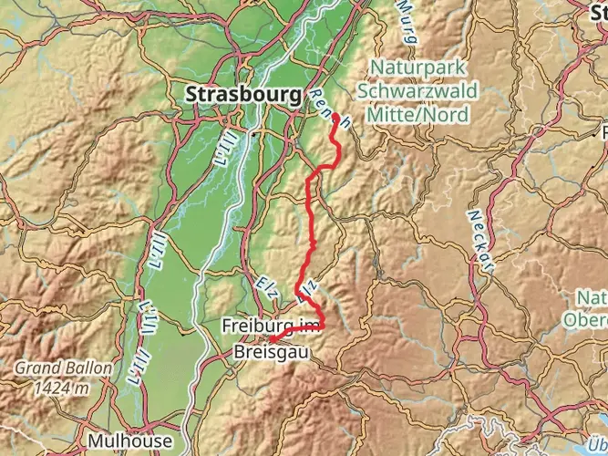
Embarking on the Zweitälersteig trail, hikers will traverse approximately 106 kilometers (about 66 miles) of diverse landscapes, with an elevation gain of around 3400 meters (approximately 11,155 feet). This point-to-point trail, nestled in the heart of the Black Forest, offers a medium difficulty rating, making it accessible to hikers with a moderate level of experience.
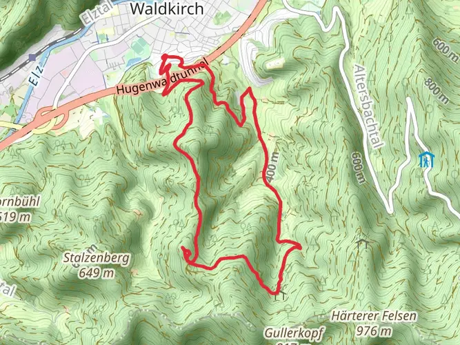
Starting Point and Access The trailhead is conveniently located near the VVG der Stadt Waldkirch, a small town in Germany that serves as the gateway to this scenic adventure. For those arriving by public transport, Waldkirch is well-connected by train, with regular services from Freiburg im Breisgau. From the train station, it's a short walk or bus ride to the trailhead. If you're driving, parking is available in the town, allowing you to leave your vehicle and embark on the hike.
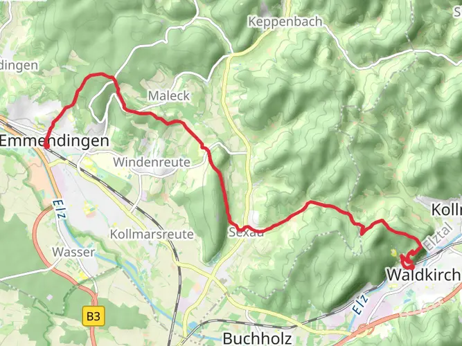
Navigating the Trail As you set out, the HiiKER app will be an invaluable tool for navigation, providing detailed maps and waypoints to guide you along the Zweitälersteig. The trail is well-marked, with signage to keep you on the right path.
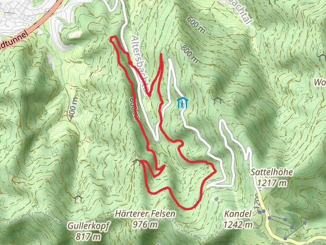
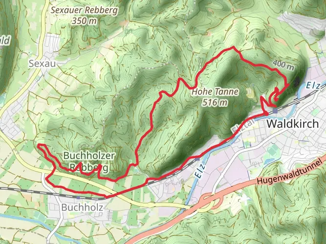
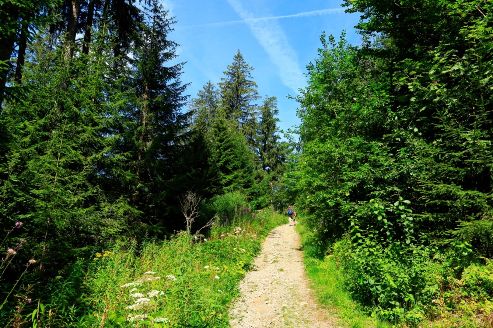
Natural Wonders and Landmarks The Zweitälersteig trail is a celebration of nature's beauty, taking you through lush forests, serene valleys, and panoramic ridges. You'll encounter the cascading waterfalls of Zweribach, a highlight that showcases the power and tranquility of nature. The trail also offers stunning views from the Kandel mountain, one of the highest peaks in the Black Forest, where on a clear day, you can see the Vosges Mountains in France.
Wildlife and Flora As you hike, keep an eye out for the diverse wildlife that inhabits the Black Forest. You may spot deer, foxes, and a variety of bird species. The forest is also home to a rich array of flora, including towering fir and spruce trees, as well as a carpet of wildflowers in the spring and summer months.
Cultural and Historical Significance The region is steeped in history, with the trail passing through traditional Black Forest villages where you can witness centuries-old architecture and customs. The trail also winds past old mills, sawmills, and other remnants of the area's past, providing a glimpse into the historical significance of the region's once-thriving timber industry.
Preparation and Planning To tackle the Zweitälersteig, it's recommended to plan for a multi-day hike, with accommodations available in the villages along the route. Ensure you have suitable hiking gear for variable weather conditions, as the Black Forest can be unpredictable. It's also wise to carry enough water and food, although there are opportunities to restock in the villages you'll pass through.
Elevation and Distance Breakdown The trail's elevation gain is spread out across its length, with some days more challenging than others. Be prepared for steep ascents and descents, particularly as you approach and depart from the higher elevations like the Kandel mountain.
Conclusion In conclusion, the Zweitälersteig is a trail that offers a rich tapestry of natural beauty, wildlife, and historical intrigue. With careful planning and a spirit of adventure, hikers will find this trail to be a rewarding journey through one of Germany's most enchanting regions.

Frequently asked questions
How many stages does the Zweitälersteig have, and what are they?
The Zweitälersteig is usually divided into 5 stages on the official route. They run Waldkirch to Kandel, Kandel to Simonswald, Simonswald to Elzach-Oberprechtal, Elzach-Oberprechtal to Biederbach-Höhenhäuser, and Biederbach-Höhenhäuser back to Waldkirch, making it a circular multi-day hike in the Black Forest.
How long is the Zweitälersteig and how much elevation gain does it have?
The Zweitälersteig is 106.24 km long in this route listing, with 3,458 m of total ascent. Other official summaries round the trail to about 108 km with roughly 3,500 m of climbing, so it is best treated as a demanding long-distance hike rather than a short hut-to-hut walk.
How difficult is the Zweitälersteig hike in Germany?
The Zweitälersteig is an Extra Difficult multi-day trail with long daily distances, repeated steep climbs, and a total ascent of 3,458 m. Official stage descriptions also classify it as hard, with the toughest sections crossing higher ground around Kandel, Rohrhardsberg, and Hörnleberg in the southern Black Forest.
Where does the Zweitälersteig start and finish?
The Zweitälersteig starts and finishes in Waldkirch, so it works as a loop rather than a point-to-point crossing. Waldkirch sits northeast of Freiburg im Breisgau and is the lowest point on the route at around 260 m, while the trail’s highest point is Kandel at about 1,240 m.
What are the main highlights on the Zweitälersteig?
Major highlights on the Zweitälersteig include the Kandel summit, the Zweribach Waterfalls, Rohrhardsberg, Hörnleberg, Landwassereck, Huberfelsen, Heidburg, and long ridge walking above the Elz and Simonswald valleys. The route is known for mixing narrow forest paths, waterfalls, rocky viewpoints, and broad views toward the Feldberg, the Vosges, and sometimes the Alps.
How long does it take to hike the Zweitälersteig?
Most hikers complete the Zweitälersteig in 5 days, following its standard 5-stage breakdown. Official timings for the individual stages add up to about 35 hours of walking, but the 106.24 km distance and 3,458 m of ascent mean many groups will want full hiking days rather than trying to rush the route.
What is the highest point on the Zweitälersteig?
The highest point on the Zweitälersteig is Kandel, at about 1,241 m above sea level. It is one of the signature climbs of the route and comes on the opening stage from Waldkirch, where the trail gains roughly 1,000 m to reach the high ground above the Elz Valley.
Comments and Reviews
User comments, reviews and discussions about the Zweitälersteig, Germany.
4.6
average rating out of 5
5 rating(s)