Download
Preview
Add to list
More
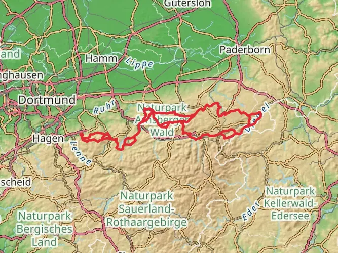
63.3 km
~4 days
1562 m
Multi-Day
“Embark on the Diemelsteig for a historical hike through Germany's enchanting landscapes and cultural landmarks.”
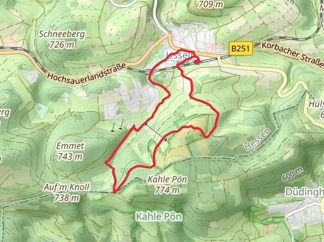
Embarking on the Diemelsteig trail, hikers will traverse approximately 63 kilometers (about 39 miles) of varied terrain with an elevation gain of around 1500 meters (nearly 4921 feet). This loop trail, nestled in the heart of Germany near Waldeck-Frankenberg, offers a medium difficulty rating, making it an accessible adventure for hikers with some experience.
Getting to the Trailhead
To reach the starting point of the Diemelsteig, travelers can drive to the region of Waldeck-Frankenberg, where parking is available near the trailhead. For those opting for public transport, the nearest train stations are typically in Korbach or Marsberg, from which you can take a bus or taxi to the trail's commencement point.
The Journey Begins
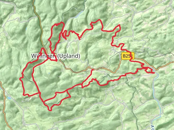
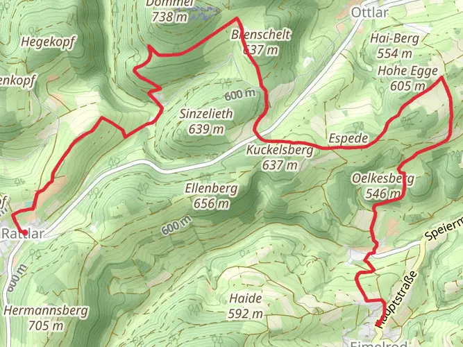
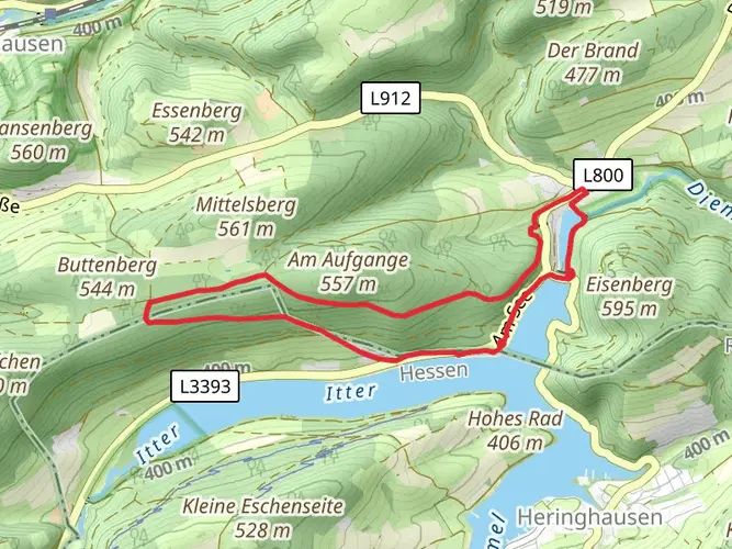
As you set out on the Diemelsteig, the path will lead you through a mosaic of dense forests, open meadows, and along the serene Diemel River. The trail is well-marked, and hikers can rely on navigation tools like HiiKER to stay on track. The initial segment introduces you to the gentle rolling hills characteristic of the region, with the path gradually ascending to higher elevations.
Historical Significance and Landmarks
The Diemelsteig trail is steeped in history, winding through a landscape dotted with medieval villages and ancient ruins. One of the notable historical landmarks is the Weidelsburg Castle, the ruins of which offer a glimpse into the past and a panoramic view of the surrounding area. As you continue, you'll encounter traditional half-timbered houses, a testament to the region's architectural heritage.
Flora and Fauna
The trail is a haven for nature enthusiasts. The diverse habitats along the route support a variety of wildlife, including deer, foxes, and numerous bird species. The changing seasons bring a kaleidoscope of colors, from the vibrant greens of spring to the rich hues of autumn. Wildflowers pepper the landscape, and the dense woodlands are home to a range of tree species, including beech, oak, and spruce.
Elevation and Terrain
Throughout the hike, you'll experience a series of ascents and descents. The most significant elevation gain occurs as you approach the higher ridges, offering rewarding vistas of the Diemel Valley. The terrain is a mix of natural paths, forest trails, and occasional paved sections as you pass through small towns.
Preparing for the Hike
Hikers should be prepared for the trail's medium difficulty by packing appropriate gear, including sturdy hiking boots, weather-appropriate clothing, and sufficient water and food. It's advisable to check the weather forecast in advance and plan for sudden changes in conditions, which are not uncommon in this region.
Conclusion
The Diemelsteig is a journey through both natural beauty and historical intrigue. With its moderate difficulty, it promises an enriching experience for those who come prepared to explore its trails. Whether you're seeking solitude in the forests or the charm of rural German culture, the Diemelsteig offers a memorable adventure for every hiker.

Frequently asked questions
Where does the Diemelsteig start and finish near Diemelsee?
The Diemelsteig is a loop, so it starts and finishes in the same area around Diemelsee-Heringhausen. Commonly listed start points are the tourist information at Heringhausen and the Florenbicke hiking parking area on the road between Helminghausen and Heringhausen, both on the Diemelsee side of the route.
How long is the Diemelsteig and how hard is the full loop?
The full Diemelsteig is 63.26 km long with 1,562 m of elevation gain. It is generally rated medium difficulty, which fits a multi-day hike with repeated climbs rather than a flat lakeside walk.
Can the Diemelsteig be hiked as a round trip in 3 stages?
Yes. The Diemelsteig is a circular multi-day trail and is commonly walked in 3 to 4 stages around the Diemelsee region. At 63.26 km total, a 3-stage plan works out to roughly 21 km per day, which suits hikers comfortable with medium-distance days and steady elevation gain.
Is the Diemelsteig just a walk around the lake at Diemelsee?
No. The Diemelsteig is a full 63.26 km round trail through the wider Diemelsee region, not a simple shoreline circuit. It loops through the uplands around the lake, so the route includes substantial climbing and a total elevation gain of 1,562 m.
Are there trekking campsites on the Diemelsteig for multi-day hiking?
The Diemelsteig is promoted as a multi-day route in the Diemelsee hiking region, but official trail information emphasizes inns, guesthouses, and pensions along the way rather than a dedicated network of Diemelsteig trekking camps. Because camping options can change by season and local rules, overnight planning is usually based around established accommodations in the Diemelsee area.
Can the Diemelsteig be done without carrying full luggage?
Yes, the route is set up for multi-day hiking with villages and accommodations around Diemelsee, and local trail information notes on-demand taxi service that can connect hikers with different start and end points. That makes it practical to organize lighter stage walks, although luggage transfer is not consistently listed as a standard trail service.
What kind of landscape does the Diemelsteig cross in Waldeck-Frankenberg?
The Diemelsteig crosses the Naturpark Diemelsee landscape in Waldeck-Frankenberg, combining wooded ridges, open meadows, and higher ground above the lake. The route is known as a quality hiking trail around Diemelsee, so the scenery is more varied than a single-valley or lakeside path.
Comments and Reviews
User comments, reviews and discussions about the Diemelsteig, Germany.
4.8
average rating out of 5
5 rating(s)