Download
3D Flyover
Add to list
More
113.8 km
~5 days
3285 m
Multi-Day
“Embark on the Pfälzer Höhenweg for a historical, scenic trek through Germany's Palatinate Forest splendor.”
The Pfälzer Höhenweg is a captivating trail that spans approximately 114 kilometers (about 71 miles) and ascends roughly 3200 meters (around 10,500 feet) in elevation. This point-to-point journey begins near the quaint town of Winnweiler in Germany, offering a medium difficulty rating that caters to hikers with some experience under their belts.
Getting to the Trailhead
To reach the starting point of the Pfälzer Höhenweg, hikers can drive to Winnweiler, which is easily accessible via the A63 motorway. For those preferring public transport, regional trains frequently service Winnweiler station. From the station, the trailhead is a short walk or taxi ride away, allowing hikers to embark on their adventure with ease.
Navigating the Trail
Hikers can rely on the HiiKER app for detailed maps and navigation assistance throughout the Pfälzer Höhenweg. The trail is well-marked, guiding adventurers through the diverse landscapes of the Palatinate Forest.
Trail Highlights and Landmarks
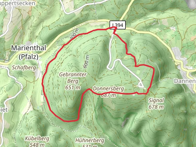
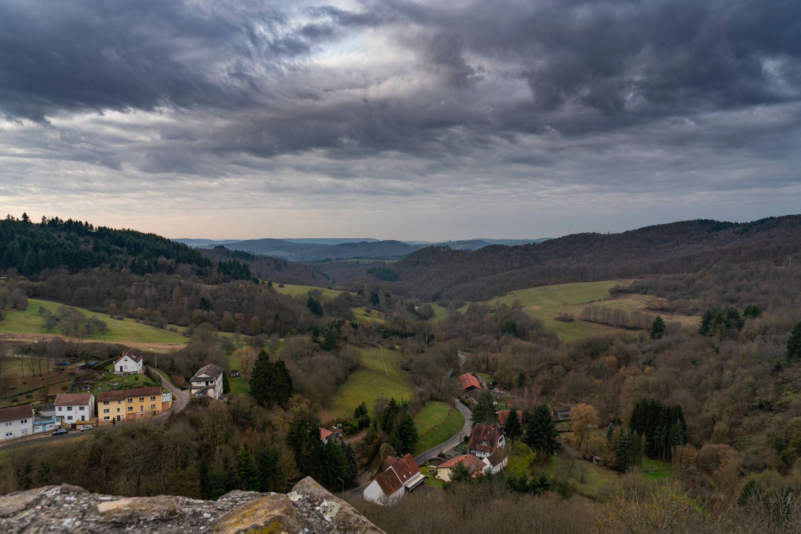
As you set off from the vicinity of Winnweiler, the trail meanders through lush woodlands, open meadows, and past rocky outcrops. One of the early highlights is the panoramic view from the Donnersberg, the highest peak in the Palatinate region, which you'll encounter after a steady climb.
Continuing on, the trail offers a mix of serene valleys and challenging ascents. Around the 40-kilometer (25-mile) mark, hikers reach the enchanting village of Obermoschel, home to the ruins of Moschellandsburg Castle. This historical site dates back to the 12th century and provides a glimpse into the region's medieval past.
Flora and Fauna
The Pfälzer Höhenweg is a haven for nature enthusiasts. The trail cuts through the biosphere reserve of the Palatinate Forest, where hikers can observe a variety of wildlife, including deer, foxes, and numerous bird species. The forest canopy is dominated by beech and oak trees, with the undergrowth featuring a rich tapestry of ferns and wildflowers, particularly vibrant in the spring and summer months.
Cultural and Historical Significance
The Palatinate region is steeped in history, with the trail passing near several castles and ruins. Hikers will encounter remnants of the region's feudal past, with each castle and fortification telling a story of the area's strategic importance through the ages. The trail also winds through picturesque vineyards, indicative of the region's rich wine-making tradition.
Preparing for the Hike
Given the trail's length and varied terrain, it's advisable to plan for a multi-day hike, with accommodations available in the towns and villages along the route. Hikers should pack accordingly for the weather, which can be quite variable, and ensure they have sufficient water and provisions, although there are opportunities to resupply in the settlements en route.
Conclusion
The Pfälzer Höhenweg is a trail that offers a rich tapestry of natural beauty, historical intrigue, and cultural experiences. With its well-marked paths and the support of navigation tools like HiiKER, hikers can immerse themselves in the splendor of the Palatinate Forest and the charm of the German countryside.

Frequently asked questions
How many stages is the Pfälzer Höhenweg usually split into?
The Pfälzer Höhenweg is commonly divided into 7 stages from Winnweiler to Wolfstein. The full route is about 113.82 km long with 3,285 meters of climbing, so most hikers spread it across a week rather than attempting it in one push.
Where does the Pfälzer Höhenweg start and finish?
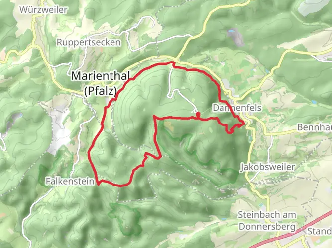
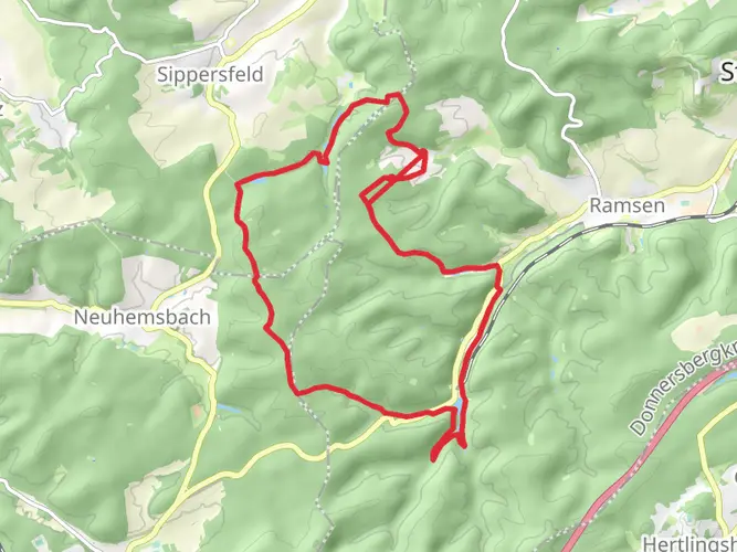
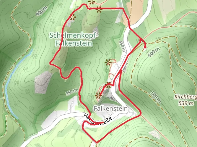
The Pfälzer Höhenweg starts in Winnweiler near the Donnersberg area and runs west to Wolfstein. Along the way it passes places including Dannenfels, Rockenhausen, Obermoschel, Meisenheim, and Lauterecken, making it a true point-to-point hike across the North Palatine uplands.
Is the Pfälzer Höhenweg difficult or suitable for beginners?
The Pfälzer Höhenweg is best described as a difficult multi-day hike rather than a beginner trail. At 113.82 km with 3,285 meters of ascent, it demands solid fitness, comfort with repeated climbs and descents, and the ability to manage several long walking days in a row.
What is the first stage of the Pfälzer Höhenweg like from Winnweiler?
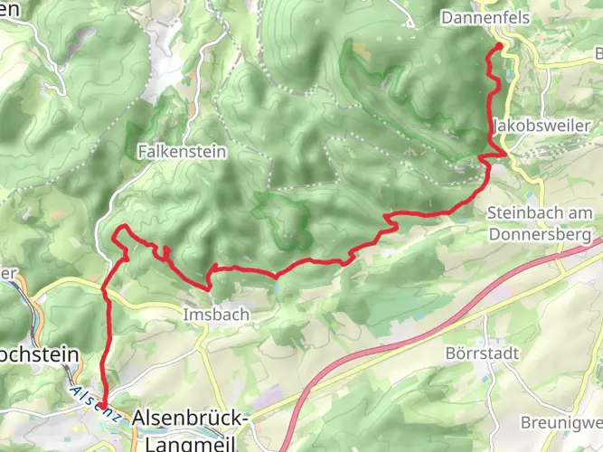
Stage 1 of the Pfälzer Höhenweg runs from Winnweiler to Dannenfels and is roughly 16.8 km. It includes an early climb toward the Donnersberg area and passes landmarks associated with the mountain such as the Adlerbogen and viewpoints near the highest peak in the Palatinate.
What are the highlights of the Pfälzer Höhenweg?
One of the biggest highlights of the Pfälzer Höhenweg is the Donnersberg, the highest mountain in the Palatinate, followed by broad ridge and valley views across the Pfälzer Bergland. The route also links historic small towns including Obermoschel, Meisenheim, and Lauterecken, which gives the trail a mix of natural scenery and cultural stops.
Can the Pfälzer Höhenweg be reached by public transport?
Yes. The eastern end of the Pfälzer Höhenweg is accessible by regional rail via Winnweiler station, and the western end is at Wolfstein, which also has a train station. That makes the route practical for a one-way hike without needing to return to the start by car.
Are there places to stay overnight on the Pfälzer Höhenweg?
Yes. Overnight stays are typically arranged in trail towns and villages along the route rather than in a single remote backcountry corridor. Winnweiler, Dannenfels, Rockenhausen, Obermoschel, Meisenheim, Lauterecken, and Wolfstein are the main settlement points used to break the 113.82 km route into manageable stages.
Comments and Reviews
User comments, reviews and discussions about the Pfälzer Höhenweg, Germany.
5.0
average rating out of 5
6 rating(s)