Download
3D Flyover
Add to list
More
41.1 km
~2 days
1029 m
Multi-Day
“The Dublin Mountains Way is an enchanting 41 km hike showcasing Ireland's history and natural splendor.”
The Dublin Mountains Way is a captivating journey that spans approximately 41 kilometers (25.5 miles) with an elevation gain of around 900 meters (2953 feet), offering hikers a medium difficulty trek through the picturesque landscape near County Dublin, Ireland. This point-to-point trail is a showcase of Ireland's natural beauty, historical landmarks, and rich wildlife.
Getting to the Trailhead
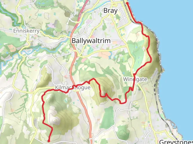
The starting point of the Dublin Mountains Way is located at the suburb of Shankill. To reach the trailhead, hikers can take public transport from Dublin city center, with buses and trains serving the area. For those driving, parking is available near the start of the trail at Brady's Pub, which is a well-known landmark in Shankill.
Trail Experience
As you embark on the Dublin Mountains Way, the trail takes you through a variety of terrains including forested areas, open moorland, and quiet country roads. The path is well-marked with yellow walking man symbols to guide hikers along the route.
Forests and Open Views
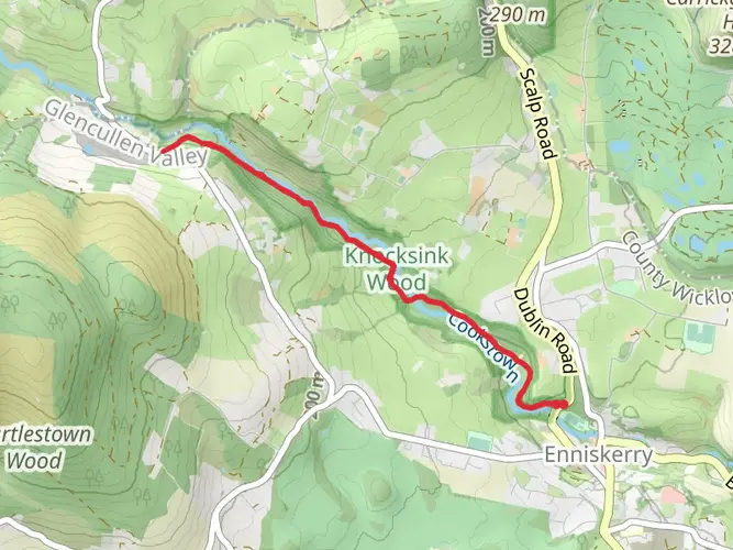
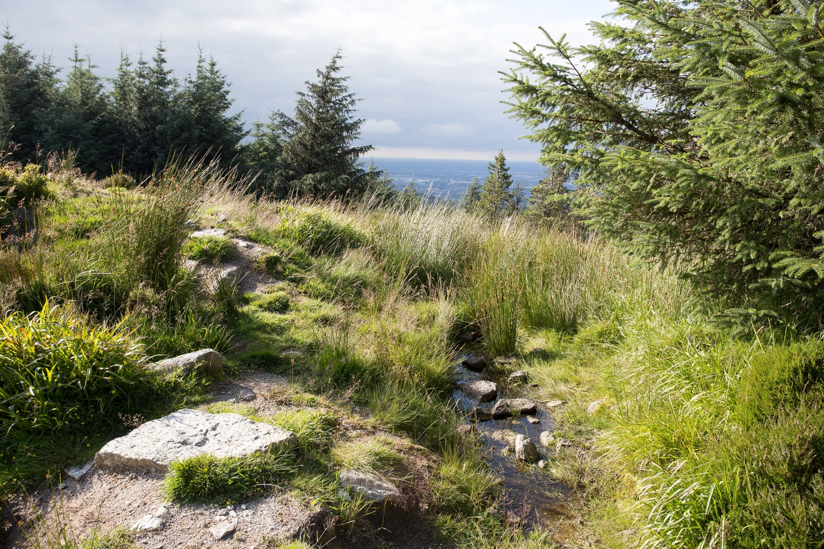
The initial section of the trail meanders through Rathmichael Wood, where the lush canopy of trees provides a serene start to the hike. As you ascend, the woodlands give way to the open vistas of the Dublin and Wicklow mountains. The views here are expansive, with the city of Dublin visible to the east and the Irish Sea stretching out to the horizon.
Historical Landmarks
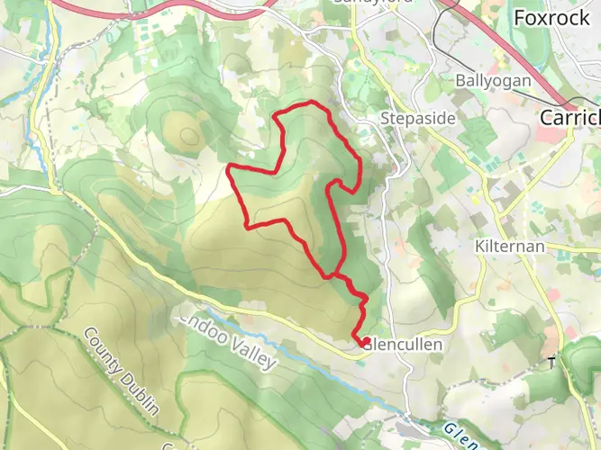
One of the significant historical landmarks along the Dublin Mountains Way is the Fairy Castle, a prehistoric cairn located near the summit of Two Rock Mountain. This ancient site is a reminder of Ireland's rich past and offers a panoramic view that is well worth the climb.
Wildlife and Flora
The trail is home to a diverse range of wildlife and plant species. Keep an eye out for native birds such as the peregrine falcon and the merlin. The heathland and peat bogs are also rich in flora, including heathers, gorse, and bog cotton, which can be particularly striking when in bloom.
Navigation and Planning
For navigation along the Dublin Mountains Way, HiiKER is an excellent tool to ensure you stay on track. It's advisable to download the trail map on HiiKER before setting out, as some sections of the trail can be remote and mobile service may be limited.
Preparation and Safety
Given the trail's length and varied terrain, it's important to be well-prepared. Wear appropriate hiking boots, carry sufficient water and food, and dress in layers to adapt to changing weather conditions. It's also wise to inform someone of your hiking plans and expected return time.
Access to Facilities
Facilities such as restrooms and places to eat can be found in the towns and villages along the way, such as Rathfarnham and Tallaght. However, there are stretches of the trail that are quite remote, so plan accordingly.
End of the Trail
The Dublin Mountains Way concludes in the village of Tallaght. Here, hikers can celebrate the completion of their trek with local amenities and transport links back to Dublin city center or to their next destination.

What to expect?
Activity types
Frequently asked questions
What is the Dublin Mountains Way and where does the Dublin Mountains Way start and finish?
The Dublin Mountains Way is a waymarked linear trail across the Dublin Mountains in County Dublin. It runs for about 41.12 km in HiiKER’s route data, with the official trail described locally as 42.6 km, linking Shankill in the east with Tallaght in the west. The Shankill trailhead is beside Brady’s pub, and the route was designed to connect with DART at Shankill and the Luas Red Line at Tallaght.
How long does it take to walk the Dublin Mountains Way?
Most hikers complete the Dublin Mountains Way in 1 to 3 days, depending on pace, weather, and how many stops are built in. With a distance of 41.12 km and 1,029 m of climbing, it is a solid medium-grade outing rather than a short day walk. Strong walkers may cover it in a long single day, but many split it into stages between Shankill, Glencullen, Tibradden, and Tallaght.
How difficult is the Dublin Mountains Way?
The Dublin Mountains Way is generally rated medium, with 1,029 m of elevation gain over just more than 41 km. The route mixes forest tracks, open mountain sections, and some road walking, so the challenge comes from its length and cumulative climbing rather than technical terrain. It is more manageable for hikers with decent fitness than for complete beginners attempting the full route in one go.
Can the Dublin Mountains Way be walked in stages?
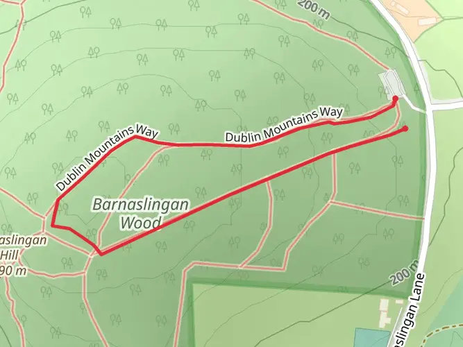
Yes. The Dublin Mountains Way is commonly split into stages, and the official local guidance notes that many walkers do it over one, two, or three days. Natural break points include Barnaslingan, Glencullen Village at about 11.5 km from Shankill, Tibradden around the midpoint, and the Bohernabreena or Glenasmole side before finishing in Tallaght. That makes it practical as a multi-day route or as separate day hikes.
Where can you park for the Dublin Mountains Way in Shankill or Tallaght?
For the eastern end, the most straightforward parking is at Shankill DART Station, about 1 km from the start, where public parking is available for a daily fee. In Tallaght, there are several paid parking options, including parking around The Square area. There is no parking at the Rathmichael Wood access lane itself, even though the route passes through that section soon after leaving Shankill.
Is the Dublin Mountains Way dog friendly?
Dogs are allowed on the Dublin Mountains Way, but they must be kept on a leash at all times. The local trail guidance states this rule applies throughout the route, with no exceptions, because of wildlife and nearby livestock. That matters on the open mountain and farmland sections as well as in the forested parts of the trail.
What landmarks and views are on the Dublin Mountains Way route?
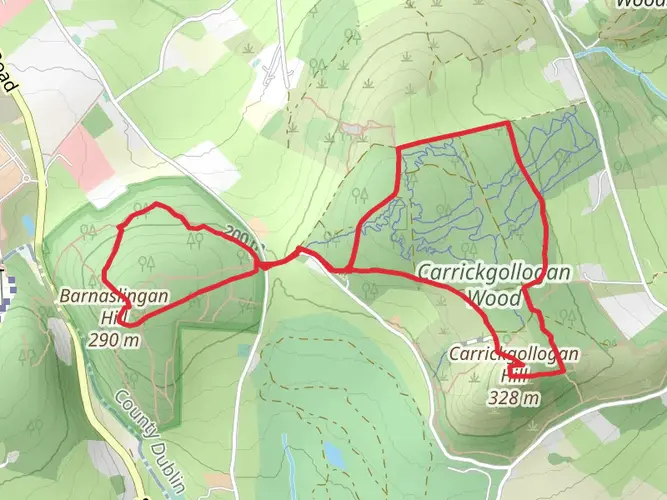
The Dublin Mountains Way passes through a mix of wooded and upland scenery including Rathmichael Wood, Carrickgollogan Wood, Barnaslingan, Glencullen, Tibradden, Cruagh, and the Glenasmole side near Tallaght. Along the way there are broad views toward Dublin Bay, the city, the Irish Sea, and the Wicklow Mountains. One notable route detail is a roughly 1 km overlap with the Wicklow Way on the western slopes of Two Rock Mountain.
Comments and Reviews
User comments, reviews and discussions about the Dublin Mountains Way, Ireland.
4.58
average rating out of 5
101 rating(s)