Download
3D Flyover
Add to list
More
128.4 km
~6 days
3982 m
Multi-Day
“Embark on the challenging Wicklow Way for a breathtaking journey through Ireland's vibrant landscapes and history.”
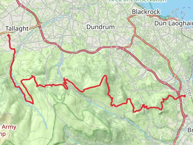
Embarking on the Wicklow Way offers an unforgettable journey through the heart of Ireland's natural beauty and rich history. Spanning approximately 129 kilometers (about 80 miles) with an elevation gain of around 3,500 meters (11,500 feet), this point-to-point trail begins near County Dublin and winds its way through the stunning landscapes of Ticknock, Tibradden Wood, and the Wicklow Mountains National Park. Rated as difficult, this trail demands preparation and respect for the terrain.
Getting There
The trailhead is conveniently accessible from Dublin, making it an ideal starting point for both locals and international visitors. If you're traveling by public transport, you can take a bus or train from Dublin to Marlay Park, which is a popular starting point for the Wicklow Way. For those driving, Marlay Park offers parking facilities, though it's advisable to check availability, especially during peak hiking seasons.
Trail Highlights and Landmarks
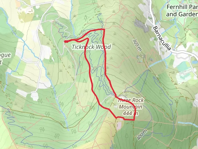
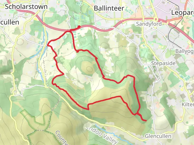
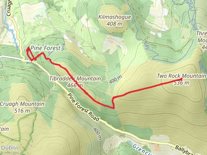
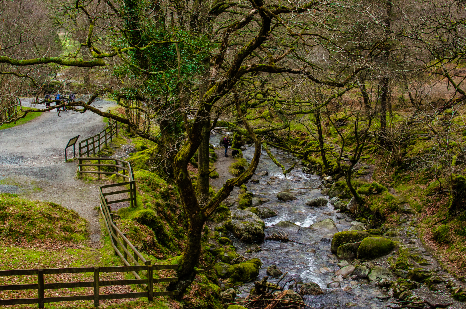
As you set off from Marlay Park, you'll soon find yourself immersed in the lush greenery of Ticknock and Tibradden Wood. These areas are known for their dense forests and serene atmosphere, providing a peaceful start to your journey. Keep an eye out for the Fairy Castle, a notable cairn located on the summit of Two Rock Mountain, offering panoramic views of Dublin and the surrounding countryside.
Continuing south, the trail leads you into the heart of the Wicklow Mountains National Park. This expansive park is a haven for wildlife enthusiasts, with opportunities to spot red deer, peregrine falcons, and a variety of other bird species. The park's diverse ecosystems range from heather-covered moorlands to ancient woodlands, each offering its own unique charm.
Historical Significance
The Wicklow Way is steeped in history, with several points of interest along the route. As you traverse the trail, you'll encounter remnants of Ireland's past, including ancient monastic sites and historical landmarks. One such site is the Glendalough Valley, home to a 6th-century monastic settlement founded by St. Kevin. This area is not only a spiritual and historical highlight but also a place of breathtaking natural beauty, with its two glacial lakes nestled amidst the mountains.
Navigation and Safety
Given the trail's length and difficulty, proper navigation tools are essential. HiiKER is a recommended resource for detailed maps and real-time trail information. Weather conditions in the Wicklow Mountains can change rapidly, so it's crucial to be prepared with appropriate gear, including waterproof clothing and sturdy hiking boots. Always check the weather forecast before setting out and be mindful of your physical limits.
Final Stretches
As you approach the southern end of the trail, the landscape gradually transitions from rugged mountains to rolling hills and farmland. The trail concludes near the village of Clonegal in County Carlow, where you can reflect on the diverse landscapes and rich history you've experienced along the way. Whether you're a seasoned hiker or embarking on your first long-distance trek, the Wicklow Way promises an adventure filled with natural wonders and cultural treasures.

What to expect?
Activity types
Frequently asked questions
How long does it take to hike the Wicklow Way from Marlay Park to Clonegal?
The Wicklow Way is about 128.43 km long, and the official route overview is commonly broken into 7 stages with a total walking time of 7 or more days. Strong hikers sometimes complete it faster, but a week is the standard plan for covering the full route from Marlay Park in Dublin to Clonegal in County Carlow.
Where does the Wicklow Way start and finish?
The Wicklow Way starts at Marlay Park in Rathfarnham on Dublin’s south side and runs south through the Dublin and Wicklow uplands before finishing in Clonegal. The northern trailhead is beside the car park near Marlay House, which is the traditional starting point for the route.
What are the main stages of the Wicklow Way hike?
The official route is typically divided into Marlay Park to Knockree, Knockree to Roundwood, Roundwood to Glendalough, Glendalough to Glenmalure, Glenmalure to Moyne, Moyne to Shillelagh, and Shillelagh to Clonegal. That stage structure helps spread the 128 km route across a manageable multi-day itinerary.
Can the Wicklow Way be reached by public transport from Dublin?
Yes. Marlay Park, the usual start of the Wicklow Way, is accessible from Dublin, and the route also has walker-focused transport links farther south. A dedicated Wicklow Way Bus connects with trains at Rathdrum and serves places such as Laragh, Glendalough, Glenmalure, Iron Bridge, and Tinahely, but it must be pre-booked.
Where can you park for the Wicklow Way at the Dublin trailhead?
The usual parking spot for the Wicklow Way start is the car park adjacent to Marlay House in Marlay Park. That makes the Dublin trailhead straightforward for point-to-point walkers beginning the first 21 km stage toward Knockree, though parking availability can be tighter during busy periods in the park.
What landmarks do you pass on the first day of the Wicklow Way?
On the opening stage from Marlay Park to Knockree, the Wicklow Way passes through the Dublin hills and goes by Kilmashogue, Fairy Castle at 536 m, Two Rock, Tibradden, the Glencullen River, and Prince William’s Seat at 555 m. That first section is about 21 km with roughly 600 m of ascent.
How hard is the Wicklow Way hike?
The Wicklow Way is a medium-difficulty multi-day trail with about 3,982 m of total elevation gain over 128.43 km. The challenge comes less from technical ground than from the sustained distance, repeated climbs through the Dublin and Wicklow uplands, and the need to manage several long days back to back.
Does the Wicklow Way stay in the mountains the whole way?
No. The route begins with upland and mountain terrain through the Dublin and Wicklow hills, including sections around Glendalough and Glenmalure, but the character changes farther south. After Iron Bridge, the trail moves out of the main mountain section and into quieter rolling countryside, leafy lanes, and green roads toward Clonegal.
Comments and Reviews
User comments, reviews and discussions about the Wicklow Way, Ireland.
4.64
average rating out of 5
208 rating(s)