Download
Preview
Add to list
More
30.2 km
~3 days
2099 m
Multi-Day
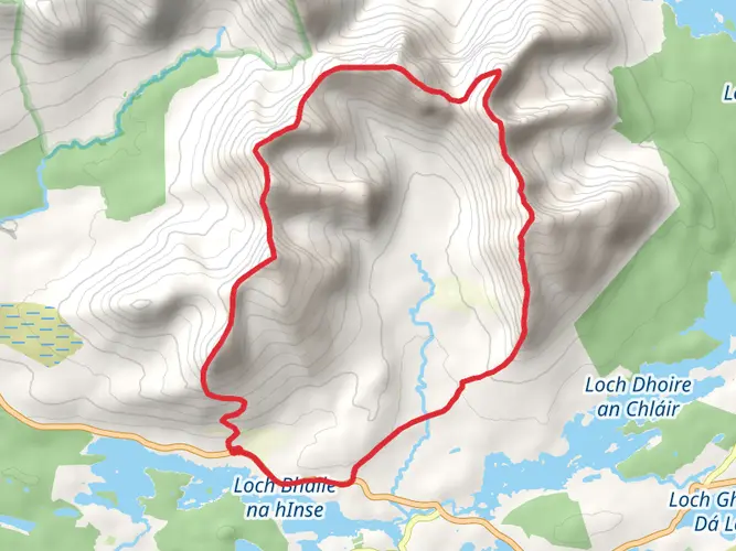
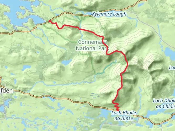
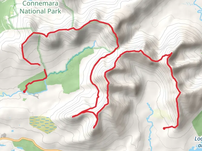
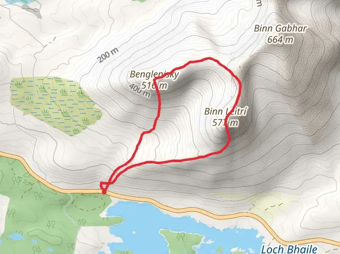
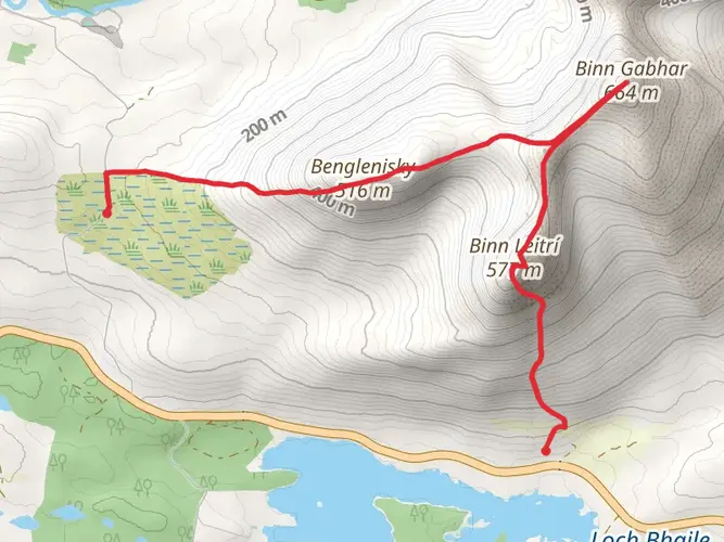
The An Bhinn Dubh and An Bhinn Bhán from Connemara is a 30.2 km trail that starts in Bencorr, County Galway, Ireland. Based on our data, the hike is graded as Extra Difficult. For information on how we grade trails, please read measuring the difficulty of a hiking trail on hiiker. Also, check our latest community posts for trail updates. This hike can be completed in approx 2 days. Caution is advised on trail times as this depends on multiple variables. For more info read about how we calculate hike time.

Frequently asked questions
How long does An Bhinn Dubh and An Bhinn Bhán from Connemara usually take to hike?
An Bhinn Dubh and An Bhinn Bhán from Connemara is a 30.24 km multi-day mountain route with 2,099 m of climbing, so it is usually treated as a full-day epic or split over 2 days. With that distance and elevation, it sits firmly in the extra-difficult category and demands strong fitness, efficient pacing, and solid mountain navigation.
How hard is An Bhinn Dubh and An Bhinn Bhán from Connemara compared with other hikes in County Galway?
An Bhinn Dubh and An Bhinn Bhán from Connemara is an extra-difficult route with 30.24 km of distance and 2,099 m of ascent, which places it among the more serious mountain outings in County Galway. The combination of a long day, steep climbing, and exposed Connemara terrain makes it better suited to experienced hikers than casual walkers.
Where do you start An Bhinn Dubh and An Bhinn Bhán from Connemara and is there parking nearby?
This route starts from the Connemara area in County Galway, and mountain hikes in this part of Connemara commonly use roadside lay-bys or trailheads reached from the N59. Parking in the area is typically limited rather than a large formal lot, so an early start is the safer assumption for a long route of this scale.
Is An Bhinn Dubh and An Bhinn Bhán from Connemara a one-day hike or an overnight route?
The route is classified as multi-day, but at 30.24 km it can also be completed in a single very demanding day by strong, experienced hikers. The deciding factors are the 2,099 m of ascent, weather on the ridges, and how quickly the rough mountain terrain can be covered in Connemara.
What kind of terrain should hikers expect on An Bhinn Dubh and An Bhinn Bhán from Connemara?
Hikers should expect classic Connemara mountain ground: boggy lower approaches, steep rocky climbs, and exposed ridges higher up. Nearby Binn Bhán routes in the same mountain area are described as waterlogged on the approach after rain, with steeper rockier terrain and sections where the path is faint, so careful footing and navigation are important.
Is An Bhinn Dubh and An Bhinn Bhán from Connemara suitable for beginners?
An Bhinn Dubh and An Bhinn Bhán from Connemara is not a beginner hike. A 30.24 km distance, 2,099 m of elevation gain, and extra-difficult rating point to a serious mountain route that is more appropriate for hikers with experience of long days, steep ascents, and poor-weather navigation in western Ireland.
What is the best time of year to hike An Bhinn Dubh and An Bhinn Bhán from Connemara?
Late spring through early autumn is usually the most practical window for An Bhinn Dubh and An Bhinn Bhán from Connemara because daylight is longer and the chances of stable visibility are better. Even then, Connemara mountains can be wet, windy, and cloud-covered at any time, and boggy ground on the lower slopes often becomes more difficult after rain.
Comments and Reviews
User comments, reviews and discussions about the An Bhinn Dubh and An Bhinn Bhán from Connemara, Ireland.
4.5
average rating out of 5
14 rating(s)