Download
Preview
Add to list
More
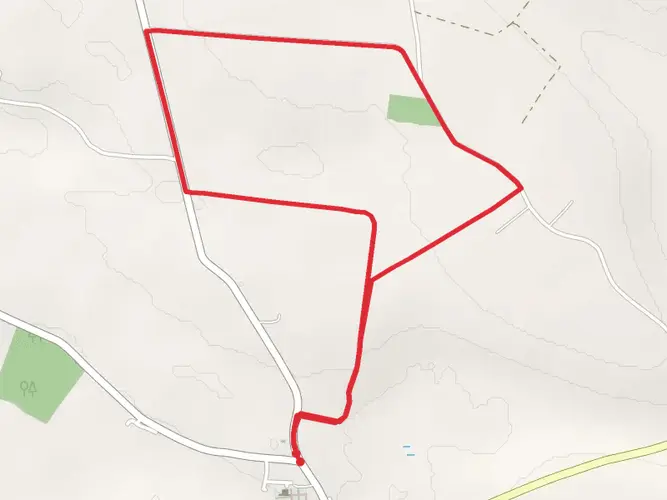
105.1 km
~4 days
584 m
Multi-Day
“Embark on the Suck Valley Way for a serene blend of Irish history, wildlife, and bucolic landscapes.”
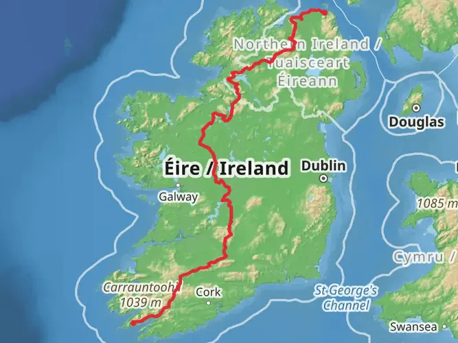
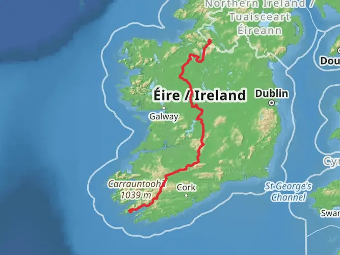
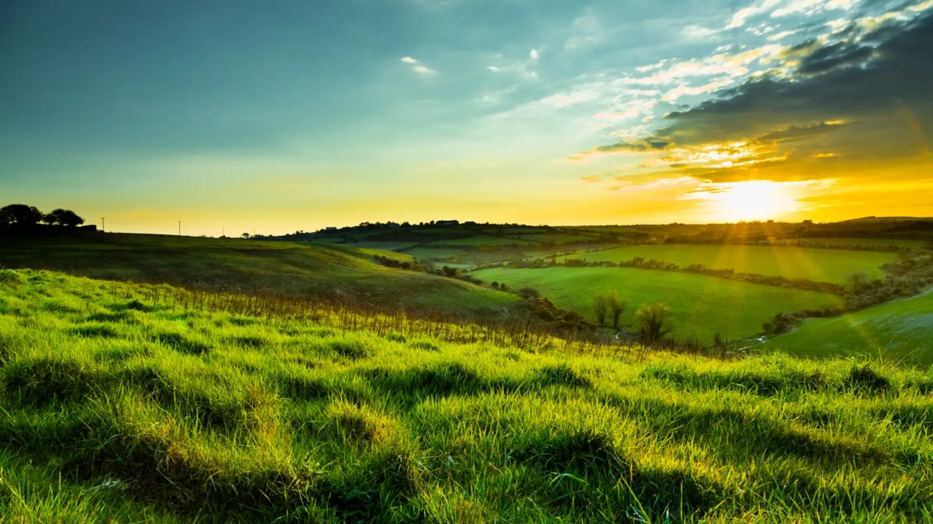
Nestled in the heart of the Irish countryside, the Suck Valley Way offers an immersive experience through a tapestry of rural landscapes, historical sites, and rich biodiversity. This loop trail, spanning approximately 105 kilometers (about 65 miles) with an elevation gain of around 500 meters (approximately 1640 feet), begins near the town of Castlerea in County Galway, Ireland.
Getting to the Trailhead
The starting point of the Suck Valley Way can be accessed by car or public transport. For those driving, Castlerea is well-connected by roads and offers parking facilities near the trailhead. Public transport users can take a train or bus to Castlerea, with the trailhead being a short walk from the station.
Navigating the Trail
As you embark on the Suck Valley Way, it's advisable to use a reliable navigation tool like HiiKER to stay on track. The trail is marked, but having a digital map can enhance your navigation through the varying terrain.
Historical Significance and Landmarks
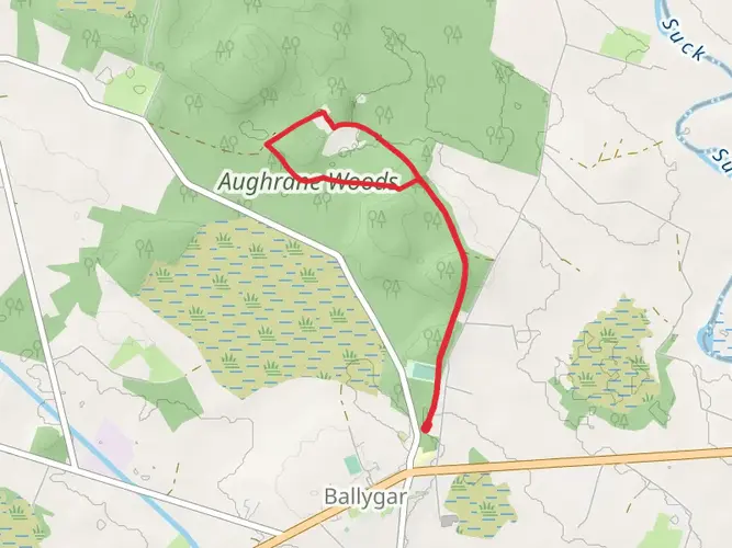
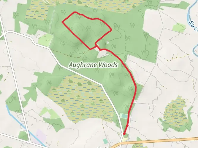
The Suck Valley Way traverses a region steeped in history. Along the route, hikers will encounter ancient ringforts, medieval abbeys, and castles that whisper tales of Ireland's past. Notable historical landmarks include the ruins of the 12th-century Ballintober Castle and the Dominican Priory in Athleague.
Natural Beauty and Wildlife
The trail winds through a mosaic of farmland, boglands, and along the banks of the River Suck, offering hikers a chance to witness a diverse range of flora and fauna. Birdwatchers will delight in the opportunity to spot species such as the whooper swan and kingfisher. The trail also passes through areas of conservation importance, such as wetlands that are home to the endangered European otter.
Terrain and Difficulty
The Suck Valley Way is rated as medium difficulty, with a mix of flat and gently undulating terrain. The trail is well-suited for walkers of moderate fitness levels. The elevation gain is gradual, with no significant steep sections to navigate.
Preparation and Planning
Hikers should prepare for variable weather conditions and pack accordingly. Waterproof clothing, sturdy hiking boots, and layers are recommended. It's also wise to carry enough food and water for the journey, as well as a first-aid kit for emergencies.
Accommodation and Amenities
The trail passes through several small towns and villages where hikers can find accommodation, ranging from B&Bs to self-catering cottages. Amenities such as shops, pubs, and restaurants are available at various points along the route, allowing for resupply and rest.
Conclusion
The Suck Valley Way is a journey through the heart of rural Ireland, offering a blend of natural beauty, wildlife, and historical intrigue. With careful preparation and an adventurous spirit, hikers can fully immerse themselves in the tranquility and charm of this captivating trail.

What to expect?
Activity types
Frequently asked questions
How long is the Suck Valley Way and how many days does the full hike usually take?
The Suck Valley Way is 105.12 km long, so it is firmly in multi-day territory rather than a short loop. Most walkers break it into about five days, which fits the trail’s easy overall grade and modest 584 m of total climbing across the route.
Is the Suck Valley Way a loop trail or do you need transport back to the start?
The Suck Valley Way is a loop, so it returns to its starting area instead of finishing at a separate endpoint. That makes logistics simpler for a multi-day walk, especially when starting in the Castlerea or Ballygar area, because there is no mandatory shuttle at the end.
Where does the Suck Valley Way go and which towns or villages does it pass through?
The route follows the River Suck valley through east Galway and west Roscommon and is known for linking the area’s Nine Friendly Villages. Places named on the way include Ballygar, Creggs, Glinsk, Ballymoe, Ballintubber, Dunamon, Castlecoote, Athleague and Mount Talbot, with Castlerea also closely associated with access to the trail.
Is the Suck Valley Way easy enough for beginners or families?
The Suck Valley Way is generally considered an easy long-distance walk, with 584 m of ascent spread over more than 105 km. The route is mostly lowland and is often described as mostly flat, so the main challenge is the distance and the need to manage several days of walking rather than steep climbing.
Can you walk the Suck Valley Way as shorter day hikes instead of doing the whole route?
Yes. Although the Suck Valley Way is a 105.12 km multi-day route, it is commonly split into shorter sections between villages such as Creggs, Ballymoe, Castlecoote, Athleague and Ballygar. That makes it practical for walkers looking for day hikes near Castlerea or along the River Suck rather than a full through-walk.
Is the Suck Valley Way well waymarked and easy to follow?
The Suck Valley Way is a waymarked national trail, and the route is signed with yellow arrows on black posts. On road sections, brown fingerposts marked Suck Valley Way are also used, which helps on a long lowland route that mixes quiet roads, farmland and river-valley terrain.
Are dogs allowed on the Suck Valley Way?
No. The current trail listing for the Suck Valley Way marks dogs as not allowed. That is an important rule to check before setting out, especially on a route that crosses farmland and lowland sections near the River Suck.
Comments and Reviews
User comments, reviews and discussions about the Suck Valley Way, Ireland.
4.5
average rating out of 5
16 rating(s)