Download
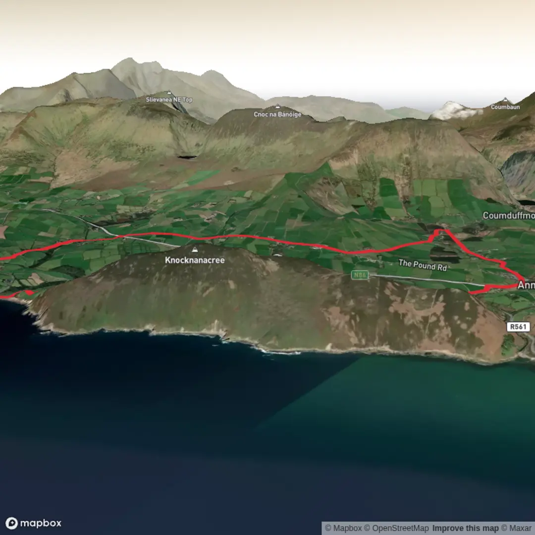
3D Flyover
Add to list
More
14.0 km
~3 hrs 9 min
219 m
Loop
“A story-rich Annascaul loop weaves Tom Crean’s legacy through lanes, farmland, and salt-bright coastal views.”
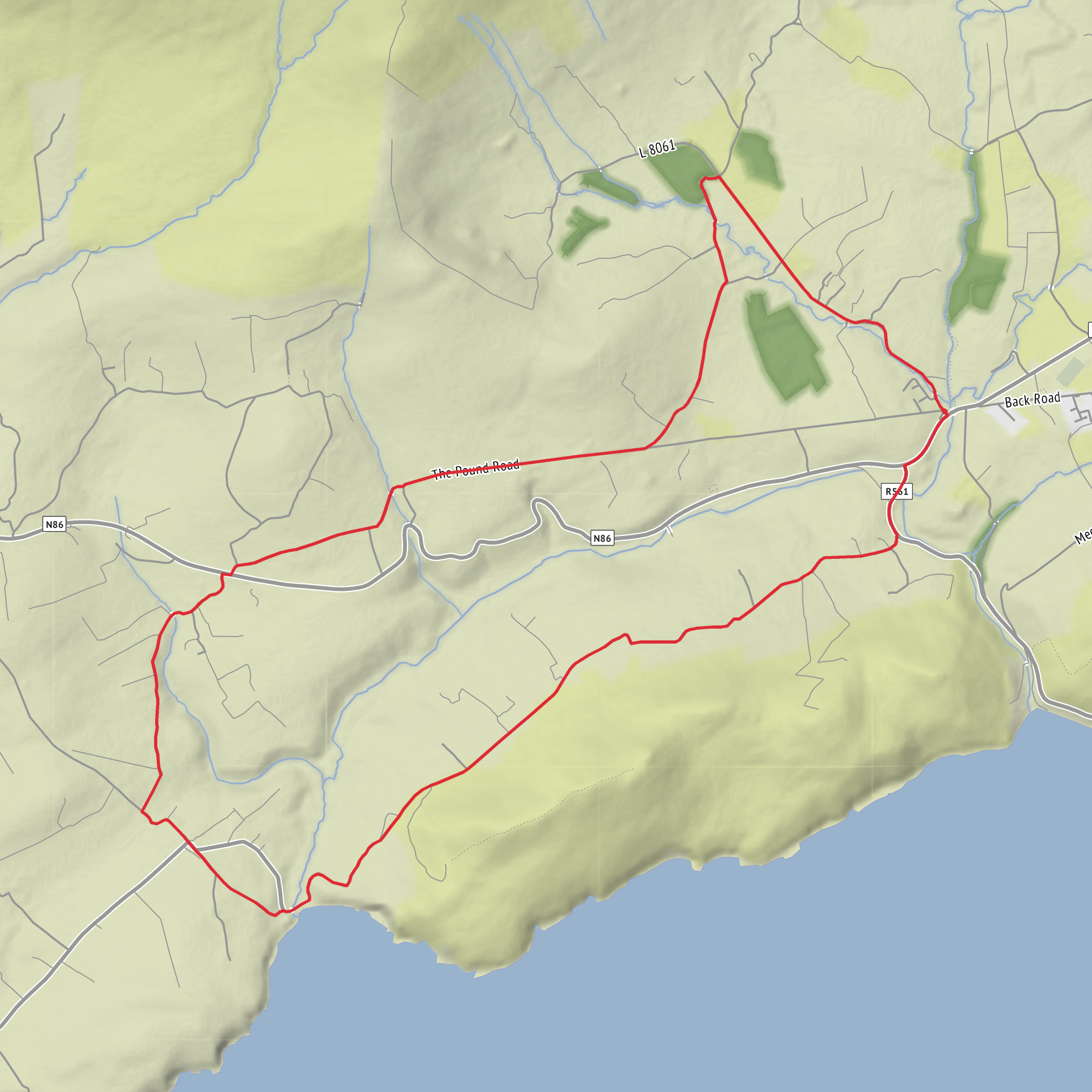
This easy-going loop around Annascaul on the Dingle Peninsula is best thought of as a heritage walk with coastal and rural scenery rather than a rugged mountain outing. At roughly 14 km / 8.7 miles with about 200 m / 656 ft of ascent, it is manageable for most walkers with a reasonable base level of fitness, but the distance is still long enough to warrant proper footwear, a waterproof layer, and enough food and water for half a day out. Older local mapping has listed the route at about 16.5 km / 10.3 miles, while more recent track recordings put it closer to 14.3 km / 8.9 miles, so it is wise to allow a little extra time. (annascaul.wordpress.com)
The route is closely tied to Tom Crean, the Antarctic explorer born in Annascaul in 1877. The walk begins in the village at the Tom Crean Garden, then links places associated with his life, including the old Coast Guard Station at Minard Cove, his birthplace at Gortacurrane, his grave at Ballinacourty, and the South Pole Inn, the pub most famously associated with him. That gives the day a strong historical thread, and even on quieter stretches you are never far from the sense that this is a walk through one man’s landscape as much as through West Kerry scenery. (annascaul.ie)
Getting to the start is straightforward by West Kerry standards. Annascaul lies on the N86 between Tralee and Dingle, and Bus Éireann route 275 serves Annascaul from both directions, while TFI Local Link Kerry route 276 also serves the village on the Killarney–Inch–Annascaul–Lispole–Dingle corridor. If arriving by rail, the nearest train station is Tralee Casement, from where you can connect onward by bus. By car, Annascaul is about 33 km / 20.5 miles west of Tralee, and the most useful landmark for the start is the Tom Crean Garden in the village centre, close to the South Pole Inn and the main street through Annascaul. (buseireann.ie)
What the walk feels like
Expect a route that mixes quiet local roads, lanes, and easier walking terrain rather than sustained hill paths. One recent recorded outing noted that much of it is on tarmac, which is worth knowing if you are expecting a soft-trail hike throughout. That said, the appeal here is in the changing views: open farmland, glimpses toward Dingle Bay, the approach to Minard, and the broader mountain-and-valley backdrop that makes this part of Kerry so memorable. (wikiloc.com)
Because the elevation gain is modest, the climbing tends to come in shorter rises rather than one major ascent. On an easy-rated route like this, the main challenge is usually exposure to weather and the cumulative effect of road walking, especially if it is wet or windy. In County Kerry, conditions can shift quickly even at low elevations, so a breezy, grey day can feel much more demanding than the numbers suggest.
Landmarks, scenery, and local character
One of the standout points on the route is Minard Cove and the old Coast Guard Station. This stretch gives the walk a more coastal feel, with sea views and a sense of the Atlantic edge that defines the peninsula. Nearby Minard Castle, a 16th-century ruin by the shore, is one of the area’s most striking historic landmarks and adds a dramatic visual note if your route or nearby detour brings it into view. The wider Annascaul area also looks across a landscape shaped by glaciation, with valleys, low ridges, and the nearby Annascaul Lake sitting in a classic mountain setting. (annascaul.ie)
The Dingle Peninsula is one of Ireland’s richest cultural landscapes, with a strong Irish-language tradition, deep folklore, and an exceptional concentration of
Surfaces
Unknown
Asphalt
Comments and Reviews
User comments, reviews and discussions about the Tom Crean Trail, Ireland.
average rating out of 5
0 rating(s)
