Download
3D Flyover
Add to list
More
57.7 km
~3 days
774 m
Multi-Day
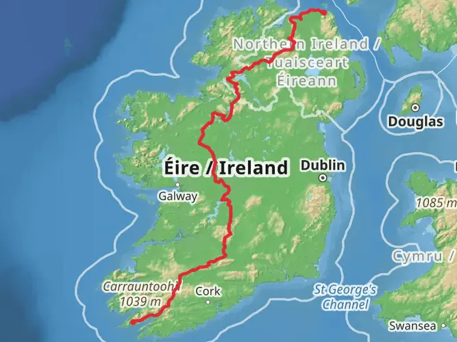
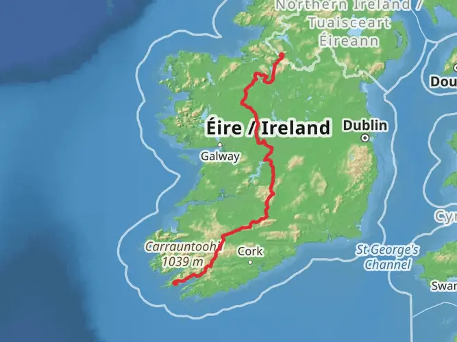
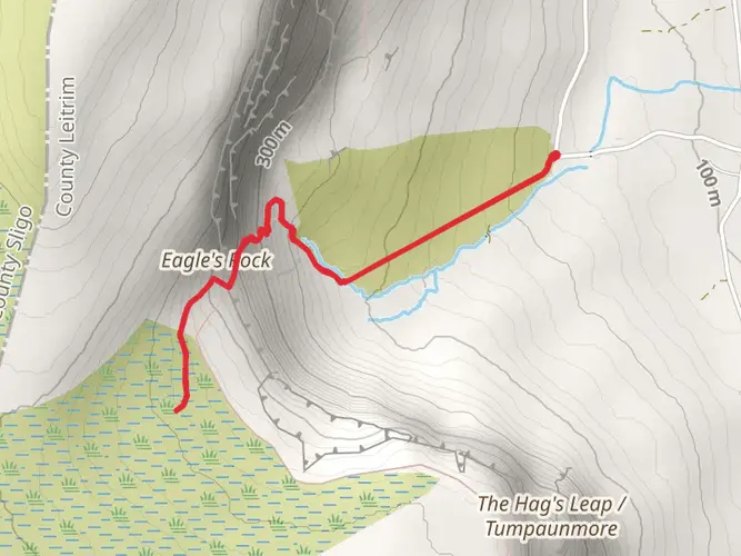
The Leitrim Way is a 57.7 km trail that starts in , County Leitrim, Ireland. Based on our data, the hike is graded as Easy. For information on how we grade trails, please read measuring the difficulty of a hiking trail on hiiker. Also, check our latest community posts for trail updates. This hike can be completed in approx 2 days. Caution is advised on trail times as this depends on multiple variables. For more info read about how we calculate hike time.

What to expect?
Activity types
Frequently asked questions
How long is the Leitrim Way and how many days does the Leitrim Way take?
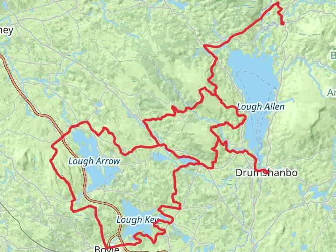
The Leitrim Way is 57.69 km long with 774 m of total ascent, so it is usually walked as a multi-day route rather than a single outing. Most walkers break it into 2 to 3 days, especially if stopping in places such as Manorhamilton, Dowra, Drumshanbo, or Leitrim Village along the line of the trail.
Where does the Leitrim Way start and finish in County Leitrim?
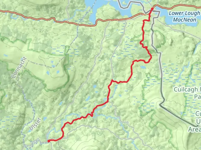
The Leitrim Way runs between Manorhamilton and Leitrim Village in County Leitrim. Official tourism and trail information describes it as a route linking Manorhamilton in north Leitrim with Leitrim Village in the south, passing through or near places including Dowra and Drumshanbo.
Is the Leitrim Way waymarked and easy to follow?
The Leitrim Way is a National Waymarked Trail and is generally described as waymarked on the ground. Sport Ireland notes that the route is marked, and recent trail information also highlights yellow walking-man and arrow signage used on the Leitrim Way as part of Ireland’s national waymarked trail network.
Where can you park for the Leitrim Way at the Leitrim Village end?
Leitrim Village is one of the main access points for the Leitrim Way and is the southern end of the route. Parking is typically sought in or around the village before joining the trail toward Drumshanbo, which is the first major section north of Leitrim Village on the waymarked route.
Does the Leitrim Way pass through Dowra and Drumshanbo?
Yes. The Leitrim Way links Manorhamilton and Leitrim Village and passes through key sections around Dowra and Drumshanbo. Official route descriptions note a crossing at Dowra and a section alongside the Shannon Blueway, with Leitrim Village to Drumshanbo forming part of the southern stretch.
Is the Leitrim Way suitable for beginners?
The Leitrim Way is graded Easy, which makes it one of the more approachable long-distance hikes in County Leitrim. The full route is still nearly 58 km, so the challenge is more about distance and time on foot than steep climbing, with 774 m of total elevation gain spread across the trail.
Comments and Reviews
User comments, reviews and discussions about the Leitrim Way, Ireland.
4.84
average rating out of 5
19 rating(s)