Download
Preview
Add to list
More
81.4 km
~3 days
798 m
Multi-Day
“Explore Ireland's heritage on the scenic Ormond Way, a trek through history and lush landscapes.”
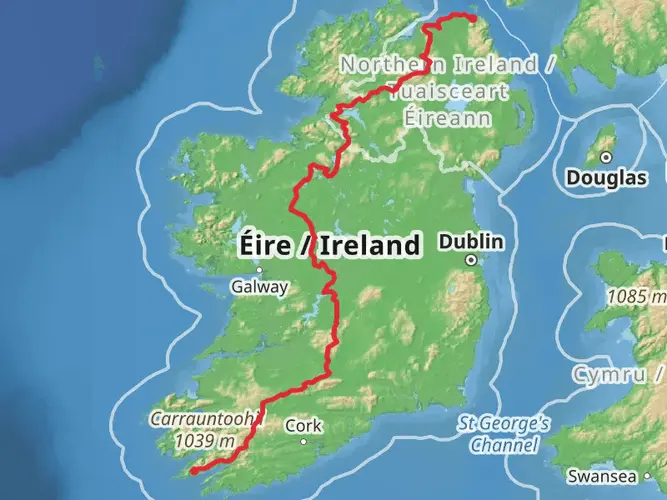
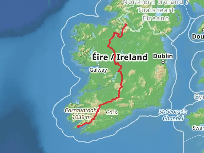
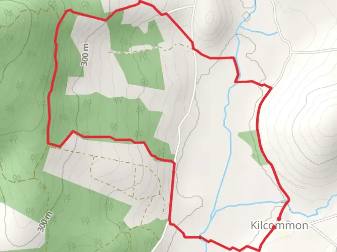
The Ormond Way is a captivating trail that stretches approximately 81 kilometers (around 50 miles) and features an elevation gain of roughly 700 meters (about 2300 feet), offering hikers a medium difficulty level trek through the heart of Ireland's picturesque countryside. This point-to-point trail begins near the historical town of Carrick-on-Suir in County Tipperary and meanders through a landscape rich in both natural beauty and historical significance.
Getting to the Trailhead
To reach the starting point of the Ormond Way, hikers can drive to Carrick-on-Suir, which is well-connected by roads and situated close to the N24, a major national route. For those preferring public transport, regular bus services operate to Carrick-on-Suir from various cities, including Waterford and Clonmel. Upon arrival in Carrick-on-Suir, the trailhead is accessible from the town center, making it convenient to start your journey.
Navigating the Trail
Hikers can utilize the HiiKER app for detailed maps and navigation assistance throughout the Ormond Way. The trail is marked, but having a digital tool can enhance the experience by providing real-time location tracking and additional route information.
Historical Significance and Landmarks
As you embark on the Ormond Way, you'll be walking through a region steeped in history. The trail takes its name from the powerful Butler family, also known as the Earls and Dukes of Ormond, who played a significant role in Ireland's past. Along the route, hikers will encounter a variety of historical landmarks, including castles, old churches, and estates that echo the stories of bygone eras.
Natural Beauty and Wildlife
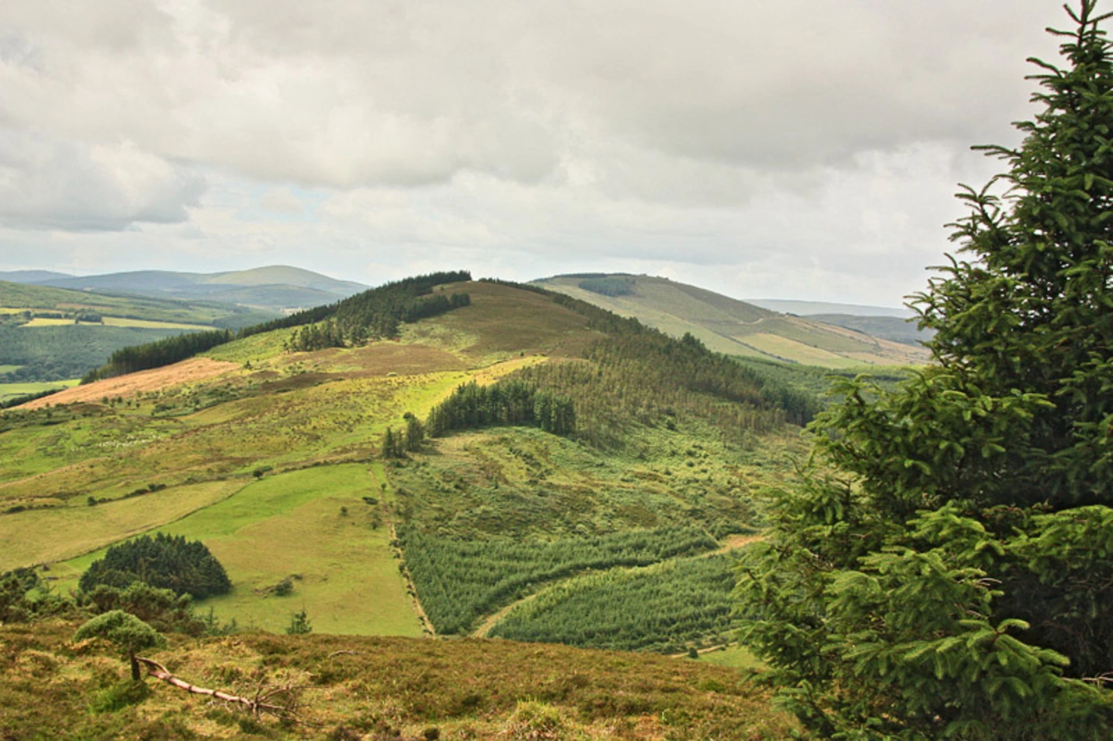
The trail offers a diverse range of scenery, from rolling farmland and quiet woodlands to riverbanks teeming with wildlife. Birdwatchers will delight in the opportunity to spot native species, while the changing landscapes provide a habitat for a variety of flora and fauna. The River Suir, which the trail frequently intersects, adds a serene backdrop to the hike and is a vital ecosystem for fish and other aquatic life.
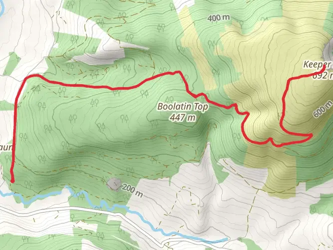
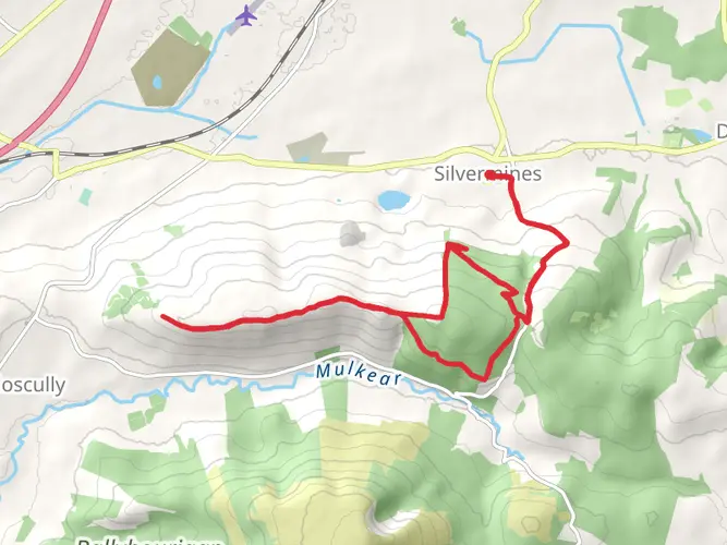
Terrain and Elevation
The Ormond Way is characterized by a mix of terrain, including country lanes, forest paths, and open fields. The elevation gain is gradual, making it a manageable challenge for hikers with a moderate level of fitness. The highest points along the trail offer panoramic views of the surrounding countryside, making the ascent well worth the effort.
Preparation and Planning
Before setting out, hikers should ensure they are adequately prepared with suitable footwear, weather-appropriate clothing, and sufficient water and food supplies. The trail can be completed in sections or as a multi-day hike, with accommodation options available in the towns and villages along the way.
Remember to respect the natural environment and historical sites you'll encounter on the Ormond Way. Leave no trace principles should be followed to preserve the trail for future generations. With its combination of natural beauty, historical intrigue, and varied landscapes, the Ormond Way is a memorable journey through the heart of Ireland's rich heritage.

What to expect?
Activity types
Frequently asked questions
What is the route of the Ormond Way in County Tipperary?
The Ormond Way is an 81.44 km multi-day route in County Tipperary. It begins near Carrick-on-Suir and forms part of the Beara-Breifne Way, the long-distance route that links into the wider Ireland Way network. The trail is point-to-point rather than a loop, so transport planning matters at both ends.
How long does it take to hike the Ormond Way?
Most hikers should plan the Ormond Way as a multi-day walk rather than a single outing. At 81.44 km with 798 m of climbing, it suits a 2 to 4 day schedule depending on pace, weather, and how many stops are built in along the route. Its easy grading reflects moderate terrain rather than a short day hike.
Is the Ormond Way part of the Beara-Breifne Way or the Ireland Way?
Yes. The Ormond Way is one of the named sections of the Beara-Breifne Way, and the Beara-Breifne Way in turn connects into the larger Ireland Way long-distance trail system. That means the Ormond Way can be walked as a stand-alone route in Tipperary or as part of a much longer cross-country journey.
Where does the Ormond Way start near Carrick-on-Suir?
The Ormond Way starts near Carrick-on-Suir in County Tipperary. Carrick-on-Suir is a practical access point because it sits on the N24 corridor and has bus connections with places including Waterford and Clonmel. The town center makes a straightforward base for the opening miles of the route.
Is the Ormond Way difficult?
The Ormond Way is graded easy, which makes it one of the more approachable long-distance walks in this part of Ireland. Even so, 81.44 km is still a substantial undertaking, and the total ascent of 798 m means it is best treated as a steady multi-day trail rather than a casual stroll.
Can the Ormond Way be done as a day hike or is it a multi-day trail?
The Ormond Way is best treated as a multi-day hike. Covering 81.44 km in one day would be a very long effort for most walkers, so it is more realistic to split it into stages over several days. That approach also makes the easy difficulty rating more meaningful in practice.
Comments and Reviews
User comments, reviews and discussions about the Ormond Way, Ireland.
4.38
average rating out of 5
21 rating(s)