Download
3D Flyover
Add to list
More
7.2 km
~2 hrs 16 min
507 m
Loop
“From Mahon Falls to Fauscoum, this rugged climb trades thunderous cascades for wild, wind-scoured grandeur.”
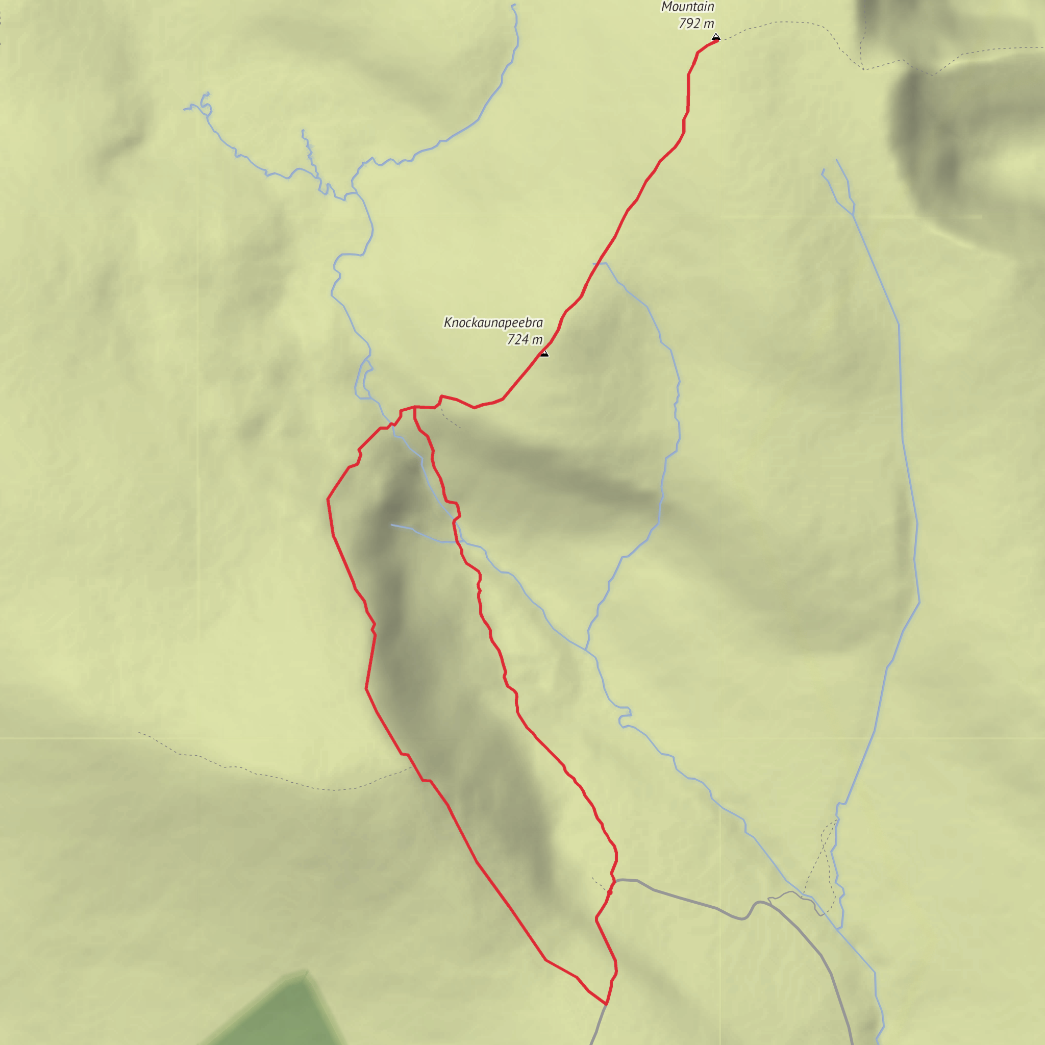
This difficult out-and-back route in the Comeragh Mountains packs a lot into roughly 7 km / 4.3–4.6 miles, with about 500–550 metres / 1,640–1,805 feet of ascent. The usual start is at Mahon Falls Car Park near Lemybrien, County Waterford, on the Mahon Valley side of the range, rather than in a town centre or village street. The route heads first toward the famous falls, then climbs beyond them onto open mountain ground over Knockaunapeebra before continuing to Kilclooney Mountain, also known as Fauscoum, one of the highest points in the Comeraghs. (alltrails.com)
The opening section is the most straightforward. From the car park, a clear path leads toward Mahon Falls, an 80 m / 262 ft waterfall where the River Mahon drops over sandstone cliffs. This lower approach is popular because it is relatively accessible and gives wide views back down the valley toward the coast and Dungarvan. Once past the falls, the character of the hike changes quickly: the route becomes steeper, rougher, and much more exposed, with rocky ground, open hillside, and little to no shelter. (discoverireland.ie)
What to expect on the climb
After the falls, the ascent toward Knockaunapeebra is where the hike earns its difficult rating. Expect a sustained climb on uneven mountain terrain, with wet patches, loose stone, and sections where the line of travel can feel less obvious in poor visibility. The Comeraghs are known for broad upland ground and boggy plateau terrain, so even on a relatively short route, progress can be slower than the distance suggests. Wind exposure is a serious factor here, especially once you leave the sheltered lower valley. (alltrails.com)
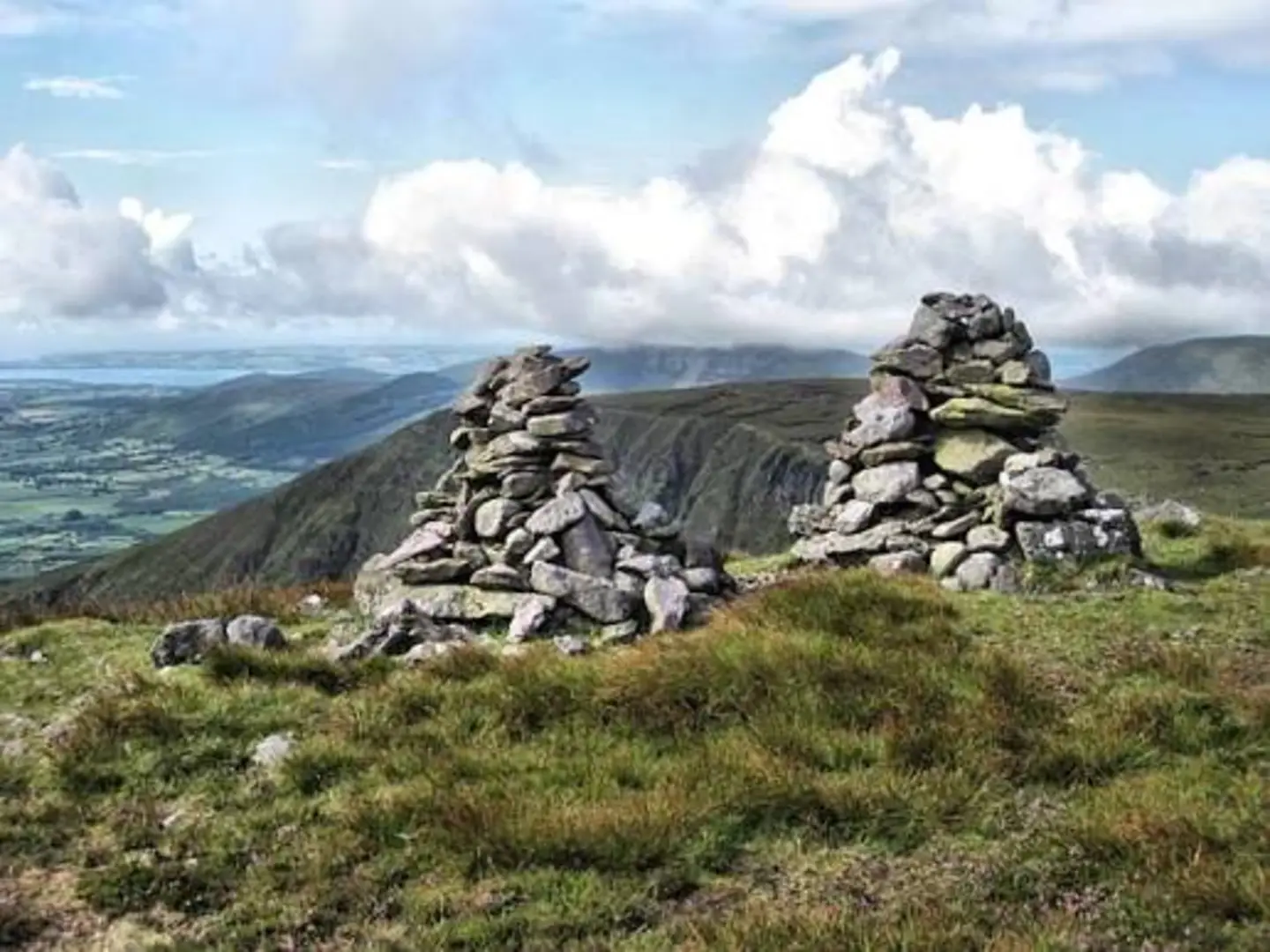
Knockaunapeebra rises to about 726 m / 2,382 ft and is one of the most visually prominent summits in the range, noted for its twin cairns. From there, the route continues on to Kilclooney Mountain / Fauscoum, the high point of this outing. Although the total distance is modest, the combination of ascent, exposure, and off-path mountain travel means this is better suited to hikers comfortable with steep upland routes than to casual walkers heading only for the waterfall. (npws.ie)
On a clear day, the rewards are extensive views across the Comeragh plateau, the Mahon Valley, and south toward the sea. In mist, however, the same open ground can become confusing very quickly. For navigation, a mapped route on HiiKER is worth having ready before setting out, especially because the upper mountain is far less defined than the approach to the falls.
Terrain, hazards, and preparation
This is a route where conditions matter as much as fitness. The lower path to Mahon Falls is comparatively solid, but above it the terrain can be rocky, wet, and pathless in places. The route also passes near cliff-edged mountain scenery, so extra care is needed in wind, rain, or low cloud. Waterproof boots with good grip are strongly recommended, along with full rain gear, warm layers, food, and more water than the short mileage might suggest. There is little shade on the route and very little protection from weather once you are on the open mountain. (alltrails.com)
Because the hike climbs from valley floor to exposed upland in a short span, weather can feel very different at the top than at the car park. Strong gusts, low cloud, and saturated ground can turn a scenic mountain walk into a serious navigation day. If visibility is poor, many hikers sensibly limit their outing to Mahon Falls itself rather than committing to the upper section.
Landscape, wildlife, and natural interest
The Comeragh Mountains are a glaciated upland landscape of Old Red Sandstone, with a high plateau cut by deep corries and valleys. Mahon Falls sits on the south-eastern side of the protected Comeragh Mountains SAC, where the River Mahon spills from the plateau into Coummahon. The area is important for upland habitats including blanket bog, heath, scree, and rocky slopes with specialized vegetation.
Surfaces
Unpaved
Gravel
Unknown
Comments and Reviews
User comments, reviews and discussions about the Kilclooney Mountain Via Mahon Falls and Knockaunapeebra, Ireland.
average rating out of 5
0 rating(s)
