Download
3D Flyover
Add to list
More
28.8 km
~5 hrs 53 min
77 m
Out and Back
“From Tralee’s green hush to Fenit’s salt-bright harbour, a gentle shared path invites unhurried reflection.”
A flat, coastal-leaning greenway walk linking Tralee to the fishing village and harbour at Fenit, this route is ideal for a long, steady day out with very little climbing—about 29 km (18.0 mi) end-to-end with roughly 100 m (328 ft) of total ascent spread so gently you’ll mostly notice it only on bridges and slight rail-bed undulations. Underfoot is typically smooth, well-compacted greenway surface suitable for walking shoes or light trail shoes; it’s also popular with cyclists, so expect shared-use etiquette throughout.
Getting to the start (and where “near” usually means)
Most hikers begin from the Tralee town side, where access is easiest and services are close by. A practical “start landmark” to aim for is Tralee town centre near Tralee Railway Station (Tralee Casement Station), Tralee, County Kerry, Ireland—a well-known, easy-to-find anchor point for arriving by bus/train and for parking nearby.
- By public transport: Tralee is the main transport hub in the area. You can reach Tralee by train and regional bus services (connections commonly route via larger towns/cities in the southwest). From the station/town centre, you can walk to the greenway access points in minutes.
- By car: Drive into Tralee and use town-centre car parks or signed parking near greenway access points. If you prefer a point-to-point with a shorter return, you can also stage a car at Fenit Harbour, Fenit, County Kerry (a clear, significant destination landmark) and walk back, or arrange a pickup.
Because it’s a linear route, planning your return matters: - Out-and-back: Walk as far as you like and return the same way (easy logistics). - One-way: Arrange a lift, taxi, or a second vehicle. If you’re using a navigation app, use HiiKER to pin your start/finish and to keep an eye on access points and nearby roads for bailout options.
What the route feels like underfoot
The greenway follows a former transport corridor, so gradients are mild and consistent—perfect for pacing. You’ll pass through a mix of town-edge paths, farmland margins, hedgerows, and open stretches where wind can be the biggest “difficulty” factor rather than hills. After rain, the surface generally drains well, but expect occasional damp patches and puddling in low spots.
Distance & ascent planning
- Total: ~29 km (18.0 mi), ~100 m (328 ft) gain
- Time estimate (walking): Many hikers take 6–8 hours moving time depending on pace and stops. Add time for photos, snack breaks, and harbour time at Fenit.
Landmarks, scenery, and the character of the countryside
Leaving Tralee’s outskirts, the route quickly settles into a quieter rhythm: green fields, hedgerows, and long sightlines that make the walk feel spacious. You’ll notice the landscape’s strong agricultural identity—pastureland, farm access lanes, and occasional crossings where you’ll slow down and check for bikes and local traffic.
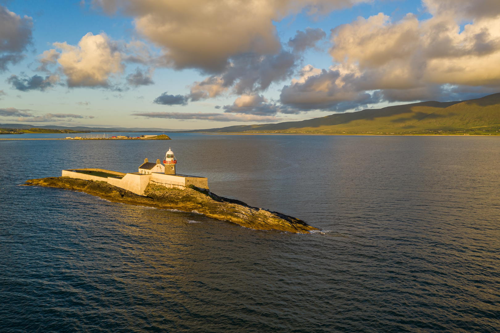
As you draw closer to Fenit, the atmosphere becomes more maritime. The approach to the village and harbour area brings: - Coastal air and stronger breezes - Wider skies and changing light (especially later in the day) - A clear sense of arrival at a working waterfront rather than a purely tourist promenade
Fenit itself is a rewarding turnaround point: the harbour and nearby shoreline give you a natural place to rest, refuel, and watch boats and seabirds.
Nature and wildlife to look out for
This is a “quiet observation” kind of walk—wildlife is there, but it’s often subtle and seasonal.
- Hedgerows and field edges: Expect small birds (finches, robins, wrens), and in warmer months, plenty of insect life. Early morning and evening are best for spotting more activity.
- Wet patches and ditches: You may see frogs or hear them in spring; dragonflies can appear in summer near still water.
- Near Fenit and the coast: Watch for gulls, terns, and other seabirds around the harbour. On calmer days, you may also spot waders feeding along the shoreline depending on tide and season.
Please keep dogs under close control around farmland and livestock, and stay on the greenway line where it’s clearly defined.
Historical context you’ll feel along the way
Greenways in Ireland commonly reuse older transport alignments, and this corridor’s gentle grades and straight, purposeful line through the landscape reflect that heritage. Tralee and the surrounding part of County Kerry sit in a region shaped by centuries of rural life, coastal trade, and movement between inland market towns and seaside communities. Fenit’s harbour presence underscores the area’s long relationship with the sea—fishing, local shipping, and coastal livelihoods that continue to influence the village’s identity today.
Practical planning: food, water, weather, and safety
- Food & water: Start with enough for a full day—there can be long stretches without immediate shops right on the path. Tralee is the best place to stock up; Fenit is a good reward stop, but don’t rely on limited hours.
- Wind and exposure: With minimal climbing, wind is the main factor that can slow you down, especially on open sections and near the coast. Pack a light windproof layer even on mild days.
- Footwear: Comfortable walking shoes are usually sufficient; trail runners work well. The surface is generally forgiving, but bring blister care for the longer distance.

Surfaces
Asphalt
Unknown
Concrete
Paved
Comments and Reviews
User comments, reviews and discussions about the Tralee- Fenit Greenway, Ireland.
average rating out of 5
0 rating(s)