Download
3D Flyover
Add to list
More
828.8 km
~42 days
50190 m
Multi-Day
“Embark on the Via Alpina - Blue Trail, an epic alpine odyssey weaving through breathtaking vistas and rich history.”
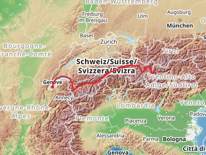
Spanning approximately 829 kilometers (515 miles) and with an elevation gain of around 50,100 meters (164,400 feet), the Via Alpina - Blue Trail is a challenging yet rewarding trek that traverses the stunning landscapes of the Alps. Starting near Verbano-Cusio-Ossola in Italy, this point-to-point trail is a true test of endurance and offers hikers an immersive experience into the heart of alpine scenery.
Getting to the Trailhead
To reach the trailhead, hikers can fly into Milan Malpensa Airport and take a combination of trains and buses to reach the starting point near Verbano-Cusio-Ossola. For those driving, the trailhead is accessible via the A26 motorway, exiting towards Gravellona Toce and following the signs to the Ossola Valley.
Navigating the Trail
Hikers can rely on the HiiKER app for detailed maps and navigation assistance throughout the journey. The trail is well-marked with the distinctive Via Alpina signage, featuring a blue and white path indicator that guides trekkers along the route.
Landmarks and Scenery
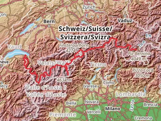
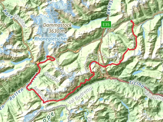
The Via Alpina - Blue Trail offers a plethora of natural and cultural landmarks. Early in the journey, hikers will encounter the serene Lake Maggiore and the enchanting Borromean Islands. As the trail ascends, the landscape transforms into rugged peaks and lush valleys, with the majestic Monte Rosa massif serving as a backdrop.
Flora and Fauna
The diverse ecosystems along the trail are home to a rich variety of flora and fauna. Hikers may spot chamois, ibex, and marmots in the higher altitudes, while the lower slopes are adorned with alpine meadows bursting with edelweiss, gentians, and rhododendrons.
Historical Significance
The region is steeped in history, with ancient trade routes and military paths crisscrossing the Alps. Hikers will pass through historic villages and towns, each with its own unique heritage. The trail also offers insights into the World War I front lines, with remnants of fortifications visible along the path.
Climate and Best Time to Hike
The best time to hike the Via Alpina - Blue Trail is from June to September when the weather is most stable. However, hikers should be prepared for sudden changes in weather conditions and pack accordingly.
Preparation and Safety
Given the trail's difficulty, hikers should be in good physical condition and have experience with multi-day treks. It's essential to carry appropriate gear, including sturdy hiking boots, warm clothing, and a reliable shelter. Always inform someone of your itinerary and check in regularly.
Accommodation and Resupply Points
There are numerous huts and guesthouses along the trail for overnight stays. Resupply points are available in the towns and villages, where hikers can stock up on food and other essentials. It's advisable to book accommodations in advance during the peak hiking season.
Environmental Considerations
Hikers are encouraged to practice Leave No Trace principles to preserve the natural beauty of the Alps. This includes packing out all trash, respecting wildlife, and staying on designated trails to prevent erosion.
By preparing adequately and respecting the trail's natural and cultural heritage, hikers can embark on an unforgettable journey through the heart of the Alps on the Via Alpina - Blue Trail.

Frequently asked questions
Where is the Via Alpina - Blue Trail and which countries does the route cross?
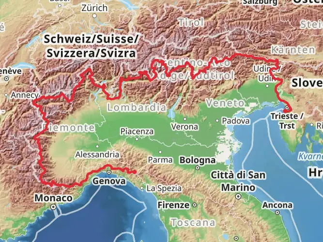
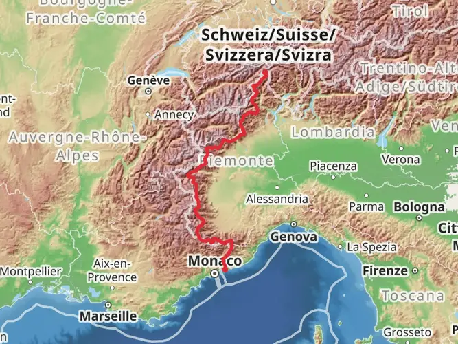
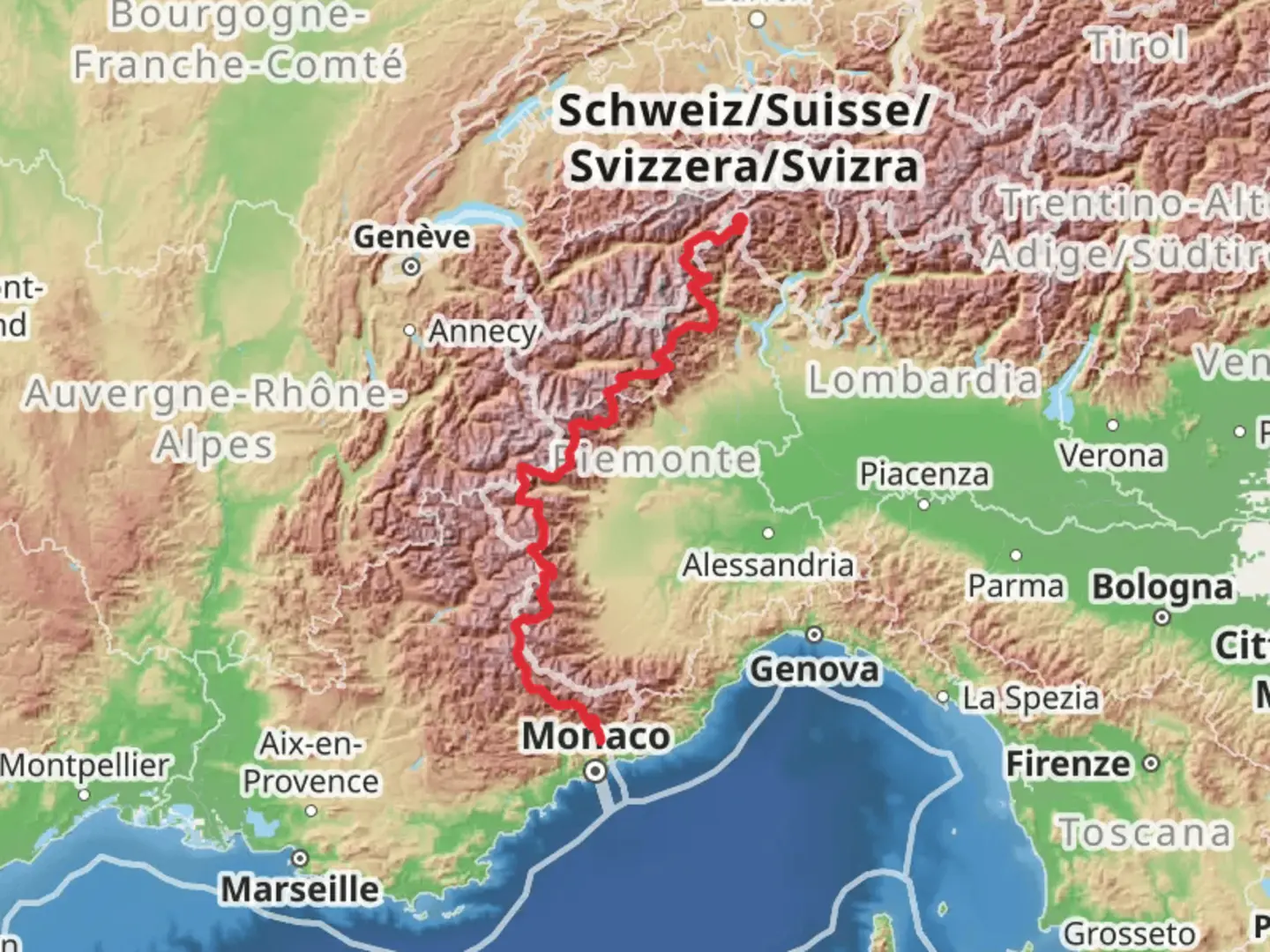
The Via Alpina - Blue Trail is an Alpine long-distance route linked to Verbano-Cusio-Ossola in northern Italy and continues across three countries: Italy, Switzerland, and France. The full Blue Trail runs from the Monte Rosa area to Sospel in the Maritime Alps, following a major westward line through the Alps.
How long is the Via Alpina - Blue Trail and how hard is it?
The Via Alpina - Blue Trail is 828.78 km long with about 50,190 m of total ascent, which places it firmly in the extra-difficult category. It is a multi-day point-to-point trek designed for experienced long-distance hikers who can handle sustained climbing, big mileage, and alpine terrain over many stages.
How many stages does the Via Alpina - Blue Trail have?
The Via Alpina - Blue Trail is commonly divided into 61 stages across Italy, Switzerland, and France. With a total length of 828.78 km, that works out to an average of roughly 13.6 km per stage, although individual days vary depending on terrain, elevation, and settlement spacing.
What is the route of the Via Alpina - Blue Trail in Italy?
In Italy, the Via Alpina - Blue Trail begins in the Monte Rosa region and passes through the Piedmontese Alps, including the Verbano-Cusio-Ossola area. The route is known for tracing sections near the Italian-Swiss border before continuing west toward France, combining high mountain terrain with historic alpine valleys.
Does the Via Alpina - Blue Trail follow the whole Via Alpina route?
No. The Via Alpina - Blue Trail is one branch of the wider Via Alpina network, not the entire route. The full Via Alpina spans more than 2,000 km across 8 Alpine countries and 116 stages, while the Blue Trail covers 828.78 km as a distinct long-distance line through 3 countries.
Is the Via Alpina - Blue Trail well marked for navigation?
The Via Alpina - Blue Trail is generally waymarked with Via Alpina signage, but it is still an alpine route where navigation can become more demanding in poor weather, on exposed sections, or where paths are less obvious. On a trail with 50,190 m of ascent and long multi-day logistics, solid route planning is essential.
Comments and Reviews
User comments, reviews and discussions about the Via Alpina - Blue Trail, Italy.
4.5
average rating out of 5
8 rating(s)