Download
3D Flyover
Add to list
More
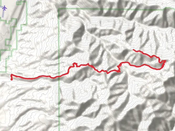
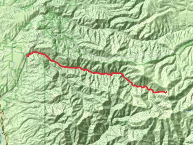
19.6 km
~5 hrs 24 min
889 m
Multi-Day
“Hike the Mogollon Baldy Peak Trail for a scenic, rugged, and historically rich wilderness adventure.”
Embarking on the Mogollon Baldy Peak Trail, hikers will find themselves traversing a challenging yet rewarding 20 km (approximately 12.4 miles) point-to-point journey through the Gila Wilderness. With an elevation gain of roughly 800 meters (about 2625 feet), this trail is not for the faint of heart and is best suited for those with a good level of fitness and experience in backcountry hiking.
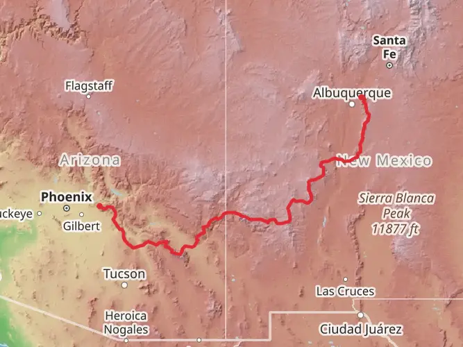
Getting to the Trailhead The trailhead is located near Catron County, New Mexico. For those driving, the closest significant landmark is the Gila Cliff Dwellings National Monument, from which you can follow the signs leading towards the Gila Wilderness. There is no direct public transportation to the trailhead, so a personal vehicle or a rented car is necessary to reach the starting point.
Navigating the Trail As you set out, the trail will guide you through a diverse landscape of dense forest, open meadows, and rocky ridges. Hikers should be prepared for the changing terrain and ensure they have a reliable navigation tool like HiiKER downloaded on their devices to keep track of their progress and avoid getting lost.
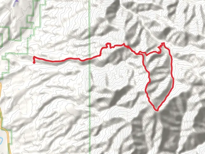
Landmarks and Scenery The Mogollon Baldy Peak Trail is a feast for the eyes, offering expansive views of the surrounding wilderness. One of the most significant landmarks you'll encounter is the Mogollon Baldy itself, a prominent peak within the range that provides panoramic vistas of the area. As you approach the summit, the trail becomes steeper and more rugged, challenging your endurance and rewarding you with breathtaking scenery.
Flora and Fauna Throughout the hike, you'll be immersed in a rich ecosystem home to a variety of wildlife, including elk, deer, and black bears. Birdwatchers will delight in the opportunity to spot numerous bird species, such as the Mexican spotted owl and the bald eagle. The trail is also adorned with a diverse array of plant life, from ponderosa pines and Douglas firs to colorful wildflowers in the spring and summer months.
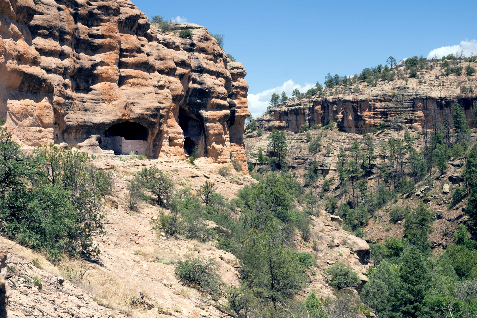
Historical Significance The region holds historical significance as part of the Gila Wilderness, which was designated as the world's first wilderness area in 1924. This area has a rich history of Native American culture, with the Mogollon people having inhabited the region long before European settlers arrived.
Preparation and Safety Given the trail's difficulty rating and remote location, hikers should come well-prepared with adequate supplies, including water, food, and layers to accommodate shifts in weather. It's also wise to inform someone of your hiking plans and expected return time. Due to the trail's length and elevation gain, consider breaking the hike into segments if you're not accustomed to high-altitude or long-distance treks.
Remember, safety is paramount, so always check the weather forecast before heading out, and be prepared for sudden changes in conditions. The trail is best tackled from late spring to early fall to avoid snow and ice.
By respecting the wilderness and practicing Leave No Trace principles, hikers can ensure that the Mogollon Baldy Peak Trail remains a pristine and enjoyable experience for all who seek the thrill of its ascent.

What to expect?
Activity types
Frequently asked questions
How long is the Mogollon Baldy Peak Trail and how much climbing does it involve?
The Mogollon Baldy Peak Trail is 19.61 km, or about 12.2 miles, with 889 m of elevation gain, roughly 2,917 feet. That combination makes it a strenuous backcountry route, with a long day or overnight effort more realistic than a casual half-day hike.
How difficult is the Mogollon Baldy Peak Trail in Catron County, New Mexico?
Mogollon Baldy Peak Trail is rated difficult, and the numbers back that up: nearly 20 km of hiking with close to 900 m of ascent. The route lies in the Gila Wilderness, where trails are remote, less developed, and better suited to experienced hikers comfortable with route-finding and backcountry conditions.
Where do you start the Mogollon Baldy Peak Trail and is there parking at the trailhead?
Mogollon Baldy Trail #152 has trailheads at West Fork Trailhead and Crest Trailhead in the Gila National Forest. The Forest Service lists ample parking at the trailheads, and the southern access is reached by following NM 15 north past the Gila Cliff Dwellings area, while the northern access is via NM 159 to Crest Trailhead at Sandy Point.
Is the Mogollon Baldy Peak Trail a loop or an out-and-back hike?
Mogollon Baldy Peak Trail is best treated as a point-to-point route rather than a loop. Forest Service information for Mogollon Baldy Trail #152 describes it as a 9.1-mile one-way trail connecting West Fork Trail #151 with Mogollon Baldy Lookout and Crest Trail #182, which matches a through-hike setup more than a circuit.
Can you backpack the Mogollon Baldy Peak Trail as an overnight trip?
Yes. The trail is categorized as a multi-day hike, and its 19.61 km length plus 889 m of climbing make it a strong overnight option for backpackers. It sits entirely within the Gila Wilderness, so an overnight trip should be planned as a self-supported backcountry outing rather than a front-country campground walk.
Are dogs allowed on the Mogollon Baldy Peak Trail?
Dogs are generally allowed in the Gila National Forest, and the Forest Service specifically states that pets must be leashed at trailheads such as 74 Mountain #153 Trailhead. On a remote wilderness route like Mogollon Baldy Peak Trail, leash control at access points and strong voice control on trail are the practical baseline.
Is the Mogollon Baldy Peak Trail open year-round?
Access in this part of the Gila is generally listed as year-round, and the Forest Service currently shows Mogollon Baldy Trail #152 as open. Even so, year-round access does not mean easy conditions in every season, since high-elevation sections near the Mogollon crest can be far more demanding in winter or during storms.
Comments and Reviews
User comments, reviews and discussions about the Mogollon Baldy Peak Trail, New Mexico.
4.7
average rating out of 5
10 rating(s)