Download
3D Flyover
Add to list
More
27.2 km
~7 hrs 2 min
960 m
Multi-Day
“Embark on a historic hike through Bandelier's stunning mesas, canyons, and ancient Puebloan relics.”
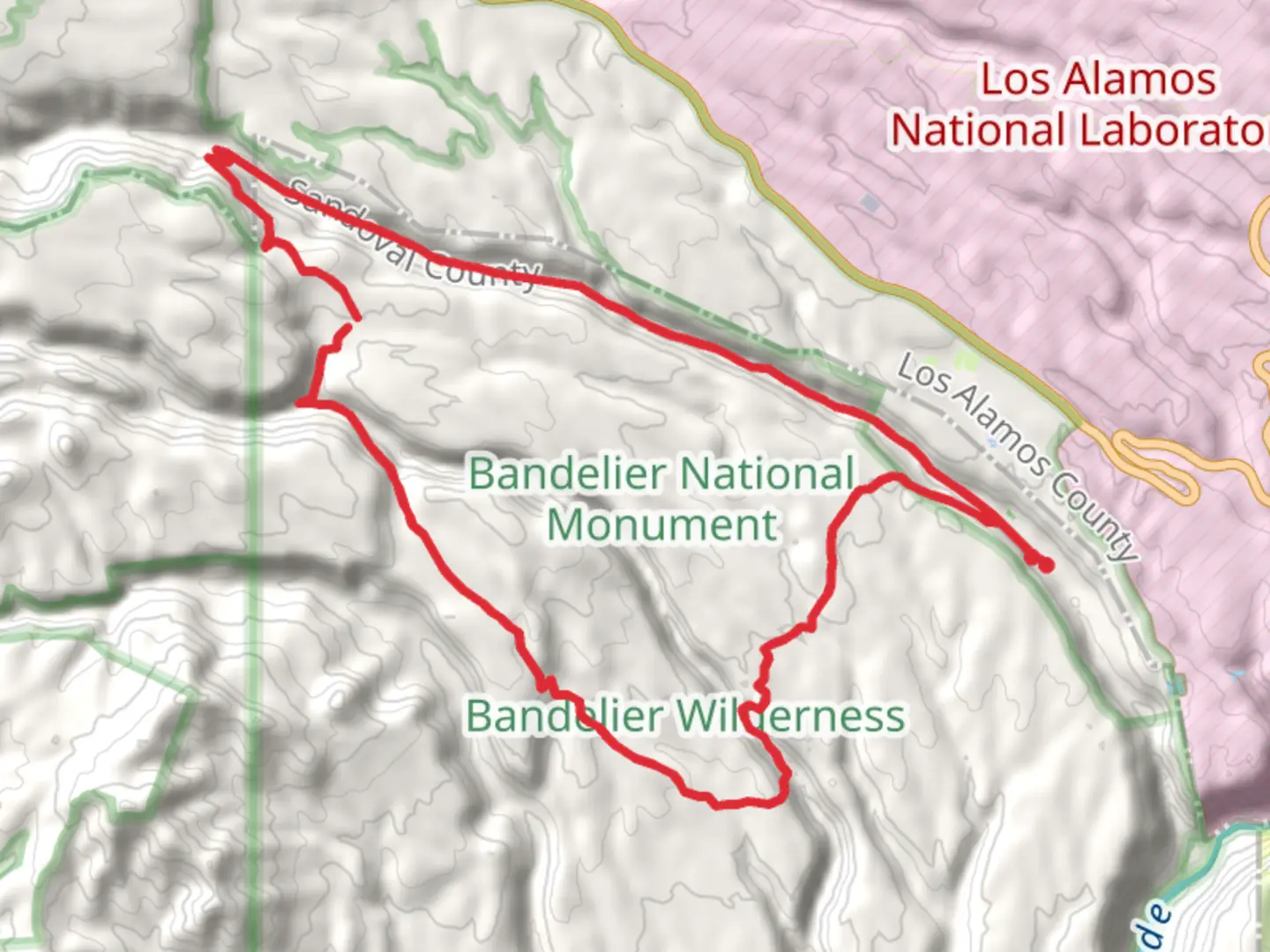
The Bandelier Wilderness Trail offers an immersive experience through the diverse landscapes of Sandoval County, New Mexico. Spanning approximately 27 kilometers (about 17 miles) with an elevation gain of around 900 meters (nearly 2950 feet), this loop trail is a journey through history, nature, and the great outdoors.
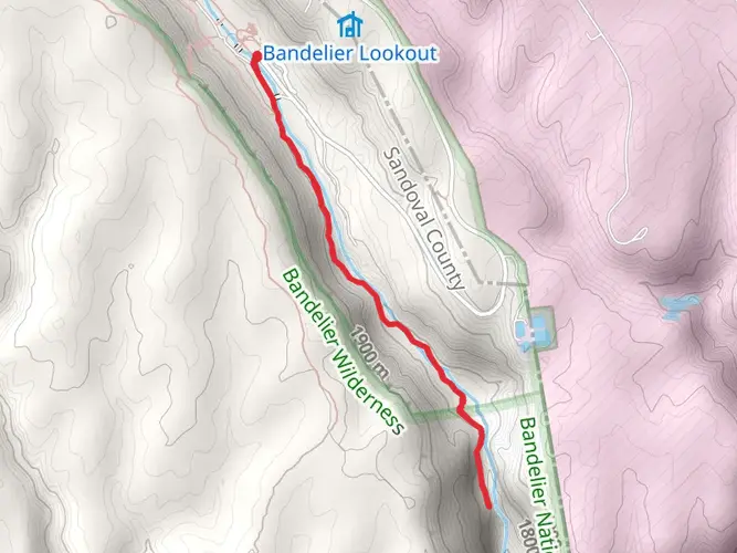
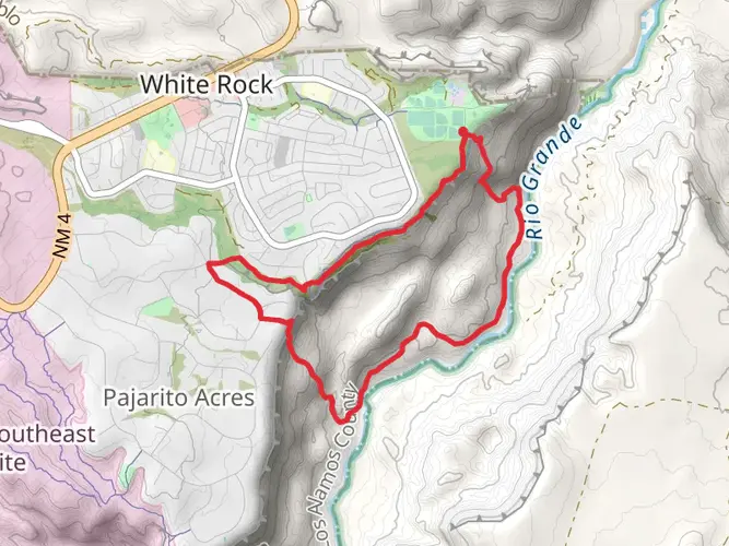
Getting to the Trailhead To reach the trailhead, you can drive to the Bandelier National Monument, which is the nearest significant landmark. From Santa Fe, take NM-502 W and NM-4 W to the entrance of the Bandelier National Monument. Public transportation options are limited, but during the peak season, shuttle buses run from the nearby White Rock Visitor Center to the monument. Parking is available at the monument, and from there, you can follow the signs to the trailhead.
Navigating the Trail As you embark on the Bandelier Wilderness Trail, it's essential to have a reliable navigation tool. HiiKER is an excellent resource for trail maps and navigation, ensuring you stay on the right path throughout your hike.
Historical Significance The trail winds through the Bandelier Wilderness, an area rich in ancestral Puebloan history. You'll encounter various archeological sites, including cliff dwellings and petroglyphs that date back over 11,000 years. These sites provide a glimpse into the lives of the ancestral Pueblo people who once thrived in this region.
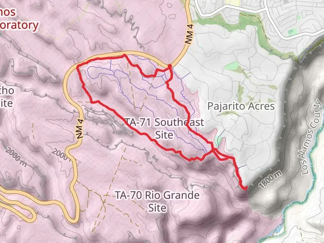
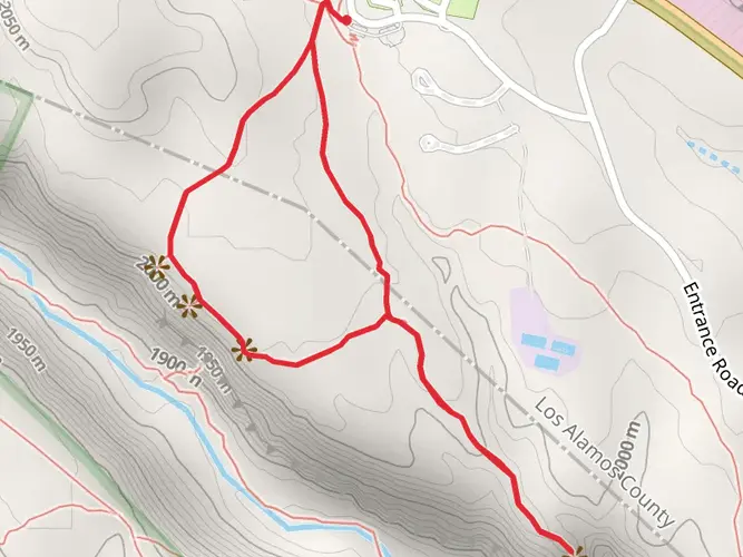
Landmarks and Natural Features The trail will take you through a variety of landscapes, from mesa tops to deep canyons. Approximately 5 kilometers (3 miles) in, you'll reach the Upper Frijoles Canyon, offering stunning views of the surrounding wilderness. As you continue, you'll ascend the mesa, where the elevation gain becomes more pronounced.
Wildlife and Flora The Bandelier Wilderness is home to a diverse array of wildlife. Keep an eye out for mule deer, Abert's squirrels, and if you're lucky, you might spot an elusive mountain lion or black bear from a safe distance. The area is also rich in birdlife, including the peregrine falcon and the mountain bluebird. The trail is lined with a mix of ponderosa pine, Douglas fir, and aspen trees, especially vibrant during the fall when the leaves change color.
Preparation and Safety Given the trail's medium difficulty rating, it's suitable for hikers with some experience. Ensure you're well-prepared with adequate water, food, and layers of clothing, as the weather can change rapidly. It's also wise to carry a first-aid kit and a means of communication in case of emergencies. Always check the weather forecast before setting out and be mindful of the altitude, which can affect even seasoned hikers.
Trail Etiquette Respect the historical sites by not touching or disturbing the structures and artifacts. Stay on marked trails to protect the fragile desert ecosystem and pack out all trash to keep the wilderness pristine for future visitors.
By following these guidelines and being prepared, hikers can fully enjoy the natural beauty and historical significance of the Bandelier Wilderness Trail.

Frequently asked questions
How long does the Bandelier Wilderness Trail take to hike?
The Bandelier Wilderness Trail covers 27.18 km, or about 16.9 miles, with 960 m of climbing, so most hikers treat it as a full-day effort or a short backpacking trip. A strong day hiker may finish in roughly 7 to 10 hours, while a more relaxed pace with breaks in Frijoles Canyon or on the mesa often turns it into an overnight route.
Is the Bandelier Wilderness Trail a backpacking route or a day hike?
The Bandelier Wilderness Trail is best described as a multi-day route, although experienced hikers can complete 27.18 km in a long single day. Overnight travel in Bandelier backcountry requires a free wilderness permit, and the park notes that same-day backpacking permits may not always be available, so advance planning matters.
Where do you park for the Bandelier Wilderness Trail?
The usual access point is inside Bandelier National Monument near the Visitor Center and Cottonwood Picnic Area in Frijoles Canyon, where several longer hikes begin. During busy periods in 2026, Bandelier may run a seasonal shuttle between the Frey Trail parking lot and the Visitor Center, and if canyon parking fills, vehicles can be turned around at the entrance station.
Are dogs allowed on the Bandelier Wilderness Trail?
No. Bandelier National Monument does not allow pets on trails, and that restriction applies to backcountry hiking routes such as the Bandelier Wilderness Trail. Service animals are permitted, but regular dogs cannot go on the trail even if they are leashed.
Do you need a permit for the Bandelier Wilderness Trail?
A permit is not generally needed for a day hike on the Bandelier Wilderness Trail, but any overnight stay in Bandelier backcountry requires a free permit. The park issues those permits through the visitor center, and they must be picked up in person, with hikers advised to complete the permit process at least 24 hours before the start date.
Is the Bandelier Wilderness Trail hard?
The Bandelier Wilderness Trail is rated medium, but 27.18 km of distance and 960 m of elevation gain make it a serious outing. Bandelier’s backcountry trails can include steep switchbacks, long drop-offs, and icy sections in winter or early spring, so the route is better suited to hikers comfortable with sustained climbing and a long day on foot.
What is the best time of year to hike the Bandelier Wilderness Trail?
Spring and fall are usually the most comfortable seasons for the Bandelier Wilderness Trail because Bandelier sits at high elevation in a hot, arid climate where dehydration is a common problem. Winter can bring icy trail conditions, especially on steeper sections, while summer heat makes water planning and an early start especially important.
What scenery and landmarks are on the Bandelier Wilderness Trail?
The Bandelier Wilderness Trail passes through the backcountry landscapes that make Bandelier National Monument distinctive, including Frijoles Canyon, mesa-top terrain, volcanic tuff formations, and broad canyon views. The monument is also an ancestral home sacred to 23 tribes, and the surrounding trail system is known for access to Ancestral Pueblo sites, cliff dwellings, and petroglyph areas in and around Frijoles Canyon.
Comments and Reviews
User comments, reviews and discussions about the Bandelier Wilderness Trail, New Mexico.
4.5
average rating out of 5
12 rating(s)