Download
3D Flyover
Add to list
More
42.4 km
~2 days
1670 m
Multi-Day
“Experience the rugged beauty of New Mexico's Sandia Mountains on a challenging 26-mile trek.”
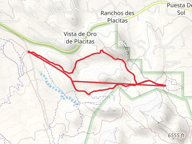
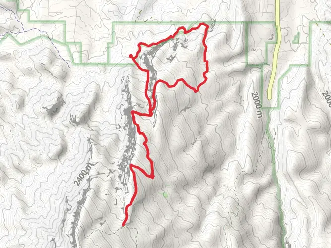
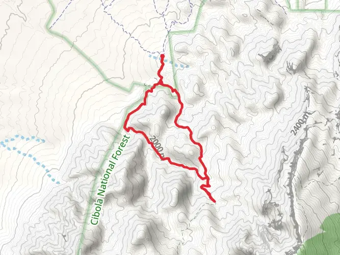
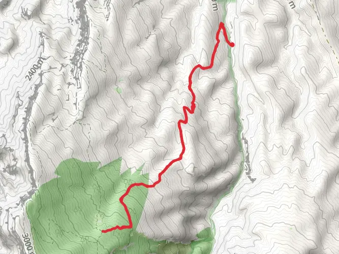
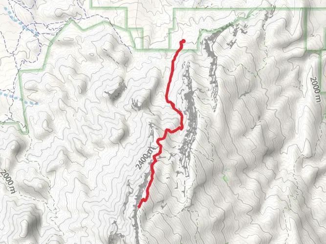
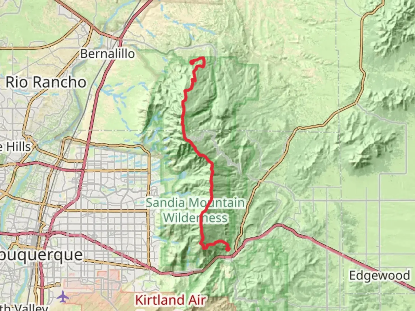
Embarking on the Sandia Crest Trail, hikers will traverse approximately 42 kilometers (26 miles) of diverse terrain, ascending roughly 1600 meters (5250 feet) in elevation. The trailhead is conveniently located near Sandoval County, New Mexico, and the journey is a point-to-point adventure, culminating at the crest of the Sandia Mountains. This trail is considered difficult due to its length and significant elevation gain, so it's best suited for experienced hikers.
Getting to the Trailhead
To reach the starting point of the Sandia Crest Trail, hikers can drive to the parking area near the base of the Sandia Peak Ski area, which is the nearest significant landmark. For those relying on public transportation, options may be limited, and it's advisable to check local transit resources for the most current routes and schedules. Once at the trailhead, hikers can prepare for their ascent, ensuring they have all necessary supplies and equipment.
Trail Experience
As you begin your hike, the trail will take you through a variety of ecosystems, starting with the high desert scrub at the lower elevations and transitioning into lush coniferous forests as you climb higher. The path is well-marked, but carrying a navigation tool like HiiKER is recommended to track your progress and ensure you stay on course.
Landmarks and Scenery
One of the most striking features of the Sandia Crest Trail is the panoramic views it offers. As you ascend, you'll be treated to vistas of the Rio Grande Valley and the surrounding mountain ranges. Approximately halfway through the hike, you'll reach the Sandia Peak Tramway, a notable landmark where many hikers pause to enjoy the scenery.
Flora and Fauna
The trail is home to a rich array of wildlife, including black bears, deer, and numerous bird species, so keep your camera ready and your food stored securely. The flora along the trail is equally impressive, with wildflowers in the spring and summer, and vibrant aspen and oak foliage in the fall.
Historical Significance
The Sandia Mountains hold historical significance for the indigenous peoples of the region, including the Sandia Pueblo, and have been a landmark for navigation and a source of resources for centuries. Hikers walking these paths tread on land steeped in cultural heritage.
Preparation Tips
Given the trail's difficulty, it's crucial to be well-prepared with adequate water, food, and layers of clothing to accommodate shifting temperatures at higher elevations. It's also wise to check weather conditions before setting out, as the weather can change rapidly in the mountains.
Conclusion
By the time you reach the crest, you will have experienced one of New Mexico's most challenging and rewarding hikes. The Sandia Crest Trail offers a comprehensive experience of the Southwest's unique landscape and history, making it a must-hike for those who are up for the challenge.

Frequently asked questions
How long does the Sandia Crest Trail take to hike in New Mexico?
The Sandia Crest Trail is about 42.43 km, or 26.4 miles, with roughly 1,670 meters of climbing, so it is usually treated as a full-day effort for very strong hikers or a multi-day route for most parties. Its difficult rating comes from the combination of distance and sustained elevation gain along the Sandia Mountains crest.
Where do you start and park for the Sandia Crest Trail?
A common access point for the Sandia Crest Trail is near Sandia Peak Ski Area on NM 536, the Sandia Crest National Scenic Byway. The Sandia Ranger District notes that day-use fees apply at trailheads and picnic areas along the crest highway, and winter road conditions on NM 536 can affect access to upper trailheads.
Is the Sandia Crest Trail hard?
Yes. The Sandia Crest Trail is rated difficult and covers 42.43 km with about 1,670 meters, or roughly 5,480 feet, of elevation gain. That combination makes it better suited to experienced hikers who are comfortable with long mileage, high elevation, and a sustained climb through the Sandia Mountains.
What is the highest point on the Sandia Crest Trail?
The route reaches the Sandia Crest, the long high ridge that forms the top of the Sandia Mountains. The crest sits at about 10,678 feet above sea level, and the area is known for broad views over Albuquerque, the Rio Grande Valley, and the west-face cliffs and spires of the range.
When is the best time of year to hike the Sandia Crest Trail?
Late spring through fall is usually the most reliable season for the Sandia Crest Trail because snow, ice, and road conditions can complicate access in winter. The Forest Service specifically advises checking winter conditions on NM 536, the Sandia Crest Scenic Byway, before heading to the crest, since upper trailheads can be affected by weather.
Can you reach the Sandia Crest Trail without driving?
Yes, in some cases. The Sandia Peak Tramway in Albuquerque provides access to the crest area and the south crest trails from the upper terminal, offering a non-driving option to reach high-elevation trail connections. Tram operations are weather dependent, and service hours can vary by season and maintenance periods.
Comments and Reviews
User comments, reviews and discussions about the Sandia Crest Trail, New Mexico.
4.83
average rating out of 5
18 rating(s)