Download
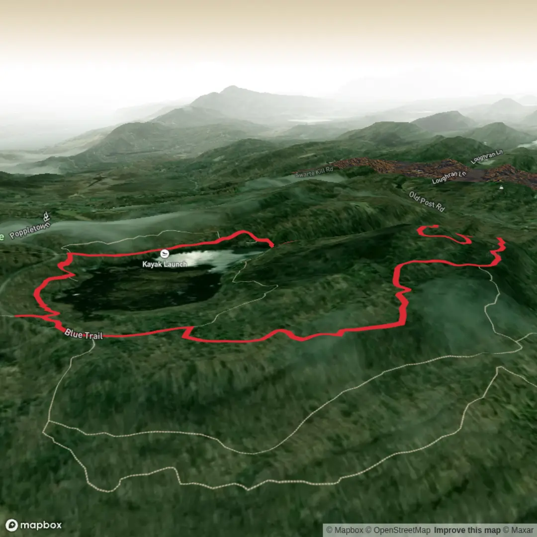
3D Flyover
Add to list
More
3.7 km
~50 min
64 m
Loop
“Wander gently through whispering woods to Louisa Pond, where birdsong and still water invite pause.”
I’m missing a few key pieces needed to write this accurately (especially the start location), but here’s what I need from you to produce a precise, plan-ready description—plus a solid draft you can use immediately if you confirm the park/region.
What I need to finalize it
1) Start point (“Hike head: near …”): please paste either:
- a Google Maps link, or
- the lat/long, or
- the name of the trailhead/parking lot/road you’re starting from.
2) Hike type: loop, out-and-back, or point-to-point (if you’re not sure, tell me whether you want to end where you started).
Once you send the start point, I’ll convert it to the nearest known address/landmark and tailor the directions, landmarks, and any local history.
You’re looking at an easy, short woodland-and-pond walk of about 4 km (2.5 mi) with roughly 100 m (330 ft) of climbing—enough elevation to feel like a few gentle rises rather than a sustained hill. Expect a relaxed pace for most hikers, with extra time if you stop at the pond, scan for wildlife, or navigate a few junctions where the Orange and Blue routes braid together.
Getting to the start (car + public transport)
By car: plan for a small trailhead pull-off or a modest parking area typical of conservation land. If the lot is unpaved or narrow, arrive earlier on weekends and avoid blocking gates or access roads.
By public transport: if this is near a town center, the usual pattern is a bus stop within 0.5–2 km (0.3–1.2 mi) and a short road walk to the trailhead. Share the start location and I’ll identify the nearest stop and the safest walking approach (shoulder width, speed limits, and where crossings are easiest).
What the route feels like
From the trailhead, the Orange Trail typically eases you into the forest on a firm, well-trodden surface—often packed dirt with leaf litter and occasional roots. Over the first 0.8–1.2 km (0.5–0.75 mi) you’ll likely gain a modest portion of the elevation (30–50 m / 100–165 ft) in small steps: short rises, then flatter stretches where the woods open slightly.
As you angle toward Louisa Pond, the air often cools and dampens a touch, and the tread can change—watch for: - muddy pockets in low spots, - slick roots where water drains across the path, - and short boardwalks or stepping areas (if present) that can be slippery when wet.
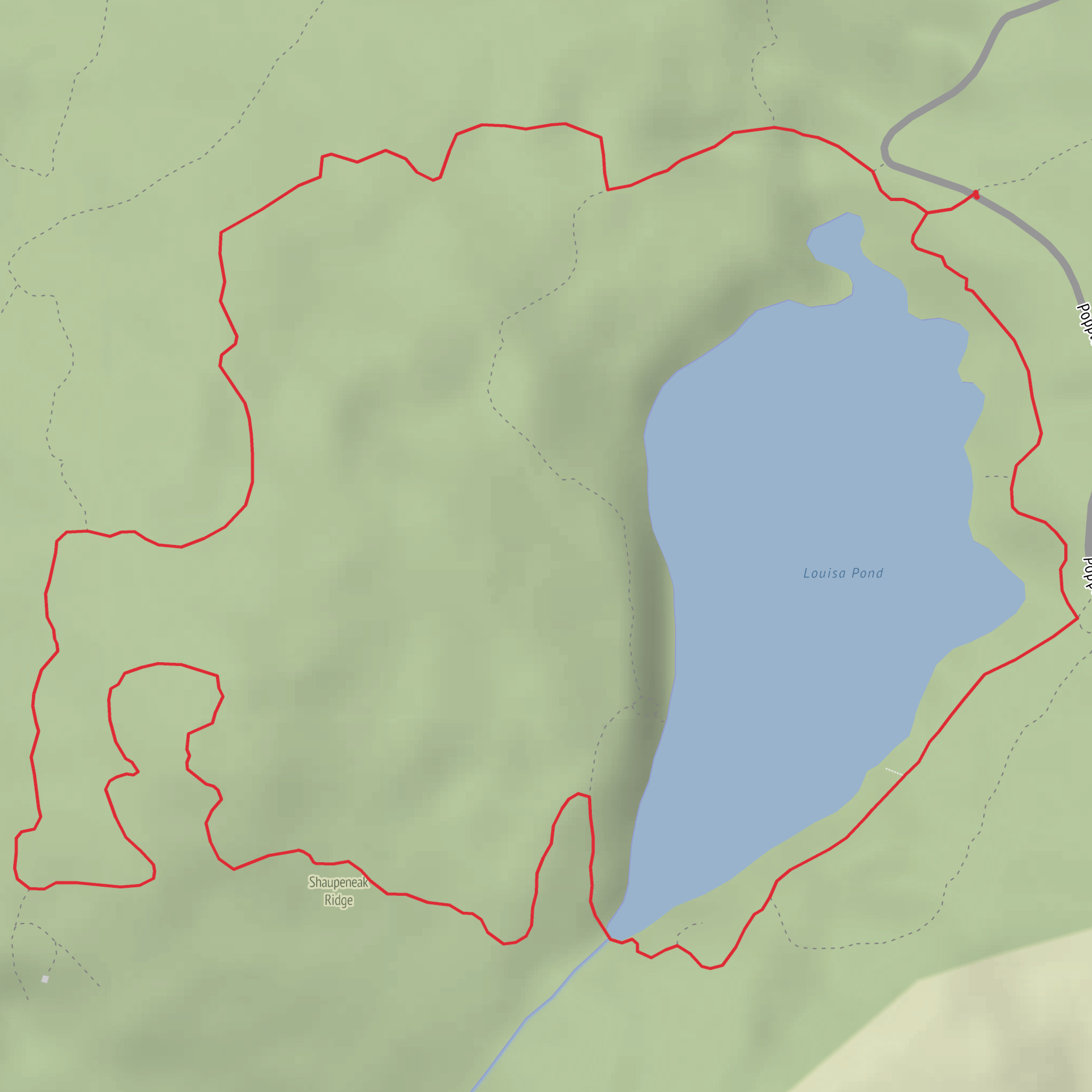
Louisa Pond is the natural “centerpiece” of a hike like this: a calm water body that draws birds and amplifies sound—wind in reeds, frogs, and the knock of woodpeckers. If there’s a shoreline spur or a small opening, it’s a good place to pause without trampling vegetation; stay on durable surfaces and avoid soft banks that erode easily.
Key junctions and navigation (Orange ↔ Blue)
The main thing to “look out for” on a two-color route is trail junction clarity. Color-blazed systems can have:
- a clear mainline with frequent blazes, and
- a few intersections where blazes are spaced farther apart right when you want reassurance.
Use HiiKER to confirm you’re taking the intended connector near the pond—especially if you see multiple footpaths that look equally worn. A good habit is to check HiiKER at each signed junction and again after you’ve walked 50–100 m (165–330 ft) beyond it; if you don’t see the next blaze where you’d expect, backtrack to the last confirmed marker.
Terrain, footing, and what to pack for an “Easy” 4 km
Even easy hikes can have one or two “gotcha” sections. Common ones on pond-and-woods loops: - Short steep-ish pitches (still easy, but enough to raise your heart rate) - Eroded ruts where water runs down the trail - Seasonal mud near the pond edge or in shaded hollows
Footwear: light hikers or trail runners are usually fine; after rain, waterproof shoes help.
Bring: water, a light layer (pond areas can feel cooler), and insect protection in warm months (mosquitoes and ticks are the usual concerns in mixed woodland).
Nature and wildlife you may encounter
Around a pond, wildlife viewing is often best if you slow down and keep voices low: - Waterfowl (ducks, geese) and smaller birds along the edges - Songbirds in the surrounding canopy - Amphibians (frogs/salamanders) in wetter seasons - Turtles basking on logs (common where ponds have sunlit perches)
In many U.S. woodland conservation areas, it’s also normal to see signs of deer and smaller mammals. If this is in tick country (much of the Northeast/Midwest), do a tick check after the hike and stay centered on the tread to avoid brushing tall grass.
Landmarks and local history (once you confirm the location)
“Louisa Pond” exists in more than one region, and the Orange/Blue trail naming is also used widely—so I don’t want to invent the wrong historical context. After you share the start point (or the park/forest name and state), I’ll add the correct local background—common possibilities include: - former working woodland (old stone walls,
Surfaces
Dirt
Unknown
Comments and Reviews
User comments, reviews and discussions about the Orange Trail and Blue Trail via Louisa Pond, New York.
average rating out of 5
0 rating(s)
