Download
3D Flyover
Add to list
More
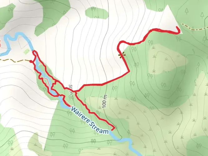
39.4 km
~2 days
472 m
Multi-Day
“Embark on New Zealand's Warawara Track, a journey through history and natural splendor in the Far North.”
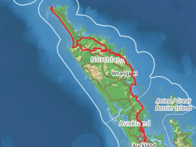
Embarking on the Warawara Track, hikers will traverse a diverse landscape that spans approximately 39 kilometers (about 24 miles) with an elevation gain of roughly 400 meters (around 1312 feet). This point-to-point trail is nestled near the Far North region of New Zealand, a place rich in both natural beauty and cultural history.
Getting to the Trailhead
The journey begins near a significant landmark, the town of Kaitaia, which serves as a gateway to the Far North. For those arriving by car, the trailhead is accessible via State Highway 1, followed by a turn onto a local road that leads to the starting point. Public transport options are available from Kaitaia, with local bus services that can drop hikers near the trailhead.
Navigating the Trail
As you set out on the Warawara Track, it's essential to have a reliable navigation tool. HiiKER is an excellent resource for trail maps and navigation, ensuring you stay on the right path throughout your hike.
Trail Highlights and Landmarks
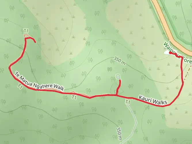
The Warawara Track meanders through a variety of terrains, including lush native forests, serene streams, and rolling hills that offer panoramic views of the surrounding landscape. The trail is marked by several significant landmarks, such as the ancient kauri trees that stand as silent witnesses to the region's history. These towering giants are a testament to the forest's age and resilience.
Flora and Fauna
As you hike, keep an eye out for the diverse wildlife that inhabits the area. Native birds such as the tui and kereru are commonly seen flitting among the trees, while the more elusive kiwi might be heard rustling in the underbrush. The trail is also home to a variety of plant species, from the delicate fronds of ferns to the hardy shrubs that cling to the hillsides.
Cultural and Historical Significance
The Far North region is steeped in Maori history, and the Warawara Track is no exception. The area is considered sacred by the local iwi (tribe), with many sites along the trail holding historical and spiritual significance. Hikers are reminded to respect these sites, leaving no trace and taking only memories.
Preparing for the Hike
Given the trail's medium difficulty rating, it's suitable for hikers with some experience. The terrain can be challenging at times, with steep sections that require a good level of fitness. It's recommended to carry sufficient water and food, as there are no facilities along the trail. Weather in the Far North can be unpredictable, so hikers should be prepared for sudden changes and pack appropriate gear.
Safety and Etiquette
Always let someone know your plans before you start the hike and check in upon completion. It's crucial to follow the Leave No Trace principles, ensuring the preservation of the trail for future generations. In case of emergency, carry a personal locator beacon or a mobile phone with coverage in the area.
By respecting the trail and its surroundings, hikers can enjoy the Warawara Track's natural beauty and cultural heritage, creating a memorable experience in the heart of New Zealand's Far North.

What to expect?
Activity types
Frequently asked questions
How long is the Warawara Track and how many days does the Warawara Track take?
The Warawara Track is 39.37 km long with 472 m of total elevation gain, so it fits the profile of an easier multi-day point-to-point hike rather than a steep alpine route. Most hikers split a distance like this over 2 days, though stronger walkers may cover it faster if daylight, transport, and conditions line up.
Is the Warawara Track difficult, or is the Warawara Track suitable for beginners?
The Warawara Track is graded easy, which makes it one of the more approachable multi-day hikes in the Far North. The route is still nearly 40 km long, so the main challenge is endurance and logistics rather than major climbing, with total ascent of 472 m spread across the track.
Where does the Warawara Track start, and how do you get to the Warawara Track from Kaitaia?
The Warawara Track is in the Far North of New Zealand, in the wider Kaitaia area. Kaitaia is the main service town for reaching tracks in this part of Northland, and Herekino Forest access nearby is reached from Kaitaia-Awaroa Road via the Herekino Gorge summit area, about 26 km southwest of Kaitaia, which helps frame the general access corridor for this hike.
Are dogs allowed on the Warawara Track in the Far North?
Dogs are generally not allowed on conservation tracks in this part of the Far North unless a special permit applies. In nearby Herekino Forest, which sits in the same wider Northland backcountry setting, dogs are strictly prohibited on access tracks and within the forest unless by special permit, so hikers should plan on the Warawara Track as a no-dogs route unless current local management rules specifically say otherwise.
What kind of scenery and forest can you expect on the Warawara Track?
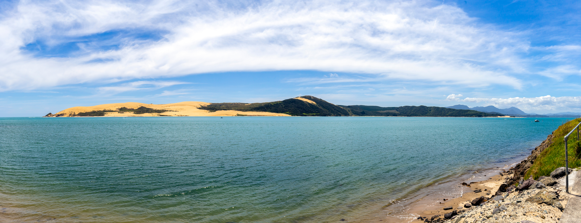
The Warawara Track passes through Far North forest country known for native bush, rolling ridgelines, and kauri landscapes rather than exposed mountain terrain. Nearby Northland forest tracks in the same region are noted for mature kauri, broadleaf and podocarp forest, streams, and long views toward places such as the Aupōuri Peninsula, Doubtless Bay, and Rangaunu Harbour.
Is the Warawara Track part of a longer route in Northland?
The Warawara Track sits in a part of Northland that is closely associated with long-distance tramping routes. Nearby Herekino Forest tracks form part of Te Araroa, the trail running the length of New Zealand, so the Warawara Track is often considered within the same broader Far North walking network used by multi-day hikers.
Comments and Reviews
User comments, reviews and discussions about the Warawara Track, New Zealand.
4.33
average rating out of 5
6 rating(s)