Download
3D Flyover
Add to list
More
30.1 km
~6 hrs 15 min
142 m
Multi-Day
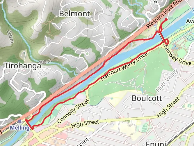
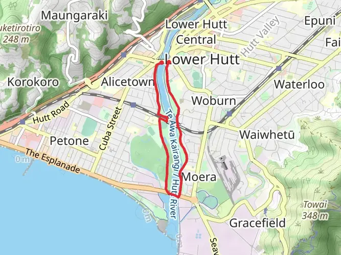
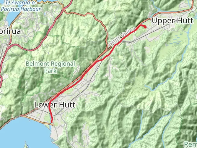
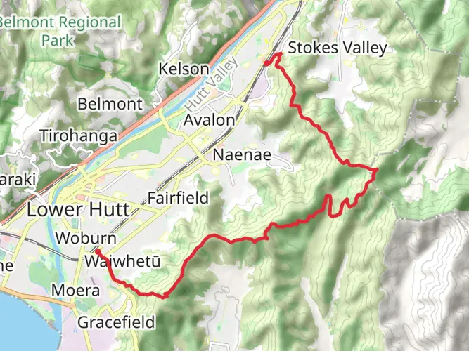
The Hutt River Trail is a 30.1 km trail that starts in Petone, Lower Hutt City, New Zealand. Based on our data, the hike is graded as Easy. For information on how we grade trails, please read measuring the difficulty of a hiking trail on hiiker. Also, check our latest community posts for trail updates. This hike can be completed in approx 6 hrs 16 mins. Caution is advised on trail times as this depends on multiple variables. For more info read about how we calculate hike time.

What to expect?
Activity types
Frequently asked questions
How long is the Hutt River Trail in Lower Hutt and how hard is it?
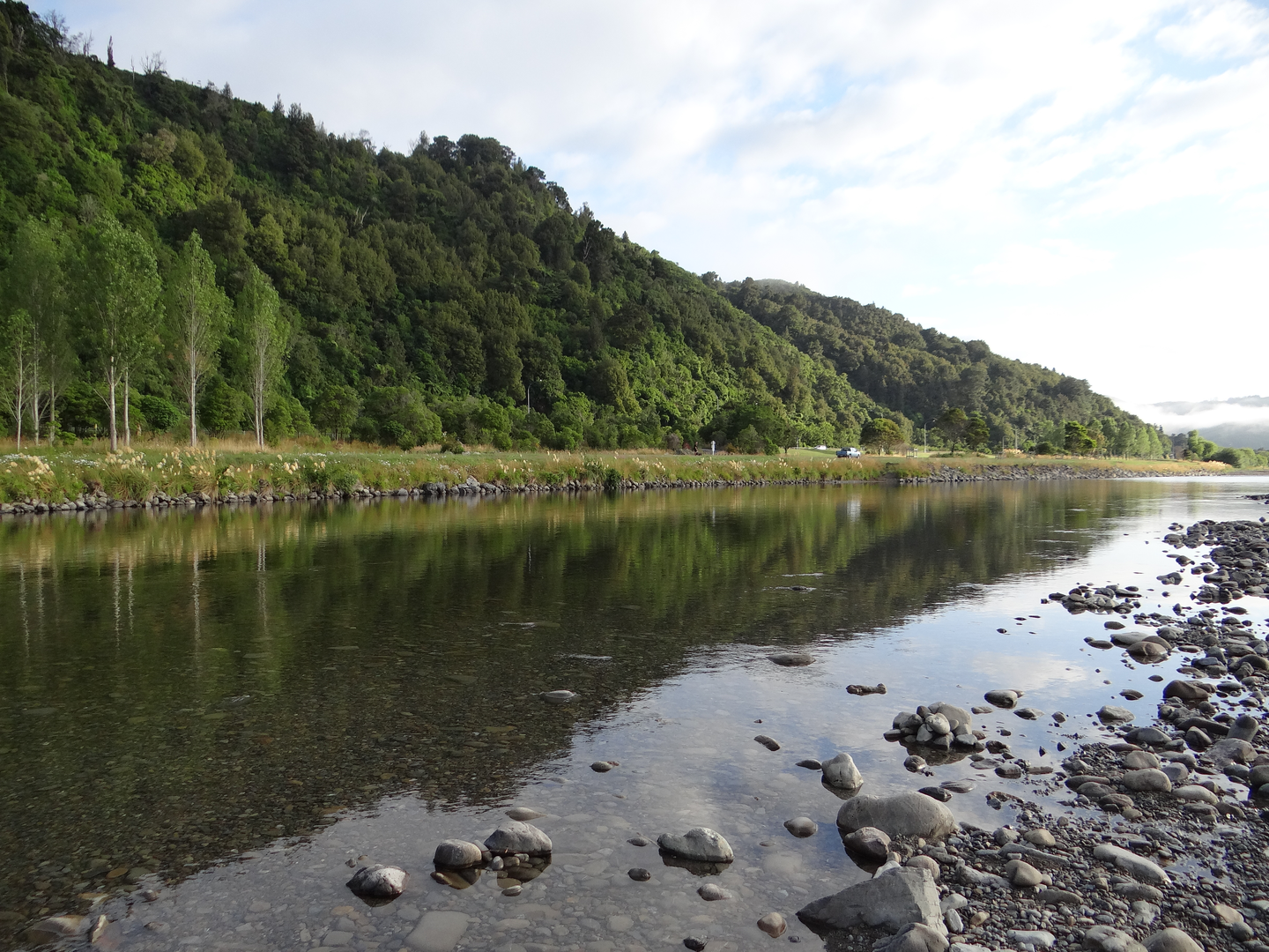
The Hutt River Trail is 30.14 km long with just 142 m of elevation gain, so it is generally an easy route rather than a steep or technical hike. The trail follows the Hutt River corridor through Lower Hutt and into Upper Hutt on mostly flat stopbanks, with a mix of gravel path and sealed sections.
Can beginners walk or run the Hutt River Trail?
Yes. The Hutt River Trail is rated easy, and its low elevation gain of 142 m over 30.14 km makes it suitable for beginners building up distance. The route is mostly flat and is also used for walking, running, and riding, with bridge crossings that create shorter loop options instead of tackling the full trail in one go.
Where can you park for the Hutt River Trail in Lower Hutt?
Parking for the Hutt River Trail is available at multiple access points along the river corridor, including central Lower Hutt and Petone approaches near the river mouth. Trail access runs from Hikoikoi Reserve at the Hutt River mouth to Birchville in Upper Hutt, so parking depends on the section being used; in the Lower Hutt CBD, some nearby parking is metered and signed with time limits.
Can you swim in the Hutt River from the Hutt River Trail?
Yes. The Hutt River is a popular swimming river and the trail gives easy access to the water at several points. Named swimming spots along the river include Taita Rock, areas just north of Fraser Park off Taita Drive, and spots near the Silverstream Bridges, although some sites can be affected by toxic algae in summer conditions.
Can you fish in the Hutt River from the Hutt River Trail?
Yes. The Hutt River is well known for trout fishing, and the Hutt River Trail provides access to the river along much of its length. A fishing licence is required to fish the Hutt River, so the trail is a practical access route rather than a separate fishing area.
What does Awakairangi mean on the Hutt River Trail?
Awakairangi, more commonly written today as Te Awa Kairangi, is the Māori name for the Hutt River. The trail follows this river from the Hutt River mouth at Petone inland through the Hutt Valley, so both names are used for the same waterway in Lower Hutt and Upper Hutt.
Are there closures or route changes on the Hutt River Trail?
Sometimes. The Hutt River Trail is generally open 24 hours a day, but sections can change because of flood-protection works, severe weather impacts, or local construction near access points. Central Lower Hutt has had route changes linked to Te Wai Takamori o Te Awa Kairangi works, and short-term closures have also affected access near Hikoikoi Reserve.
Comments and Reviews
User comments, reviews and discussions about the Hutt River Trail, New Zealand.
average rating out of 5
0 rating(s)