Download
3D Flyover
Add to list
More
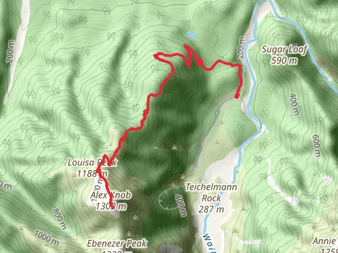
26.6 km
~2 days
1571 m
Multi-Day
“Embark on the Ball Pass Crossing, an alpine trek through New Zealand's majestic Southern Alps, steeped in natural beauty and mountaineering lore.”
Ball Pass Crossing is a challenging and rewarding trek nestled in the heart of New Zealand's Southern Alps, offering hikers an opportunity to traverse the alpine landscape with stunning views of Mount Cook/Aoraki. The trail covers approximately 27 kilometers (about 17 miles) and involves an elevation gain of around 1500 meters (nearly 4921 feet), making it a medium-difficulty hike that requires good fitness levels and alpine experience.
Getting to the Trailhead
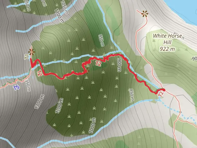
The trailhead is accessible near Mackenzie, a region known for its picturesque landscapes and clear starry nights. To reach the starting point, hikers can drive to the White Horse Hill Campground, which is situated near the village of Mount Cook. This campground serves as the common starting point for several walks and is about 2.5 hours drive from Queenstown or 4 hours from Christchurch. Public transport options are limited, but shuttle services from nearby towns are available, and these can be booked in advance.
Navigating the Trail
Hikers should be well-prepared with topographical maps and a reliable GPS tool, such as HiiKER, to navigate the trail effectively. The route is not always well marked, and weather conditions can change rapidly, making navigation challenging.
The Trek Itself
The journey begins with a gentle walk through the Hooker Valley, filled with lush vegetation and the sound of flowing rivers. After approximately 4 kilometers (about 2.5 miles), the trail starts to ascend more steeply as you approach the Hooker Lake. This glacial lake offers a perfect spot for a short break, with icebergs often seen floating in the water and the grandeur of Mount Cook in the background.
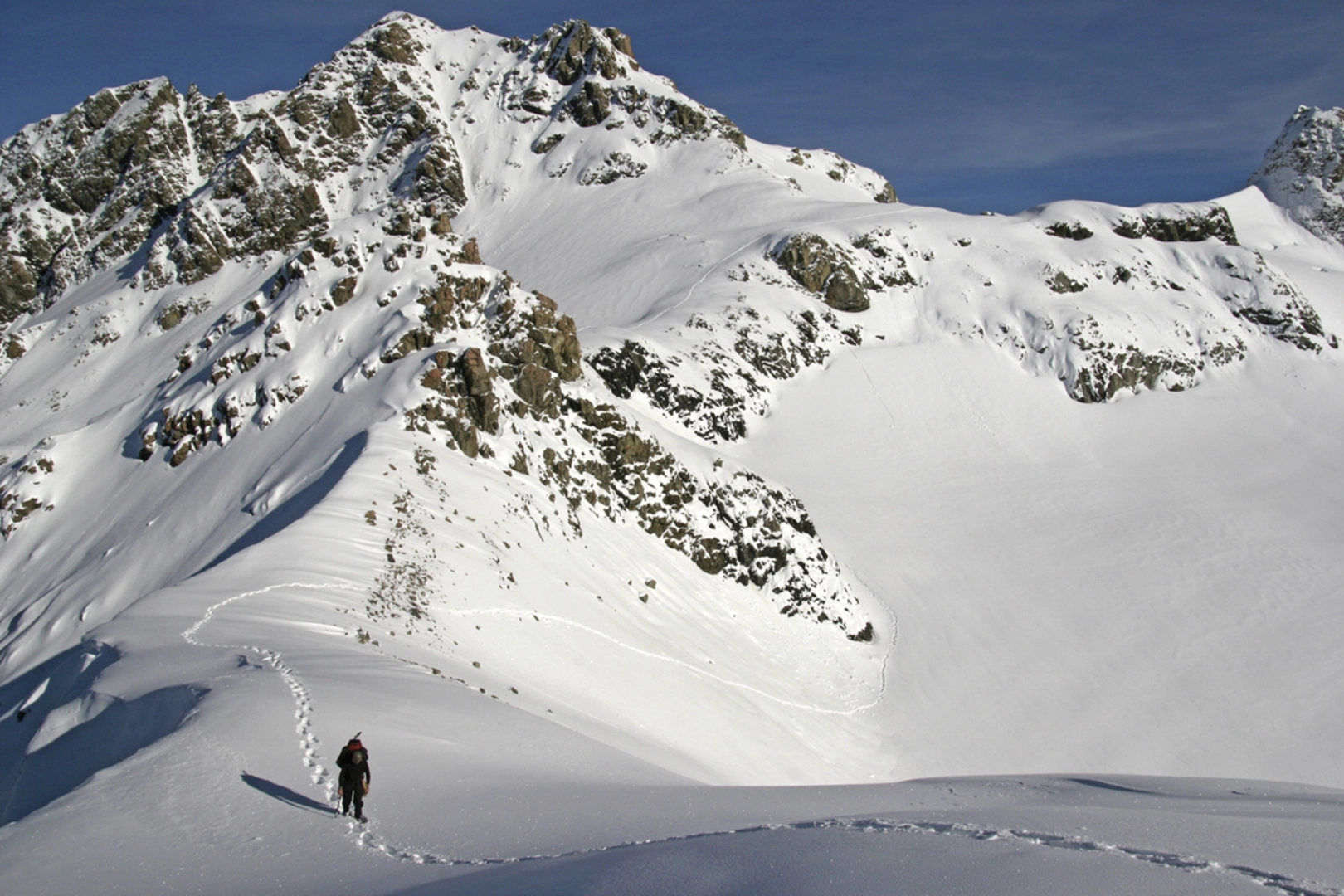
Continuing on, the trail becomes more rugged and the vegetation sparser as you gain altitude. The next section involves a steep climb up to the Ball Shelter, where hikers can rest and take shelter if necessary. This historic hut is a remnant of the early mountaineering expeditions in the region and offers a glimpse into the past.
Alpine Pass and Descent
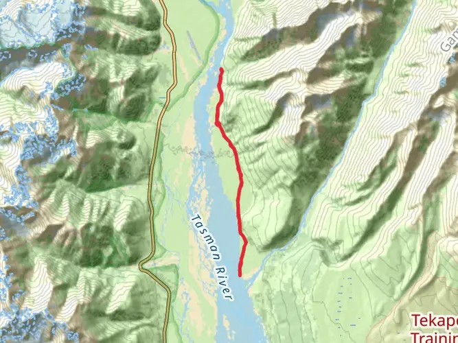
The crux of the hike is the ascent to Ball Pass itself, which is a steep and technical section requiring good weather conditions and alpine skills. The pass provides a dramatic view of the Tasman Glacier to the east and the Hooker Glacier to the west, with Mount Cook towering above.
The descent from Ball Pass is equally challenging, with loose scree and steep slopes leading down to the Tasman Valley. Hikers should proceed with caution and be prepared for a long and demanding descent.
Flora and Fauna
Throughout the hike, you may encounter a variety of alpine plants, including the Mount Cook Lily (Ranunculus lyallii), which is the world's largest buttercup. Kea, the world's only alpine parrot, may also be seen or heard, known for their intelligence and curiosity.
Historical Significance
The region is steeped in mountaineering history, with Sir Edmund Hillary training here before his historic Everest ascent. The trail itself is a testament to the rugged beauty that has attracted adventurers for centuries.
Safety and Preparation
Due to the challenging nature of Ball Pass Crossing, it is essential that hikers are well-prepared with the appropriate gear, including crampons and an ice axe when necessary. Weather conditions can change rapidly, and it is crucial to check the forecast and be prepared for all eventualities. It is also advisable to inform someone of your hiking plans and expected return time.
Conclusion
Ball Pass Crossing is a hike that offers an authentic alpine experience with breathtaking views and a touch of history. With careful planning and preparation, it can be an unforgettable adventure in one of New Zealand's most spectacular landscapes.

What to expect?
Activity types
Frequently asked questions
How hard is the Ball Pass Crossing hike in Aoraki / Mount Cook National Park?
Ball Pass Crossing is a difficult 26.57 km multi-day alpine route with about 1,571 m of elevation gain. It is an unmarked crossing between the Hooker and Tasman valleys, and the Department of Conservation describes it as a demanding 2 to 3 day route that requires strong route-finding skills in steep alpine terrain.
Where do you start the Ball Pass Crossing and where can you park?
The recommended start for Ball Pass Crossing is White Horse Hill in Aoraki / Mount Cook National Park, heading up the East Hooker Valley before crossing Ball Pass and descending Ball Ridge toward Ball Hut. Day parking is available at the White Horse Hill car park next to White Horse Hill Campsite at the end of Hooker Valley Road.
Can you camp on the Ball Pass Crossing route?
Camping is possible at the White Horse Hill area, which has the White Horse Hill Campsite at the end of Hooker Valley Road, and the Ball Pass Crossing page also lists the East Hooker Valley camping site as part of the route approach. Because this is a serious alpine crossing, many parties also use huts rather than relying only on tents in exposed terrain.
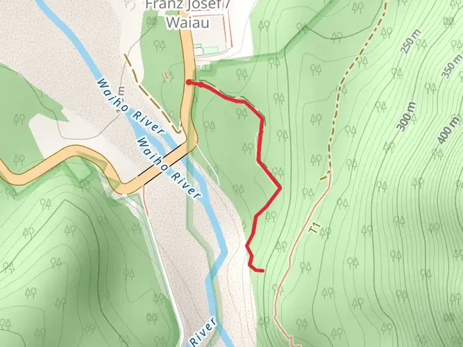
Are there huts on the Ball Pass Crossing, including Ball Hut and Caroline Hut?
Ball Pass Crossing is commonly linked with Ball Hut and Caroline Hut. Ball Hut is a standard 3-bunk DOC hut in the Tasman Valley, while Caroline Hut sits on Ball Ridge and is a common objective for parties approaching from Ball Flat or crossing the pass. These huts are part of why the route is usually done over 2 to 3 days rather than as a single push.
How long does the Ball Pass Crossing take?
Most parties complete Ball Pass Crossing in 2 to 3 days. The route is 26.57 km long, but the time commitment is driven more by the 1,571 m climb, unmarked alpine terrain, and the need to move carefully over steep ground than by distance alone.
What is the weather like on the Ball Pass Crossing?
Weather on Ball Pass Crossing can change very quickly because the route sits in high alpine terrain in Aoraki / Mount Cook National Park. MetService warns of hazards including heavy rain, gale-force wind, wind chill, and snow in the park, and DOC also flags avalanche risk in the Ball Pass area, so stable conditions are essential before setting out.
Can you do the Ball Pass Crossing as a guided hike?
Yes. DOC lists Ball Pass Crossing among places where approved commercial guiding operates in and around Aoraki / Mount Cook National Park. That matters on this route because it is unmarked and involves steep alpine ground where snow travel skills and careful navigation are often needed.
Comments and Reviews
User comments, reviews and discussions about the Ball Pass Crossing, New Zealand.
4.75
average rating out of 5
4 rating(s)