Download
3D Flyover
Add to list
More
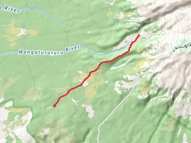
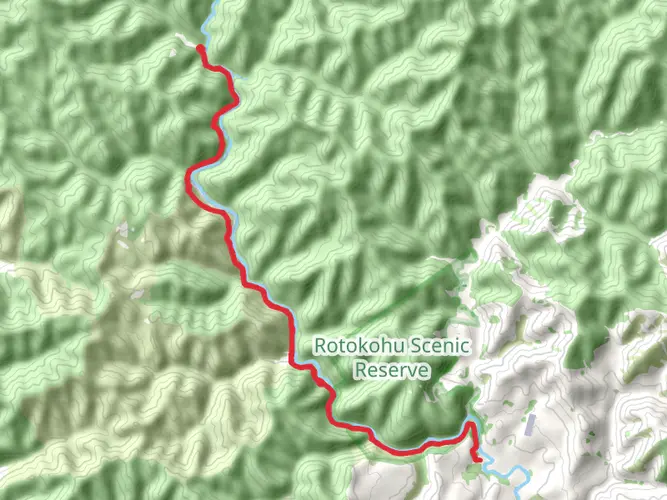
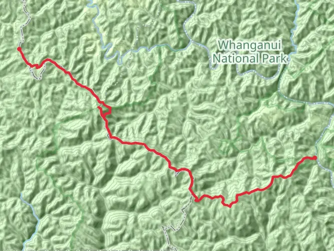
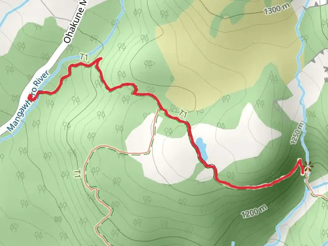
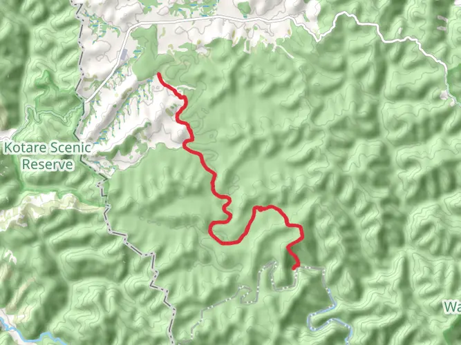
39.4 km
~2 days
1391 m
Multi-Day
“Embark on the Mangapurua Kaiwhakauka Track, where New Zealand's wilderness whispers tales of history and beauty.”
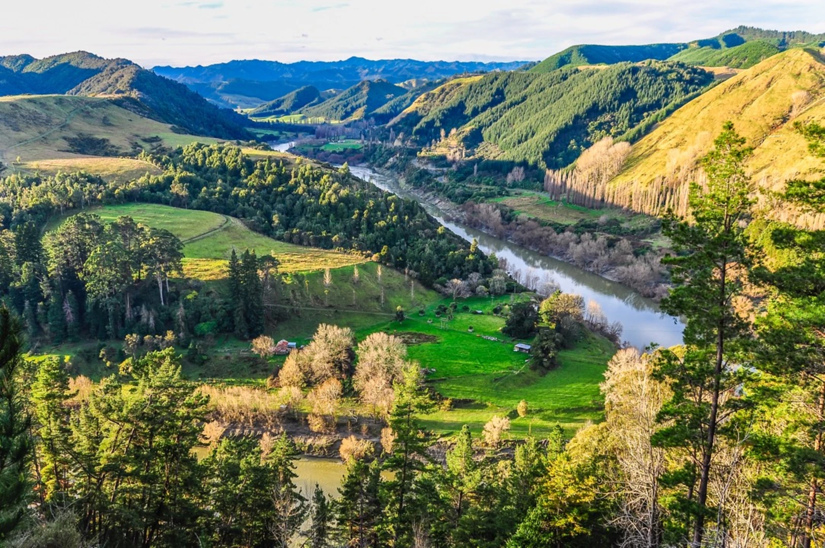
The Mangapurua Kaiwhakauka Track is a journey through New Zealand's remote wilderness, offering hikers a unique blend of natural beauty and historical significance. Spanning approximately 39 kilometers (about 24 miles) with an elevation gain of around 1300 meters (approximately 4265 feet), this point-to-point trail is nestled near Ruapehu, a region known for its dramatic landscapes and outdoor adventures.
Getting to the Trailhead
To reach the trailhead, travelers can drive to the end of Mangapurua Road, which is the closest access point by car. For those relying on public transport, options are limited due to the trail's remote location. However, hikers can take a bus or train to the nearest towns, such as Ohakune or Taumarunui, and then arrange for a shuttle service or taxi to the trailhead.
The Journey Begins
Setting out from the trailhead near Ruapehu, hikers will immediately be immersed in the lush native bush that characterizes the region. The path meanders through dense forest, with the calls of native birds echoing among the trees. The track is well-marked, but carrying a navigation tool like HiiKER is advisable to stay on course and monitor progress.
Historical Significance and Landmarks
As you traverse the Mangapurua Kaiwhakauka Track, you'll encounter remnants of the area's past. This region was once home to pioneering farmers who attempted to settle the land after World War I. The trail leads to the iconic Bridge to Nowhere, a poignant reminder of these abandoned settlements. Built in 1936, the bridge stands as a monument to the settlers' determination and the ultimate failure of their farming community.
Flora and Fauna
The track is a haven for wildlife enthusiasts, with the opportunity to spot rare bird species such as the North Island brown kiwi and the blue duck (whio). The surrounding forest is a mix of native podocarp and broadleaf species, with the occasional fern-lined clearing offering a change of scenery.
Challenges Along the Way
The trail's difficulty is rated as medium, with some challenging sections that require a good level of fitness. The terrain can be uneven, with steep climbs and descents. Weather conditions can also add to the challenge, as the track can become slippery and muddy after rain.
Navigating the Trail
Throughout the hike, elevation changes are gradual but cumulative. The highest point of the trail offers breathtaking views of the surrounding wilderness, making the climb worthwhile. Hikers should be prepared with adequate water, food, and gear to navigate the changing conditions.
Conclusion of the Trek
Upon completing the Mangapurua Kaiwhakauka Track, hikers will find themselves at the Whanganui River. From here, one can either arrange for a jet boat pickup to navigate downstream or continue on foot to the Mangapurua Landing, where the trail officially ends.
Preparation and Safety
Before embarking on this adventure, it's essential to check the weather forecast and trail conditions. Hikers should inform someone of their plans and expected return time. It's also crucial to pack essentials such as a first aid kit, extra clothing, and emergency shelter.
The Mangapurua Kaiwhakauka Track is a journey that offers more than just a physical challenge; it's a walk through New Zealand's history, set against a backdrop of stunning natural beauty. With proper preparation and respect for the trail's challenges, hikers will find this experience both rewarding and unforgettable.

What to expect?
Activity types
Frequently asked questions
How long is the Mangapurua Kaiwhakauka Track and how many days does it take?
The Mangapurua Kaiwhakauka Track is 39.37 km long with 1,391 m of climbing, so it is usually treated as a multi-day trip rather than a short walk. Most hikers split it over 2 to 3 days, especially if they want time at the Bridge to Nowhere and the historic Mangapurua Valley sites.
How difficult is the Mangapurua Kaiwhakauka Track in Ruapehu?
The Mangapurua Kaiwhakauka Track is generally rated medium difficulty. Over 39.37 km, the route packs in 1,391 m of elevation gain, so the challenge comes from the length, sustained climbs and descents, and the remote point-to-point setting in Whanganui National Park rather than technical terrain alone.
Is the Mangapurua Kaiwhakauka Track open right now?
The Mangapurua Kaiwhakauka Track is generally open for walking, and a 2025 Department of Conservation update noted that winter gate restrictions applied to larger powered vehicles while the track remained open for walking and hunting. Because access conditions can change after slips, storms, or river issues, current status should always be checked close to departure.
Does the Mangapurua Kaiwhakauka Track go to the Bridge to Nowhere?
Yes. The Mangapurua Kaiwhakauka Track passes through the Mangapurua Valley and reaches the Bridge to Nowhere before continuing to Mangapurua Landing on the Whanganui River. That bridge is the route’s best-known landmark and one of the main reasons hikers choose this track.
How long is the Bridge to Nowhere walk from the Mangapurua Kaiwhakauka Track?
The short walk from Mangapurua Landing to the Bridge to Nowhere takes about 40 minutes each way on a gentle track. On the full Mangapurua Kaiwhakauka Track, the bridge is part of the through-route, so many hikers see it as a highlight within the 39.37 km journey rather than as a separate standalone walk.
Can I use a map for the Mangapurua Kaiwhakauka Track and is there a PDF map?
Yes. The Department of Conservation publishes a Mangapurua and Kaiwhakauka tracks map PDF, and the route is also suitable for planning and navigation in HiiKER. For a remote 39.37 km point-to-point track with multiple access points including Ruatiti Road end and Mangapurua Landing, carrying a proper map is important.
Is hunting allowed near the Mangapurua Kaiwhakauka Track?
Hunting is allowed in the wider Mangapurua hunting area, but there is no hunting on the Mangapurua and Kaiwhakauka Tracks or within 50 meters of them. The track is also shared with trampers and mountain bikers, so that separation rule is an important safety detail in this part of Whanganui National Park.
Comments and Reviews
User comments, reviews and discussions about the Mangapurua Kaiwhakauka Track, New Zealand.
4.5
average rating out of 5
2 rating(s)