Download
3D Flyover
Add to list
More
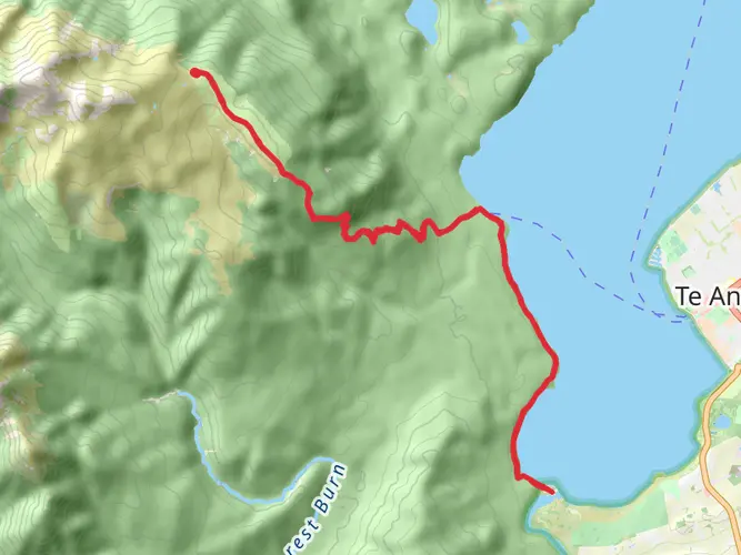
50.1 km
~3 days
2395 m
Multi-Day
“Embark on the Dusky Track, a thrilling trek through Fiordland's raw and majestic wilderness.”
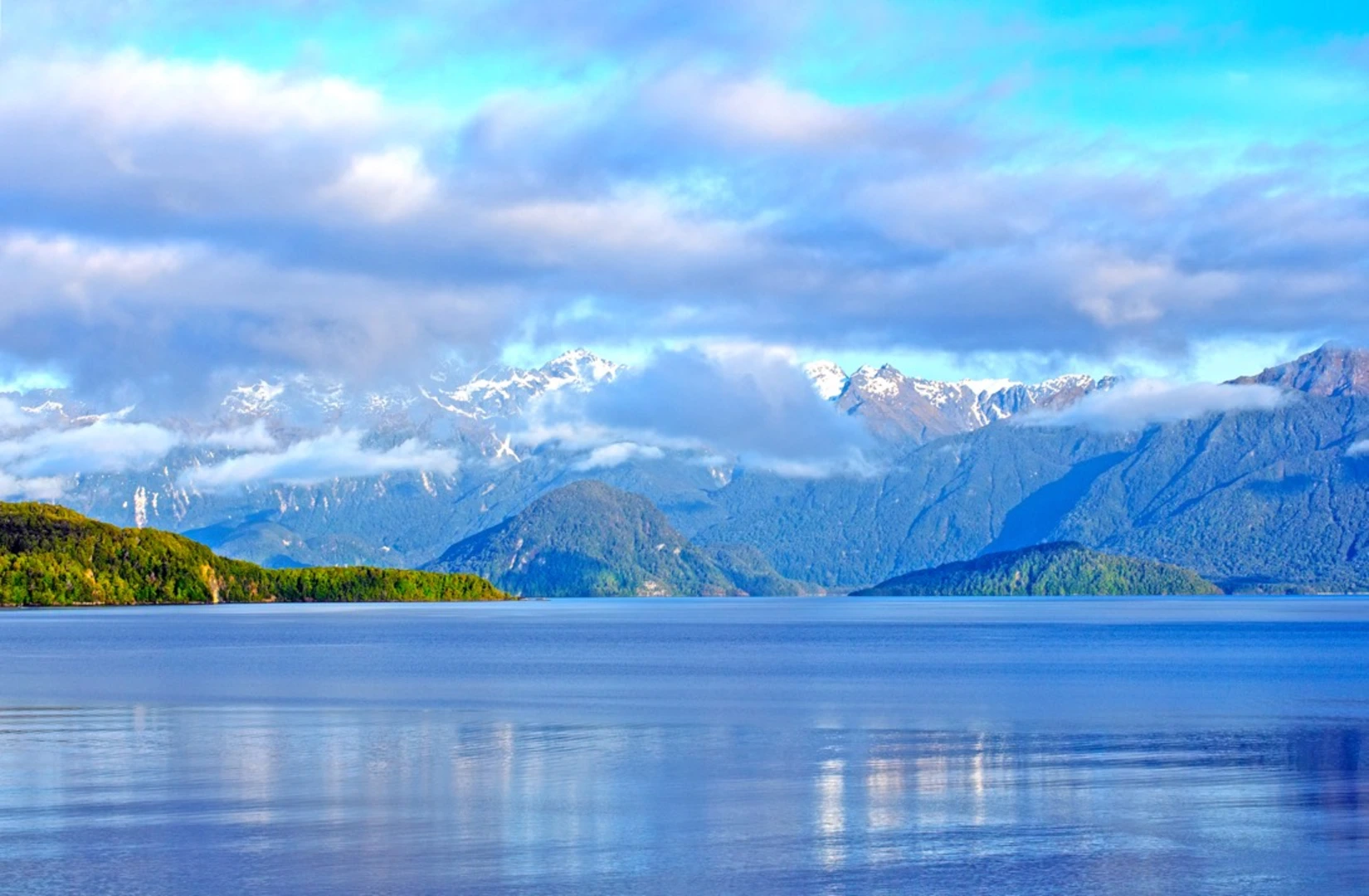
The Dusky Track is a challenging and remote journey through the heart of Fiordland National Park, renowned for its rugged terrain and breathtaking landscapes. Spanning approximately 50 kilometers (31 miles) and with an elevation gain of around 2300 meters (7546 feet), this point-to-point trail is not for the faint-hearted but offers an unparalleled wilderness experience for the seasoned hiker.
Getting to the Trailhead
To embark on the Dusky Track adventure, hikers typically start near Lake Hauroko, Southland, which is the deepest lake in New Zealand. Access to the trailhead is an adventure in itself, often beginning with a boat trip across Lake Hauroko to the remote landing at Hauroko Burn Hut. Those traveling by car can reach the lake via Clifden on Southern Scenic Route, with the last section of the road being gravel and somewhat narrow. Public transport options are limited, so hikers may need to arrange private shuttles or join guided tours that include transportation.
Navigating the Trail
Once on the trail, hikers will navigate dense beech forests, subalpine moorlands, and steep mountain passes. The use of a reliable navigation tool like HiiKER is essential, as the track can be challenging to follow, especially in adverse weather conditions. The trail is marked with orange triangles, but sections can become obscured by fallen trees or overgrowth.
Landmarks and Terrain
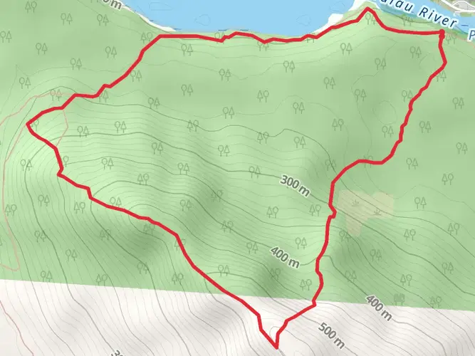
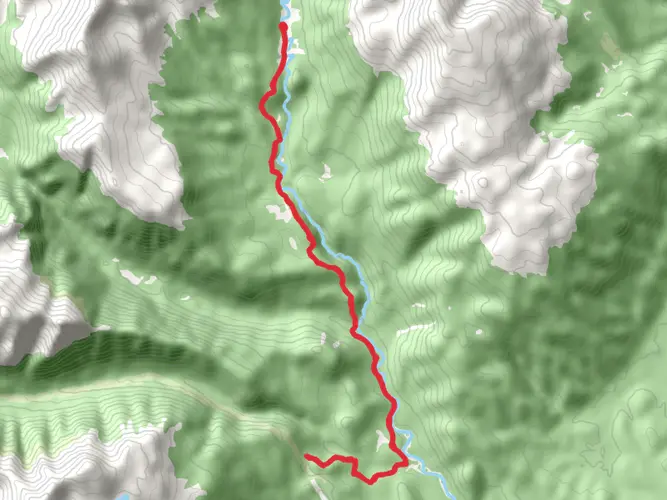
The Dusky Track is known for its numerous swing bridges, including the three-wire bridges that add to the adventure. One of the most significant landmarks is the Pleasant Range, offering panoramic views of the surrounding mountains and valleys. The track also leads to the historic Supper Cove, a remote and scenic spot on Dusky Sound, which was visited by Captain Cook in 1773.
Flora and Fauna
The trail traverses through parts of Fiordland that are home to a diverse range of flora and fauna. Hikers can expect to see species such as the Fiordland crested penguin, kākā, and the elusive kiwi. The dense forest canopy is composed of native beech trees, ferns, and mosses, creating a lush green environment that is often shrouded in mist.
Weather and Conditions
Fiordland's weather is notoriously unpredictable, and hikers should be prepared for rain, as the region is one of the wettest in the world. The track can become muddy and slippery, and rivers may swell quickly, making crossings dangerous. It is essential to carry appropriate gear, including waterproof clothing and sturdy boots.
Historical Significance
The Dusky Track area is steeped in history, from early Māori routes to European explorers like Captain Cook, who charted the Dusky Sound in the 18th century. The track itself is a testament to New Zealand's commitment to preserving its wilderness and allowing adventurers to experience its raw beauty.
Preparation and Planning
Due to the track's difficulty and isolation, thorough preparation is crucial. Hikers should be self-sufficient, carrying enough food and equipment for the entire trek, as there are no facilities along the way. It is also recommended to check in with the Department of Conservation for updates on track conditions and to leave a trip plan with someone before setting out.
Conclusion
The Dusky Track is a demanding yet rewarding expedition that offers an authentic wilderness experience. With proper preparation and respect for the natural environment, hikers can immerse themselves in the untamed beauty of New Zealand's Fiordland National Park.

What to expect?
Activity types
Frequently asked questions
How hard is the Dusky Track in Fiordland National Park?
The Dusky Track is an extra-difficult, remote multiday route covering 50.06 km with 2,395 m of climbing. DOC describes it as suitable only for experienced, well-equipped trampers, with knee-deep mud, rough ground, river crossings, tree falls, and 21 three-wire bridges along the way.
How long does the Dusky Track usually take to complete?
The Dusky Track is 50.06 km long, but the terrain makes it much slower than the distance suggests. Most parties plan it as a multiday trip, and delays are common in Fiordland when rivers rise or sections flood, especially around the Seaforth River and the route between Loch Maree and Supper Cove.
What is the elevation gain on the Dusky Track?
The Dusky Track has 2,395 m of total elevation gain over 50.06 km. The route crosses two mountain ranges and three major valley systems, so the climbing is spread across repeated steep ascents and descents rather than one single sustained climb.
How do hikers get to the Dusky Track trailheads?
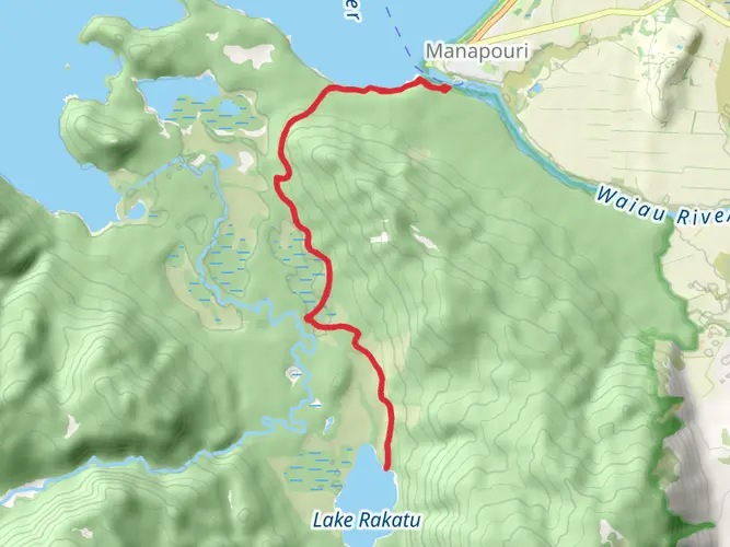
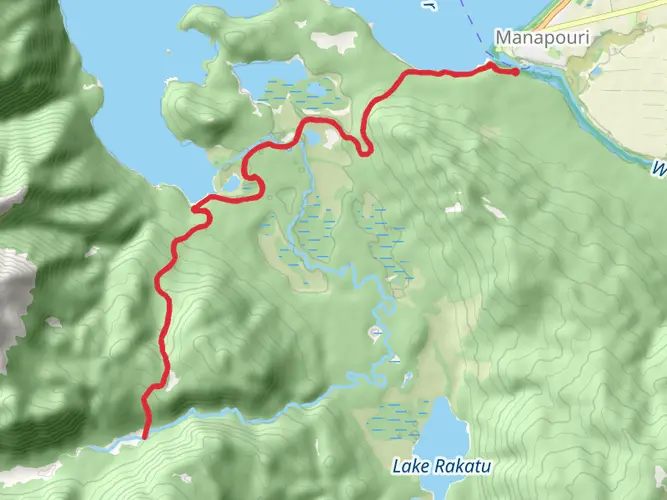
The Dusky Track can be walked in either direction, with access from Lake Hauroko in the south or West Arm on Lake Manapouri in the north. DOC notes that a scheduled boat service reaches the track start at the head of Lake Hauroko, and a daily boat service operates to West Arm on Lake Manapouri; some parties also use floatplane or helicopter access to Supper Cove or Lake Hauroko.
How much does the Dusky Track cost to hike?
The track itself does not have a separate entry fee, but overnight costs apply because the route uses DOC backcountry huts. Hauroko Burn Hut is a DOC hut, and DOC states that standard backcountry huts are paid for with Backcountry Hut Tickets or a Backcountry Hut Pass, so the total cost depends on hut nights and transport across Lake Hauroko or Lake Manapouri.
What is the weather like on the Dusky Track?
Weather on the Dusky Track is a major factor because Fiordland is extremely wet and conditions can change fast. DOC warns that sections flood easily, the Seaforth River can become impassable after continual rain, and being stranded for two days is not uncommon, so weather windows matter as much as fitness on this route.
Where does the Dusky Track go and what are the main landmarks?
The Dusky Track runs through Fiordland National Park between Lake Hauroko and Lake Manapouri, with an optional two-day detour to Supper Cove in Tamatea/Dusky Sound. Key places named by DOC include Hauroko Burn Hut, Lake Roe Hut, Loch Maree Hut, the Pleasant Range, the Seaforth River, Wilmot Pass Road, and West Arm.
Comments and Reviews
User comments, reviews and discussions about the Dusky Track, New Zealand.
5.0
average rating out of 5
2 rating(s)