Download
3D Flyover
Add to list
More
127.4 km
~6 days
3714 m
Multi-Day
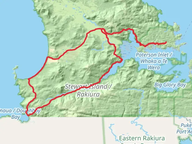
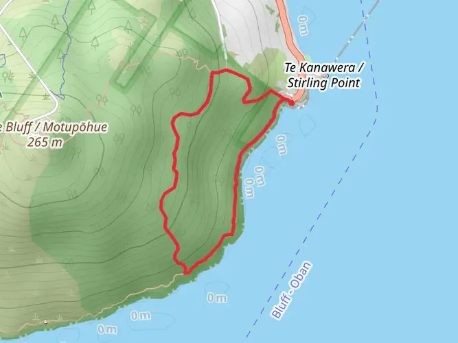
The North West Circuit Stewart Island - Rakiura is a 127.4 km trail that starts in Halfmoon Bay, Southland, New Zealand. Based on our data, the hike is graded as Extra Difficult. For information on how we grade trails, please read measuring the difficulty of a hiking trail on hiiker. Also, check our latest community posts for trail updates. This hike can be completed in approx 6 days. Caution is advised on trail times as this depends on multiple variables. For more info read about how we calculate hike time.

What to expect?
Activity types
Frequently asked questions
How long does the North West Circuit Stewart Island - Rakiura take to hike?
North West Circuit Stewart Island - Rakiura is a 127.43 km multi-day route with 3,714 m of climbing, so it is a substantial backcountry trip rather than a short Great Walk-style circuit. The Department of Conservation describes it as a challenging tramp around Stewart Island’s northern coast, and the length and terrain mean it is typically planned over several days between huts such as Bungaree, Christmas Village, Yankee River, Long Harry, East Ruggedy, Mason Bay, Freshwater, and North Arm.
How difficult is the North West Circuit Stewart Island - Rakiura?
North West Circuit Stewart Island - Rakiura is rated Extra Difficult and that matches the on-the-ground character of the route. DOC describes it as a challenging multi-day tramp, with steep and slippery sections, very muddy ground near Mount Anglem/Hananui, soft sand around East Ruggedy, and river or stream crossings that can become unsafe in flood.
Where does the North West Circuit Stewart Island - Rakiura start and how do hikers get there?
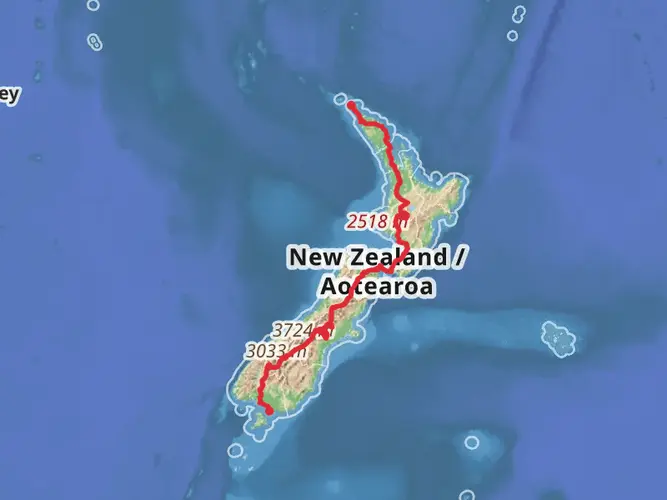
The circuit is on Stewart Island/Rakiura in Southland, and most trips are organized from Oban at Halfmoon Bay, the island’s only settlement. Stewart Island/Rakiura is reached either by a 20-minute flight from Invercargill or by a one-hour ferry crossing from Bluff to Oban, where there are supplies, accommodation, and the DOC visitor center before departure.
Does the North West Circuit Stewart Island - Rakiura connect with the Rakiura Track?
Yes. North West Circuit Stewart Island - Rakiura shares part of the same network as the Rakiura Track around North Arm. DOC notes the North West Circuit passes the Rakiura Track turn-off to North Arm, and North Arm Hut itself is a 24-bunk Great Walk hut on the Rakiura Track, so this area is the key junction between the longer remote circuit and the island’s better-known Great Walk.
What huts are on the North West Circuit Stewart Island - Rakiura?
The route uses a chain of backcountry huts including Bungaree Hut, Christmas Village Hut, Yankee River Hut, Long Harry Hut, East Ruggedy Hut, Mason Bay Hut, Freshwater Hut, and North Arm Hut. North Arm is part of the Rakiura Track Great Walk system, while the other North West Circuit huts use the backcountry hut ticket or pass system.
Do you need to book huts for the North West Circuit Stewart Island - Rakiura?
Yes, hut planning matters on this route. DOC states that all backcountry huts on the North West Circuit require Backcountry Hut Tickets or a Backcountry Hut Pass, and if the trip includes Great Walk sites such as North Arm Hut, North Arm Campsite, Port William Hut, Port William Campsite, or Maori Beach Campsite, those must be booked before departure.
What are the main hazards on the North West Circuit Stewart Island - Rakiura?
The main hazards on North West Circuit Stewart Island - Rakiura are flooding, unbridged or partly bridged river crossings, mud, tides, and long remote sections between huts. DOC specifically warns that the Murray River bridge has been removed and the river must be assessed carefully, Smoky River may be waded unless it is in flood or extreme high tide, and the Freshwater area can flood during heavy rain.
Comments and Reviews
User comments, reviews and discussions about the North West Circuit Stewart Island - Rakiura, New Zealand.
average rating out of 5
0 rating(s)