Download
Preview
Add to list
More
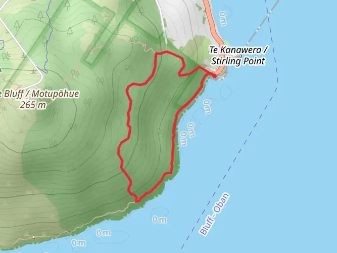
112.3 km
~7 days
2597 m
Multi-Day
“Embark on a captivating 70-mile trek through Stewart Island's rugged beauty, rich history, and diverse wildlife.”
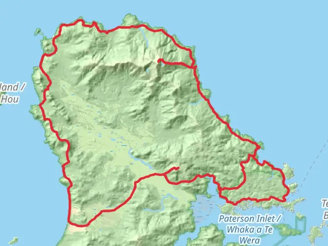
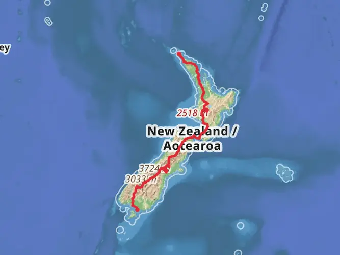
Embarking on the Southern Circuit on Stewart Island - Rakiura, hikers will traverse approximately 112 kilometers (about 70 miles) of diverse landscapes, with an elevation gain of roughly 2500 meters (8202 feet). This loop trail, rated medium in difficulty, offers a unique opportunity to explore the remote wilderness of New Zealand's third-largest island.
Getting to the Trailhead
The adventure begins near Southland, New Zealand. To reach the trailhead, travelers can drive to Invercargill and then take a ferry from Bluff to Oban, the main settlement on Stewart Island. From Oban, the trailhead is accessible by foot, being just a short distance from the town's center. For those without a car, there are bus services to Invercargill from major cities and shuttle services to Bluff, connecting seamlessly with the ferry schedules.
Navigating the Trail
Hikers can rely on HiiKER to navigate the trail, ensuring they stay on the correct path throughout their journey. The loop can be tackled in either direction, but many choose to go clockwise, which allows a more gradual ascent and offers a strategic approach to the more challenging sections.
Landmarks and Natural Features
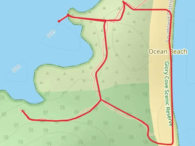
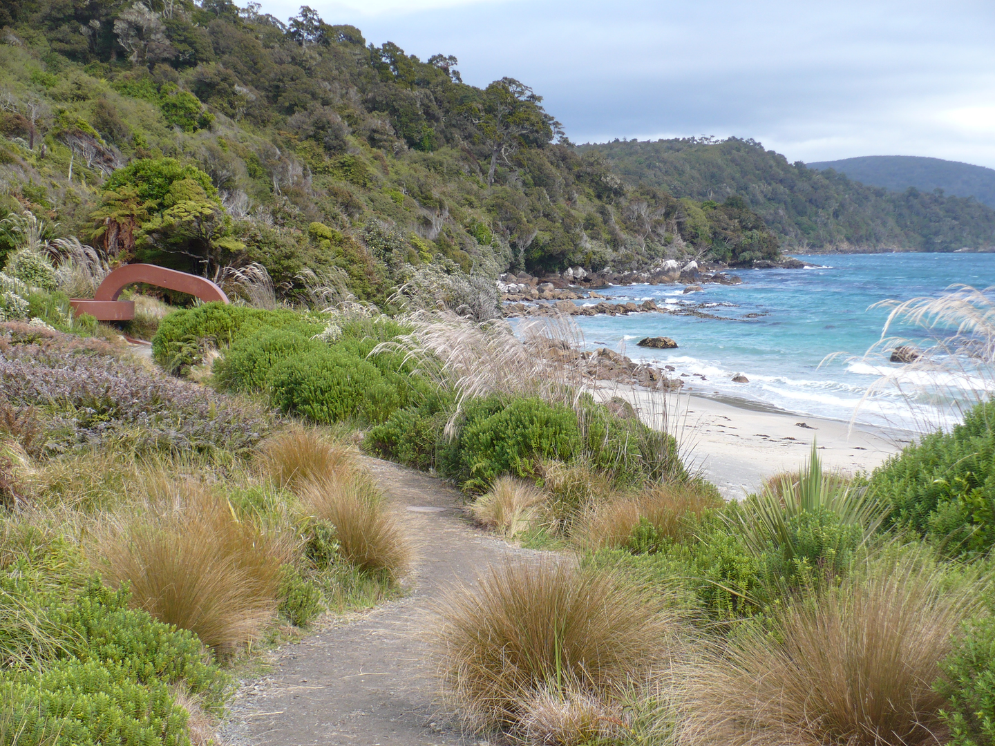
The Southern Circuit winds through dense rainforests, crosses pristine beaches, and climbs over rugged ridges, providing a full spectrum of Stewart Island's natural beauty. Notable landmarks include the historic Port William, an early Maori and European settlement site, and the sweeping sands of Maori Beach, where the remnants of a sawmill and tram lines from the logging era can still be seen.
As hikers progress, they'll encounter the Freshwater Landing, which is a gateway to the serene Freshwater River and is often used as a rest stop or campsite. The trail also passes by the imposing granite outcrops of the Ruggedy Mountains, offering panoramic views of the wild coastline.
Wildlife Encounters
Stewart Island is a haven for birdwatchers, with the elusive kiwi often spotted at dusk or dawn. The island's forests are alive with the songs of bellbirds, kaka, and tui, while the shores are frequented by penguins and sea lions. Hikers should be mindful of the wildlife and maintain a respectful distance, preserving the natural habitat of these creatures.
Historical Significance
The region is steeped in history, with Stewart Island being known as Rakiura by the Maori, translating to "the land of glowing skies." This is a nod to the spectacular aurora australis that can sometimes be seen from the island. The trail itself traverses areas that were once bustling with Maori hunting parties and later, European settlers who came for whaling and logging.
Preparation and Planning
Hikers should be well-prepared for changeable weather conditions and pack accordingly. It's recommended to carry waterproof gear, warm layers, and sufficient food and water supplies. The circuit can take 6-8 days to complete, and there are designated campsites and huts along the route, which should be booked in advance through the Department of Conservation.
With careful planning, the Southern Circuit on Stewart Island - Rakiura presents an unforgettable trekking experience, rich in natural wonders and historical intrigue.

What to expect?
Activity types
Frequently asked questions
How long does the Southern Circuit Stewart Island - Rakiura usually take to complete?
The Southern Circuit Stewart Island - Rakiura is 112.31 km and is generally planned as a 9 to 11 day backcountry trip. That pace matches the long, remote nature of the route and the rougher sections around Freshwater, Mason Bay, and the southern coast, where mud, beach travel, and weather can slow progress.
Where do you start the Southern Circuit Stewart Island - Rakiura from Oban?
Most walkers reach Oban by the one-hour ferry from Bluff or a 20-minute flight from Invercargill, then arrange access to the circuit from there. For the Southern Circuit, the easiest start and finish is typically by water taxi to or from Freshwater Landing, Freds Camp, or Rakeahua Hut rather than walking directly from town.
What are the main huts and sections on the Southern Circuit Stewart Island - Rakiura?
The route links a series of backcountry huts including Freshwater Hut, Mason Bay Hut, and the southern huts around Freds Camp and Rakeahua. On the northern side, Freshwater Hut to Mason Bay Hut is about 15.5 km and usually takes 3 to 4 hours, while Freshwater Hut to North Arm Hut is about 11 km and commonly takes 6 to 7 hours on steep, slippery ground.
Is the Southern Circuit Stewart Island - Rakiura difficult or suitable for intermediate hikers?
The Southern Circuit Stewart Island - Rakiura is rated medium, but it is still a serious multi-day tramp with 2,597 m of climbing over 112.31 km. The challenge comes less from altitude and more from remoteness, long days between huts, muddy track, beach sections, steep gullies, and river or creek crossings that can become difficult after heavy rain.
What is the terrain like on the Southern Circuit Stewart Island - Rakiura?
The Southern Circuit crosses a wide range of Stewart Island terrain, including dense forest, tussock wetland, mānuka country, long beaches, and rugged coastal sections. Around Mason Bay, the track passes one of the most extensive inland dune systems in the Southern Hemisphere, while the Freshwater area is known for muddy ground and flood-prone sections near Scott Burn Stream.
When is the best time of year to hike the Southern Circuit Stewart Island - Rakiura?
The circuit can be walked year-round, but the most settled conditions are usually in the warmer months from late spring through autumn. Even then, Stewart Island is known for persistent rain, mud, and flooding, and sections such as the track between Freshwater and Mason Bay or the creeks near North Arm can become much harder or temporarily unsafe in wet weather.
Are dogs allowed on the Southern Circuit Stewart Island - Rakiura?
Dog access on Stewart Island conservation land is tightly controlled, and dogs are not something to assume is permitted on the Southern Circuit. DOC advises checking the specific access rules with the local visitor center before setting out, which is especially important on a remote route inside Rakiura National Park.
Comments and Reviews
User comments, reviews and discussions about the Southern Circuit Stewart Island - Rakiura, New Zealand.
average rating out of 5
0 rating(s)