Download
3D Flyover
Add to list
More
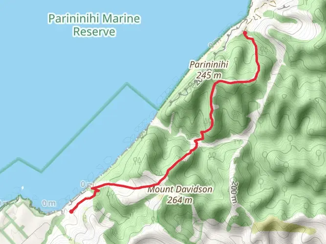
35.3 km
~2 days
1118 m
Multi-Day
“Embark on New Zealand's Matemateaonga Track, a historic and biodiverse medium-difficulty hiking adventure.”
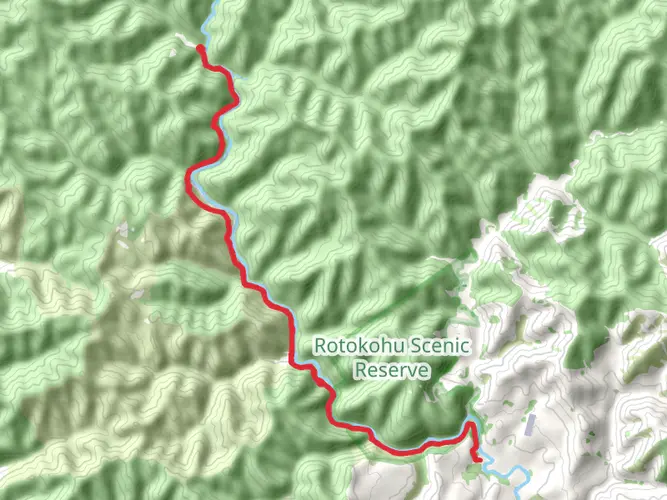
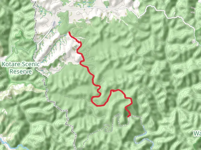
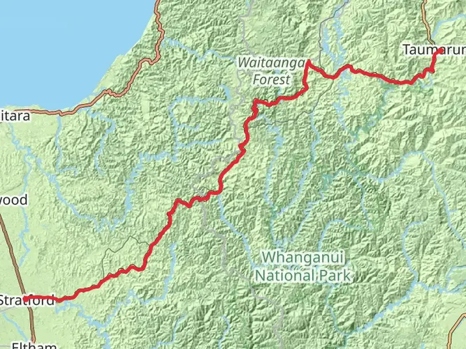
The Matemateaonga Track stretches approximately 35 kilometers (about 22 miles) and features an elevation gain of around 1100 meters (roughly 3600 feet), offering a medium difficulty level that caters to hikers with some experience. This point-to-point trail is nestled in the lush landscapes near Stratford, New Zealand, and is renowned for its rich history and stunning natural beauty.
Getting to the Trailhead
To reach the trailhead, which is situated near Stratford, hikers can drive to the end of Pembroke Road, which is the closest access point by car. For those relying on public transport, options are limited, but it's possible to take a bus to Stratford and then arrange for a local shuttle or taxi service to the trailhead.
Navigating the Trail
Hikers can utilize the HiiKER app to navigate the trail, ensuring they stay on the correct path and can anticipate upcoming changes in terrain or elevation. The app provides detailed maps and is a valuable tool for planning rest stops and campsites along the route.
Trail Highlights and Landmarks
As you embark on the Matemateaonga Track, you'll be greeted by dense native forest that provides a canopy for the rich biodiversity below. The trail is a haven for birdwatchers, with the potential to spot rare species such as the North Island brown kiwi and the kererū, New Zealand's native wood pigeon.
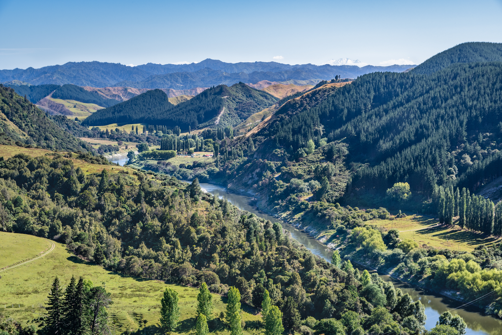
The track follows an historic bridle path and is steeped in Maori history. Hikers will encounter remnants of past settlements and ancient Maori pa sites, offering a glimpse into the region's cultural heritage. The Whanganui River, which the track eventually leads to, has been a significant waterway for Maori and early European settlers, used for transport and trade.
Terrain and Elevation Changes
The trail's terrain varies, with some sections featuring well-maintained paths while others may be more rugged and require careful footing. The elevation gain is gradual but noticeable, especially in the sections that lead up to the highest points of the track. Hikers should be prepared for potentially muddy conditions, especially after rain.
Preparing for the Hike
Given the track's length and remote nature, it's essential to be well-prepared with adequate supplies, including food, water, and appropriate gear for overnight camping if you plan to complete the trail over multiple days. Weather can be unpredictable, so layered clothing and waterproof gear are recommended.
End of the Trail
The Matemateaonga Track concludes at the Whanganui River, where hikers can arrange for a jet boat pickup to take them to Pipiriki—a small community downriver. This unique end to the hike allows for a scenic and restful return after the journey.
By providing these details, hikers can adequately prepare for the Matemateaonga Track, ensuring a memorable and safe experience through one of New Zealand's most historically and ecologically rich landscapes.

What to expect?
Activity types
Frequently asked questions
How difficult is the Matemateaonga Track and how long does the full hike take?
The Matemateaonga Track is generally considered a medium-difficulty multi-day hike. HiiKER lists it at 35.31 km with 1,118 m of elevation gain, while DOC describes the route as usually taking 3 to 5 days one way through remote Whanganui National Park. The terrain follows an old road line for much of the route, but mud, slips, and windfall can make progress slower after bad weather.
Where do you start the Matemateaonga Track and where does it finish?
The most common direction is from Kohi Saddle at the end of Upper Mangaehu Road, reached from SH 43 at Strathmore east of Stratford. The track then runs east across the Matemateāonga Range to the Whanganui River near Puketotara Hut, making it a point-to-point trip rather than a circuit. That means transport needs to be organized for the river end.
Do you need transport for the Matemateaonga Track, and is there public transport from Stratford?
Yes. The Matemateaonga Track is not a loop, so transport is normally needed at the finish on the Whanganui River. DOC notes that jet boat or canoe transport must be pre-arranged for the river end, and the usual road access is via Kohi Saddle near Stratford. Public transit options are limited, so most walkers use a private vehicle, shuttle, or taxi to the trailhead and pre-book river pickup at the far end.
Can you camp on the Matemateaonga Track or do you have to stay in huts?
Overnight stays on the Matemateaonga Track are usually planned around the backcountry huts on the route, including Ōmaru Hut, Pōuri Hut, Ngāpurua Hut, and Puketōtara Hut. DOC classifies these as serviced huts and says hut tickets or a Backcountry Hut Pass are required for overnight stays. Water at the huts is collected from the roof and should be boiled, filtered, or treated if there is any doubt about purity.
What is the latest update on Pōuri Hut on the Matemateaonga Track?
Pōuri Hut is no longer available for overnight use. DOC reported that the 12-bunk hut was destroyed by fire on December 11, 2025, and in May 2026 confirmed the site had been cleaned up and a water collector installed. Anyone planning to stay between Ōmaru Hut and Ngāpurua Hut now needs to carry their own shelter for that section.
Is hunting allowed on the Matemateaonga Track?
Hunting is permitted in most places around the Matemateaonga Track through much of the year, but it is regulated. DOC states that hunters need to check exclusion dates, zones, and any special conditions for hunting with dogs, and a printed hunting permit must be carried at all times. That makes it important to confirm current access rules before setting out.
Is the Kaiwhakauka Track connected to the Matemateaonga Track?
The Kaiwhakauka Track is not the same trail as the Matemateaonga Track, but both are in Whanganui National Park and are often researched together for longer backcountry trips. Kaiwhakauka forms part of the Mangapurua/Kaiwhakauka Track system, a separate 35.5 to 40 km route that links with the Bridge to Nowhere area and the Whanganui River. Matemateaonga instead runs from Kohi Saddle across the range toward Puketotara Hut and the river.
Is there an official map or PDF for the Matemateaonga Track?
Yes. DOC publishes a Matemateāonga Track brochure and map PDF for the route. It shows key places including Kohi Saddle, Ōmaru Hut, Pōuri Hut, Ngāpurua Hut, Puketōtara Hut, Mt Humphries, and the Whanganui River, but DOC also notes that the brochure map is not to scale and is not suitable for navigation. For on-trail navigation, a proper topographic map or offline mapping is the safer choice.
Comments and Reviews
User comments, reviews and discussions about the Matemateaonga Track, New Zealand.
4.5
average rating out of 5
4 rating(s)